 |
|
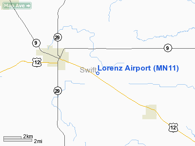
Location & QuickFacts
| FAA Information Effective: | 2008-09-25 |
| Airport Identifier: | MN11 |
| Airport Status: | Operational |
| Longitude/Latitude: | 095-32-42.1160W/45-17-59.8560N
-95.545032/45.299960 (Estimated) |
| Elevation: | 1050 ft / 320.04 m (Estimated) |
| Land: | 4 acres |
| From nearest city: | 5 nautical miles E of Benson, MN |
| Location: | Swift County, MN |
| Magnetic Variation: | 06E (1985) |
Owner & Manager
| Ownership: | Privately owned |
| Owner: | Donn H. Lorenz |
| Address: | 160 40th Avenue Se
Benson, MN 56215 |
| Phone number: | 320-843-2171 |
| Manager: | Donn H. Lorenz |
| Address: | 160 40th Avenue Se
Benson, MN 56215 |
| Phone number: | 320-843-2171 |
Airport Operations and Facilities
| Airport Use: | Private |
| Wind indicator: | Yes |
| Segmented Circle: | No |
| Control Tower: | No |
| Sectional chart: | Twin Cities |
| Region: | AGL - Great Lakes |
| Boundary ARTCC: | ZMP - Minneapolis |
| Tie-in FSS: | PNM - Princeton |
| FSS Toll Free: | 1-800-WX-BRIEF |
Runway Information
Runway 17/35
| Dimension: | 2600 x 90 ft / 792.5 x 27.4 m |
| Surface: | TURF, |
| |
Runway 17 |
Runway 35 |
| Traffic Pattern: | Left | Left |
|
Radio Navigation Aids
| ID |
Type |
Name |
Ch |
Freq |
Var |
Dist |
| BBB | NDB | Benson | | 239.00 | 05E | 4.7 nm |
| AQP | NDB | Appleton | | 356.00 | 05E | 20.1 nm |
| GHW | NDB | Glenwood | | 346.00 | 03E | 22.8 nm |
| EE | NDB | Tamie | | 374.00 | 04E | 31.2 nm |
| DXX | NDB | Dawson/madison | | 341.00 | 06E | 32.9 nm |
| VVV | NDB | Ortonville | | 332.00 | 05E | 37.1 nm |
| BDH | VOR/DME | Willmar | 84X | 113.70 | 04E | 20.8 nm |
| MVE | VOR/DME | Montevideo | 053X | 111.60 | 05E | 20.9 nm |
| ILL | VOR/DME | Willmar | 084X | 113.70 | 04E | 22.1 nm |
| MOX | VOR/DME | Morris | 033X | 109.60 | 05E | 24.0 nm |
| AXN | VOR/DME | Alexandria | 075X | 112.80 | 07E | 41.7 nm |
| DWN | VORTAC | Darwin | 027X | 109.00 | 07E | 48.0 nm |
Remarks
- PROVIDED RWY END IS RELOCATED AND MARKED TO PROVIDE A 20:1 APPROACH OVER SPECIFIC OBSTRUCTIONS.
Images and information placed above are from
http://www.airport-data.com/airport/MN11/
We thank them for the data!
| General Info
|
| Country |
United States
|
| State |
MINNESOTA
|
| FAA ID |
MN11
|
| Latitude |
45-17-59.856N
|
| Longitude |
095-32-42.116W
|
| Elevation |
1050 feet
|
| Near City |
BENSON
|
We don't guarantee the information is fresh and accurate. The data may
be wrong or outdated.
For more up-to-date information please refer to other sources.
|
|


