 |
|
Location & QuickFacts
| FAA Information Effective: | 2008-09-25 |
| Airport Identifier: | 70MY |
| Airport Status: | Operational |
| Longitude/Latitude: | 093-31-20.0000W/44-36-12.0000N
-93.522222/44.603333 (Estimated) |
| Elevation: | 944 ft / 287.73 m (Estimated) |
| Land: | 0 acres |
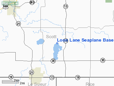
| From nearest city: | 4 nautical miles NE of New Prague, MN |
| Location: | Scott County, MN |
| Magnetic Variation: | 03E (1985) |
Owner & Manager
| Ownership: | Privately owned |
| Owner: | Miles E. Lunak |
| Address: | 615 Spencer St
Shakopee, MN 55379 |
| Phone number: | 952-496-1294 |
| Address: |
|
Airport Operations and Facilities
| Airport Use: | Private |
| Wind indicator: | Yes |
| Segmented Circle: | No |
| Control Tower: | No |
| Landing fee charge: | No |
| Sectional chart: | Twin Cities |
| Region: | AGL - Great Lakes |
| Boundary ARTCC: | ZMP - Minneapolis |
| Tie-in FSS: | PNM - Princeton |
| FSS on Airport: | No |
| FSS Toll Free: | 1-800-WX-BRIEF |
Runway Information
Runway 11W/29W
| Dimension: | 4500 x 1000 ft / 1371.6 x 304.8 m |
| Surface: | WATER, |
| |
Runway 11W |
Runway 29W |
| Traffic Pattern: | Left | Left |
|
Runway 18W/36W
| Dimension: | 10000 x 1000 ft / 3048.0 x 304.8 m |
| Surface: | WATER, |
| |
Runway 18W |
Runway 36W |
| Traffic Pattern: | Left | Left |
|
Radio Navigation Aids
| ID |
Type |
Name |
Ch |
Freq |
Var |
Dist |
| MS | NDB | Narco | | 266.00 | 02E | 22.7 nm |
| GYL | NDB | Glencoe | | 407.00 | 03E | 25.9 nm |
| PPI | NDB | Hopey | | 400.00 | 03E | 29.6 nm |
| ACQ | NDB | Waseca | | 371.00 | 02E | 32.1 nm |
| HCD | NDB | Hutchinson | | 209.00 | 04E | 39.8 nm |
| ULM | NDB/DME | New Ulm | 050X | 272.00 | 04E | 45.2 nm |
| FCM | VOR/DME | Flying Cloud | 055X | 111.80 | 06E | 13.7 nm |
| MSP | VOR/DME | Minneapolis | 100X | 115.30 | 02E | 21.4 nm |
| FOW | VOR/DME | Halfway | 049X | 111.20 | 02E | 24.8 nm |
| MKT | VOR/DME | Mankato | 045X | 110.80 | 07E | 28.5 nm |
| FGT | VORTAC | Farmington | 104X | 115.70 | 06E | 14.6 nm |
| GEP | VORTAC | Gopher | 120X | 117.30 | 06E | 33.2 nm |
| DWN | VORTAC | Darwin | 027X | 109.00 | 07E | 49.2 nm |
| MSP | VOT | Minneapolis St Paul | | 111.00 | | 21.4 nm |
| STP | VOT | St Paul | | 114.40 | | 28.3 nm |
Images and information placed above are from
http://www.airport-data.com/airport/70MY/
We thank them for the data!
| General Info
|
| Country |
United States
|
| State |
MINNESOTA
|
| FAA ID |
70MY
|
| Latitude |
44-36-12.000N
|
| Longitude |
093-31-20.000W
|
| Elevation |
944 feet
|
| Near City |
NEW PRAGUE
|
We don't guarantee the information is fresh and accurate. The data may
be wrong or outdated.
For more up-to-date information please refer to other sources.
|
|


