 |
|
Longville Municipal Airport |
| Longville Municipal Airport |
| IATA: none – ICAO: KXVG – FAA LID: XVG |
| Summary |
| Airport type |
Public |
| Owner |
City of Longville |
| Serves |
Longville, Minnesota |
| Elevation AMSL |
1,334 ft / 407 m |
| Coordinates |
46°59′25″N 094°12′14″W / 46.99028°N 94.20389°W / 46.99028; -94.20389 |
| Runways |
| Direction |
Length |
Surface |
| ft |
m |
| 13/31 |
3,781 |
1,152 |
Asphalt |
| Statistics (2005) |
| Aircraft operations |
6,725 |
| Based aircraft |
8 |
| Sources: Minnesota DOT, FAA |
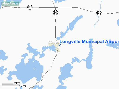
Longville Municipal Airport (ICAO: KXVG, FAA LID: XVG) is a city-owned public-use airport located one nautical mile (1.85 km) northeast of the central business district of Longville, a city in Cass County, Minnesota, United States.
Although most U.S. airports use the same three-letter location identifier for the FAA and IATA, this airport is assigned XVG by the FAA but has no designation from the IATA.
Facilities and aircraft
Longville Municipal Airport covers an area of 55 acres (22 ha) at an elevation of 1,334 feet (407 m) above mean sea level. It has one runway designated 13/31 with an asphalt surface measuring 3,781 by 75 feet (1,152 x 23 m).
For the 12-month period ending August 31, 2005, the airport had 6,725 aircraft operations, an average of 18 per day: 99.6% general aviation and 0.4% air taxi. At that time there were 8 aircraft based at this airport: 87.5% single-engine and 12.5% multi-engine.
The above content comes from Wikipedia and is published under free licenses – click here to read more.
Location & QuickFacts
| FAA Information Effective: | 2008-09-25 |
| Airport Identifier: | XVG |
| Airport Status: | Operational |
| Longitude/Latitude: | 094-12-14.4080W/46-59-24.5890N
-94.204002/46.990164 (Estimated) |
| Elevation: | 1334 ft / 406.60 m (Estimated) |
| Land: | 55 acres |
| From nearest city: | 1 nautical miles NE of Longville, MN |
| Location: | Cass County, MN |
| Magnetic Variation: | 03E (2000) |
Owner & Manager
| Ownership: | Publicly owned |
| Owner: | City Of Longville |
| Address: | Box 217
Longville, MN 56655 |
| Phone number: | 218-363-2022 |
| Manager: | Arlene Schoffow |
| Address: | Box 217
Longville, MN 56655 |
| Phone number: | 218-363-2022 |
Airport Operations and Facilities
| Airport Use: | Open to public |
| Wind indicator: | Yes |
| Segmented Circle: | No |
| Control Tower: | No |
| Lighting Schedule: | DUSK-DAWN
ACTVT MIRL RY 13/31 - CTAF. |
| Beacon Color: | Clear-Green (lighted land airport) |
| Landing fee charge: | No |
| Sectional chart: | Twin Cities |
| Region: | AGL - Great Lakes |
| Boundary ARTCC: | ZMP - Minneapolis |
| Tie-in FSS: | PNM - Princeton |
| FSS on Airport: | No |
| FSS Toll Free: | 1-800-WX-BRIEF |
| NOTAMs Facility: | XVG (NOTAM-d service avaliable) |
| Federal Agreements: | NY1 |
Airport Communications
Airport Services
| Fuel available: | 100LL
SELF SERVE FUEL AVAILABLE 24 HRS. |
Runway Information
Runway 13/31
| Dimension: | 3781 x 75 ft / 1152.4 x 22.9 m |
| Surface: | ASPH, Good Condition |
| Weight Limit: | Single wheel: 9000 lbs.
Dual wheel: 14000 lbs. |
| Edge Lights: | Medium |
| |
Runway 13 |
Runway 31 |
| Longitude: | 094-12-32.9080W | 094-11-55.9070W |
| Latitude: | 46-59-38.3390N | 46-59-10.8390N |
| Elevation: | 1333.00 ft | 1330.00 ft |
| Traffic Pattern: | Left | Left |
| Markings: | Non-precision instrument, Good Condition | Non-precision instrument, Good Condition |
| Displaced threshold: | 690.00 ft | 0.00 ft |
| Runway End Identifier: | No | No |
| Centerline Lights: | No | No |
| Touchdown Lights: | No | No |
| Obstruction: | 20 ft trees, 200.0 ft from runway, 150 ft right of centerline
RWY 13 ROAD +18, 720 FM DSPLCD THLD 300R; 40:1 BASED ON DSPLCD THLD.
RY 13/31 +20 FT ROAD 150-250 FT R, 100-200 FT L & R OF CNTRLN. | 11 ft trees, 270.0 ft from runway, 270 ft left of centerline, 6:1 slope to clear
+55 FT TREES 200 FT L, 1300 FT FM RY END 20:1. |
|
Radio Navigation Aids
| ID |
Type |
Name |
Ch |
Freq |
Var |
Dist |
| XVG | NDB | Longville | | 392.00 | 04E | 0.3 nm |
| PWC | NDB | Pine River | | 330.00 | 03E | 17.5 nm |
| PK | NDB | Spida | | 269.00 | 04E | 33.0 nm |
| AIT | NDB | Aitkin | | 397.00 | 03E | 34.4 nm |
| SAZ | NDB | Staples | | 257.00 | 04E | 44.1 nm |
| GPZ | VOR/DME | Grand Rapids | 051X | 111.40 | 06E | 31.1 nm |
| PKD | VOR/DME | Park Rapids | 043X | 110.60 | 04E | 36.0 nm |
| BRD | VORTAC | Brainerd | 116X | 116.90 | 03E | 39.3 nm |
| BJI | VORTAC | Bemidji | 023X | 108.60 | 04E | 48.6 nm |
Remarks
- ULTRALIGHTS ON & INVOF ARPT.
- DEER AND BIRDS ON & INVOF AIRPORT.
Images and information placed above are from
http://www.airport-data.com/airport/XVG/
We thank them for the data!
| General Info
|
| Country |
United States
|
| State |
MINNESOTA
|
| FAA ID |
XVG
|
| Latitude |
46-59-24.589N
|
| Longitude |
094-12-14.408W
|
| Elevation |
1334 feet
|
| Near City |
LONGVILLE
|
We don't guarantee the information is fresh and accurate. The data may
be wrong or outdated.
For more up-to-date information please refer to other sources.
|
|


