 |
|
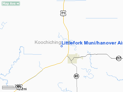
Littlefork Muni / Hanover Airport |
Location & QuickFacts
| FAA Information Effective: | 2008-09-25 |
| Airport Identifier: | 13Y |
| Airport Status: | Operational |
| Longitude/Latitude: | 093-35-10.5800W/48-24-59.8000N
-93.586272/48.416611 (Estimated) |
| Elevation: | 1145 ft / 349.00 m (Estimated) |
| Land: | 40 acres |
| From nearest city: | 2 nautical miles NW of Littlefork, MN |
| Location: | Koochiching County, MN |
| Magnetic Variation: | 03E (1985) |
Owner & Manager
| Ownership: | Publicly owned |
| Owner: | City Of Littlefork |
| Address: | 901 Main St., Box 135
Littlefork, MN 56653 |
| Phone number: | 218-278-6710 |
| Manager: | Mike Fairchild |
| Address: | 901 Main St., Box 135
Littlefork, MN 56653 |
| Phone number: | 218-278-4468 |
Airport Operations and Facilities
| Airport Use: | Open to public |
| Wind indicator: | Yes |
| Segmented Circle: | No |
| Control Tower: | No |
| Landing fee charge: | No |
| Sectional chart: | Twin Cities |
| Region: | AGL - Great Lakes |
| Boundary ARTCC: | ZMP - Minneapolis |
| Tie-in FSS: | PNM - Princeton |
| FSS on Airport: | No |
| FSS Toll Free: | 1-800-WX-BRIEF |
| NOTAMs Facility: | PNM (NOTAM-d service avaliable) |
| Federal Agreements: | 1 |
Airport Communications
Airport Services
Runway Information
Runway 09/27
| Dimension: | 3000 x 150 ft / 914.4 x 45.7 m |
| Surface: | TURF, Good Condition |
| |
Runway 09 |
Runway 27 |
| Longitude: | 093-35-08.1600W | 093-34-23.7000W |
| Latitude: | 48-24-29.8000N | 48-24-29.7900N |
| Elevation: | 1130.00 ft | 1125.00 ft |
| Traffic Pattern: | Left | Left |
| Markings: | None,
RY 09/27 MKD WITH YELLOW CONES. | None, |
| Runway End Identifier: | No | No |
| Centerline Lights: | No | No |
| Touchdown Lights: | No | No |
| Obstruction: | 36 ft trees, 1200.0 ft from runway, 100 ft right of centerline, 33:1 slope to clear | 6 ft brush, 50.0 ft from runway, 100 ft left of centerline, 8:1 slope to clear |
|
Radio Navigation Aids
| ID |
Type |
Name |
Ch |
Freq |
Var |
Dist |
| IN | NDB | Raize | | 353.00 | 06E | 12.9 nm |
| YAG | NDB | Fort Frances | | 376.00 | 02E | 16.5 nm |
| ORB | NDB | Orr | | 341.00 | 02E | 37.6 nm |
| FOZ | NDB | Bigfork | | 345.00 | 02E | 38.1 nm |
| SCG | NDB | Scott | | 385.00 | 02E | 45.4 nm |
| BDE | VOR/DME | Baudette | 053X | 111.60 | 04E | 44.6 nm |
| INL | VORTAC | International Falls | 047X | 111.00 | 06E | 11.5 nm |
Remarks
- ARPT CLSD WINTER MONTHS.
- ULTRALIGHT TRAFFIC ON & INVOF ARPT.
- ANTENNA +25, 500 FEET SE OF RUNWAY, MARKED AND LIGHTED.
- PRVDD OBSTNS IN RWY APCH SLOPE SFCS ARE RMVD/LWRD OR RWY THR DSPLCD & MKD SO AS TO PRVD A MIN 20:1 APP CLRNC OVR THE OBSTNS.
Images and information placed above are from
http://www.airport-data.com/airport/13Y/
We thank them for the data!
| General Info
|
| Country |
United States
|
| State |
MINNESOTA
|
| FAA ID |
13Y
|
| Latitude |
48-24-59.800N
|
| Longitude |
093-35-10.580W
|
| Elevation |
1145 feet
|
| Near City |
LITTLEFORK
|
We don't guarantee the information is fresh and accurate. The data may
be wrong or outdated.
For more up-to-date information please refer to other sources.
|
|


