 |
|
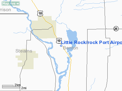
Little Rock / Rock Port Airport |
Location & QuickFacts
| FAA Information Effective: | 2008-09-25 |
| Airport Identifier: | 3MN5 |
| Airport Status: | Operational |
| Longitude/Latitude: | 094-11-37.9740W/45-43-22.8760N
-94.193882/45.723021 (Estimated) |
| Elevation: | 1055 ft / 321.56 m (Estimated) |
| Land: | 0 acres |
| From nearest city: | 2 nautical miles S of Rice, MN |
| Location: | Benton County, MN |
| Magnetic Variation: | 04E (1985) |
Owner & Manager
| Ownership: | Privately owned |
| Owner: | John Herman |
| Address: | R-2
Rice, MN 56367 |
| Phone number: | 612-393-2312 |
| Manager: | Merlyn F. Reberg |
| Address: | R-2
Rice, MN 56367 |
| Phone number: | 612-393-2312 |
Airport Operations and Facilities
| Airport Use: | Private
PERSONAL USE. |
| Wind indicator: | Yes |
| Segmented Circle: | No |
| Control Tower: | No |
| Landing fee charge: | No |
| Sectional chart: | Twin Cities |
| Region: | AGL - Great Lakes |
| Boundary ARTCC: | ZMP - Minneapolis |
| Tie-in FSS: | PNM - Princeton |
| FSS on Airport: | No |
| FSS Toll Free: | 1-800-WX-BRIEF
OR LOCAL CALL 253-2540. |
Airport Communications
Runway Information
Runway 16/34
| Dimension: | 1800 x 140 ft / 548.6 x 42.7 m |
| Surface: | TURF, |
| |
Runway 16 |
Runway 34 |
| Traffic Pattern: | Left | Right |
| Obstruction: | 35 ft tree, 250.0 ft from runway | , 2645.0 ft from runway |
|
Radio Navigation Aids
| ID |
Type |
Name |
Ch |
Freq |
Var |
Dist |
| LXL | NDB | Little Falls | | 359.00 | 03E | 15.0 nm |
| XCR | NDB | Ripley | | 404.00 | 03E | 22.3 nm |
| PNM | NDB | Princeton | | 368.00 | 03E | 26.4 nm |
| JMR | NDB | Mora | | 327.00 | 03E | 40.1 nm |
| CBG | NDB | Cambridge | | 350.00 | 03E | 40.4 nm |
| EE | NDB | Tamie | | 374.00 | 04E | 46.8 nm |
| SAZ | NDB | Staples | | 257.00 | 04E | 47.1 nm |
| GHW | NDB | Glenwood | | 346.00 | 03E | 47.5 nm |
| RYM | TACAN | Camp Ripley | 048X | | 03E | 23.1 nm |
| STC | VOR/DME | St Cloud | 058X | 112.10 | 03E | 11.9 nm |
| AXN | VOR/DME | Alexandria | 075X | 112.80 | 07E | 45.7 nm |
| BRD | VORTAC | Brainerd | 116X | 116.90 | 03E | 38.2 nm |
| DWN | VORTAC | Darwin | 027X | 109.00 | 07E | 39.7 nm |
| GEP | VORTAC | Gopher | 120X | 117.30 | 06E | 49.0 nm |
Images and information placed above are from
http://www.airport-data.com/airport/3MN5/
We thank them for the data!
| General Info
|
| Country |
United States
|
| State |
MINNESOTA
|
| FAA ID |
3MN5
|
| Latitude |
45-43-22.876N
|
| Longitude |
094-11-37.974W
|
| Elevation |
1055 feet
|
| Near City |
RICE
|
We don't guarantee the information is fresh and accurate. The data may
be wrong or outdated.
For more up-to-date information please refer to other sources.
|
|


