 |
|
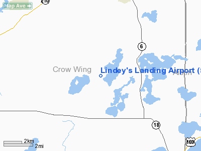
Location & QuickFacts
| FAA Information Effective: | 2008-09-25 |
| Airport Identifier: | 5MN7 |
| Airport Status: | Operational |
| Longitude/Latitude: | 093-55-54.9370W/46-23-13.8620N
-93.931927/46.387184 (Estimated) |
| Elevation: | 1295 ft / 394.72 m (Estimated) |
| Land: | 0 acres |
| From nearest city: | 5 nautical miles S of Deerwood, MN |
| Location: | Crow Wing County, MN |
| Magnetic Variation: | 03E (1985) |
Owner & Manager
| Ownership: | Privately owned |
| Owner: | Grant G Lindemer, Et Al |
| Address: | 3600 N Snelling Ave
Arden Hills, MN 55112 |
| Phone number: | 218-764-2263 |
| Address: |
|
Airport Operations and Facilities
| Airport Use: | Private
PERSONAL USE. |
| Wind indicator: | No |
| Segmented Circle: | No |
| Control Tower: | No |
| Landing fee charge: | No |
| Sectional chart: | Twin Cities |
| Region: | AGL - Great Lakes |
| Boundary ARTCC: | ZMP - Minneapolis |
| Tie-in FSS: | PNM - Princeton |
| FSS on Airport: | No |
| FSS Toll Free: | 1-800-WX-BRIEF |
Runway Information
Runway 04W/22W
| Dimension: | 10000 x 2600 ft / 3048.0 x 792.5 m |
| Surface: | WATER, |
| |
Runway 04W |
Runway 22W |
| Traffic Pattern: | Left | Left |
|
Runway 09/27
| Dimension: | 1800 x 50 ft / 548.6 x 15.2 m |
| Surface: | TURF, |
| |
Runway 09 |
Runway 27 |
| Traffic Pattern: | Left | Left |
|
Runway 18/36
| Dimension: | 2400 x 50 ft / 731.5 x 15.2 m |
| Surface: | TURF, |
| |
Runway 18 |
Runway 36 |
| Traffic Pattern: | Left | Left |
|
Radio Navigation Aids
| ID |
Type |
Name |
Ch |
Freq |
Var |
Dist |
| AIT | NDB | Aitkin | | 397.00 | 03E | 14.3 nm |
| XCR | NDB | Ripley | | 404.00 | 03E | 25.2 nm |
| PWC | NDB | Pine River | | 330.00 | 03E | 27.7 nm |
| LXL | NDB | Little Falls | | 359.00 | 03E | 31.3 nm |
| SAZ | NDB | Staples | | 257.00 | 04E | 36.2 nm |
| XVG | NDB | Longville | | 392.00 | 04E | 38.2 nm |
| JMR | NDB | Mora | | 327.00 | 03E | 40.7 nm |
| MZH | NDB | Moose Lake | | 362.00 | 02E | 46.8 nm |
| RYM | TACAN | Camp Ripley | 048X | | 03E | 25.0 nm |
| BRD | VORTAC | Brainerd | 116X | 116.90 | 03E | 4.5 nm |
Remarks
- PROVIDE OBSTNS REMOVED IN RWY APCH OR RWY THR IS DSPCLD & MARKED TO PROVIDE 20:1 APCH CLEARANCE OVER OBSTNS.
Images and information placed above are from
http://www.airport-data.com/airport/5MN7/
We thank them for the data!
| General Info
|
| Country |
United States
|
| State |
MINNESOTA
|
| FAA ID |
5MN7
|
| Latitude |
46-23-13.862N
|
| Longitude |
093-55-54.937W
|
| Elevation |
1295 feet
|
| Near City |
DEERWOOD
|
We don't guarantee the information is fresh and accurate. The data may
be wrong or outdated.
For more up-to-date information please refer to other sources.
|
|


