 |
|
Location & QuickFacts
| FAA Information Effective: | 2008-09-25 |
| Airport Identifier: | 4MN3 |
| Airport Status: | Operational |
| Longitude/Latitude: | 093-09-01.3090W/45-18-39.9770N
-93.150364/45.311105 (Estimated) |
| Elevation: | 1080 ft / 329.18 m (Estimated) |
| Land: | 0 acres |
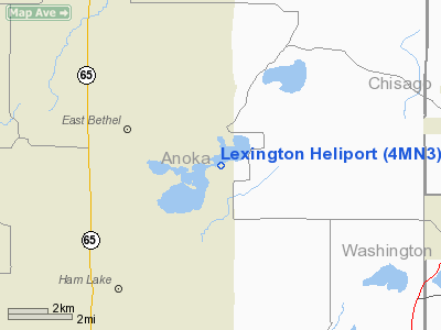
| From nearest city: | 0 nautical miles N of Ham Lake, MN |
| Location: | Anoka County, MN |
| Magnetic Variation: | 02E (1995) |
Owner & Manager
| Ownership: | Privately owned |
| Owner: | Steven M. Thul |
| Address: | 4656 169th Lane Ne
Ham Lake, MN 55304 |
| Phone number: | 612-434-6415 |
| Manager: | Steven M. Thul |
| Address: | 4656 169th Lane Ne
Ham Lake, MN 55304 |
| Phone number: | 612-434-6415 |
Airport Operations and Facilities
| Airport Use: | Private |
| Segmented Circle: | No |
| Control Tower: | No |
| Sectional chart: | Twin Cities |
| Region: | AGL - Great Lakes |
| Boundary ARTCC: | ZMP - Minneapolis |
| Tie-in FSS: | PNM - Princeton |
| FSS Toll Free: | 1-800-WX-BRIEF |
Runway Information
Helipad H1
| Dimension: | 200 x 85 ft / 61.0 x 25.9 m |
| Surface: | TURF, |
| |
Runway H1 |
Runway |
| Traffic Pattern: | Left | Left |
|
Radio Navigation Aids
| ID |
Type |
Name |
Ch |
Freq |
Var |
Dist |
| CBG | NDB | Cambridge | | 350.00 | 03E | 15.5 nm |
| OEO | NDB | Osceola | | 233.00 | 01E | 19.5 nm |
| PNM | NDB | Princeton | | 368.00 | 03E | 24.6 nm |
| ROS | NDB | Rush City | | 282.00 | 02E | 24.6 nm |
| PPI | NDB | Hopey | | 400.00 | 03E | 27.8 nm |
| RNH | NDB | New Richmond | | 257.00 | 02E | 27.9 nm |
| MS | NDB | Narco | | 266.00 | 02E | 29.3 nm |
| AHH | NDB | Ameron | | 278.00 | 01E | 33.0 nm |
| JMR | NDB | Mora | | 327.00 | 03E | 35.2 nm |
| BXR | NDB | Big Doctor | | 203.00 | 02E | 45.0 nm |
| MSP | VOR/DME | Minneapolis | 100X | 115.30 | 02E | 25.2 nm |
| FCM | VOR/DME | Flying Cloud | 055X | 111.80 | 06E | 31.9 nm |
| STC | VOR/DME | St Cloud | 058X | 112.10 | 03E | 40.9 nm |
| RZN | VOR/DME | Siren | 031X | 109.40 | 02E | 44.8 nm |
| GEP | VORTAC | Gopher | 120X | 117.30 | 06E | 13.7 nm |
| FGT | VORTAC | Farmington | 104X | 115.70 | 06E | 40.9 nm |
| STP | VOT | St Paul | | 114.40 | | 22.6 nm |
| MSP | VOT | Minneapolis St Paul | | 111.00 | | 25.8 nm |
Remarks
- PRVDD ALL APCH/DEP FM 030-045, THE AREA FM 110-170 MAY BE USED AFTER SMALL TREES ARE REMOVED, WIND INDICATOE MAINTAINED, COMPLY WITH FAR 91.126(B)(2), MAINTAIN WARNING SIGNS AROUND TAKEOFF & LANDING AREA.
Images and information placed above are from
http://www.airport-data.com/airport/4MN3/
We thank them for the data!
| General Info
|
| Country |
United States
|
| State |
MINNESOTA
|
| FAA ID |
4MN3
|
| Latitude |
45-18-39.977N
|
| Longitude |
093-09-01.309W
|
| Elevation |
1080 feet
|
| Near City |
HAM LAKE
|
We don't guarantee the information is fresh and accurate. The data may
be wrong or outdated.
For more up-to-date information please refer to other sources.
|
|


