 |
|
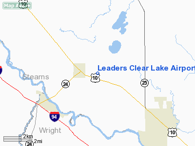
Leaders Clear Lake Airport |
Location & QuickFacts
| FAA Information Effective: | 2008-09-25 |
| Airport Identifier: | 8Y6 |
| Airport Status: | Operational |
| Longitude/Latitude: | 093-58-15.9300W/45-26-39.8760N
-93.971092/45.444410 (Estimated) |
| Elevation: | 990 ft / 301.75 m (Estimated) |
| Land: | 190 acres |
| From nearest city: | 2 nautical miles E of Clear Lake, MN |
| Location: | Sherburne County, MN |
| Magnetic Variation: | 04E (1985) |
Owner & Manager
| Ownership: | Privately owned |
| Owner: | Bob Leaders |
| Address: | Box 157
Clear Lake, MN 55319 |
| Phone number: | 612-743-2294 |
| Manager: | Bob Leaders |
| Address: | Box 157
Clear Lake, MN 55319 |
| Phone number: | 612-743-2294 |
Airport Operations and Facilities
| Airport Use: | Open to public |
| Wind indicator: | Yes |
| Segmented Circle: | No |
| Control Tower: | No |
| Landing fee charge: | No |
| Sectional chart: | Twin Cities |
| Region: | AGL - Great Lakes |
| Boundary ARTCC: | ZMP - Minneapolis |
| Tie-in FSS: | PNM - Princeton |
| FSS on Airport: | No |
| FSS Toll Free: | 1-800-WX-BRIEF |
| NOTAMs Facility: | PNM (NOTAM-d service avaliable) |
Airport Communications
Airport Services
| Fuel available: | 100LL |
| Airframe Repair: | MAJOR |
| Power Plant Repair: | MAJOR |
| Bottled Oxygen: | NONE |
| Bulk Oxygen: | NONE |
Runway Information
Runway 18/36
| Dimension: | 3000 x 150 ft / 914.4 x 45.7 m |
| Surface: | ASPH-TURF, Poor Condition
ALONG THE CENTER OF THE RY THERE ARE SEVERAL LOW BARE SPOTS WHICH CAN FORM 1-3 INCH PUDDLES OF WATER AFTER A RAIN. 20 FT BY 1000 FT ASPH AREA S END. |
| |
Runway 18 |
Runway 36 |
| Longitude: | 093-58-15.9300W | 093-58-15.9300W |
| Latitude: | 45-26-53.6900N | 45-26-24.0700N |
| Elevation: | 985.00 ft | 985.00 ft |
| Traffic Pattern: | Left | Left |
| Runway End Identifier: | No | No |
| Centerline Lights: | No | No |
| Touchdown Lights: | No | No |
| Obstruction: | 35 ft trees, 465.0 ft from runway, 170 ft right of centerline, 13:1 slope to clear | 15 ft road, 0.0 ft from runway
TREES +16, 210 FM END, 25L, 13:1. |
|
Radio Navigation Aids
| ID |
Type |
Name |
Ch |
Freq |
Var |
Dist |
| PNM | NDB | Princeton | | 368.00 | 03E | 16.9 nm |
| CBG | NDB | Cambridge | | 350.00 | 03E | 30.6 nm |
| LXL | NDB | Little Falls | | 359.00 | 03E | 34.1 nm |
| HCD | NDB | Hutchinson | | 209.00 | 04E | 39.4 nm |
| JMR | NDB | Mora | | 327.00 | 03E | 39.9 nm |
| XCR | NDB | Ripley | | 404.00 | 03E | 41.2 nm |
| GYL | NDB | Glencoe | | 407.00 | 03E | 41.4 nm |
| ROS | NDB | Rush City | | 282.00 | 02E | 45.3 nm |
| RYM | TACAN | Camp Ripley | 048X | | 03E | 42.1 nm |
| STC | VOR/DME | St Cloud | 058X | 112.10 | 03E | 7.3 nm |
| FCM | VOR/DME | Flying Cloud | 055X | 111.80 | 06E | 43.1 nm |
| MSP | VOR/DME | Minneapolis | 100X | 115.30 | 02E | 45.3 nm |
| DWN | VORTAC | Darwin | 027X | 109.00 | 07E | 29.6 nm |
| GEP | VORTAC | Gopher | 120X | 117.30 | 06E | 31.0 nm |
| MSP | VOT | Minneapolis St Paul | | 111.00 | | 46.5 nm |
| STP | VOT | St Paul | | 114.40 | | 49.1 nm |
Remarks
- ULTRALIGHT TRAFFIC ON & INVOF AIRPORT.
Images and information placed above are from
http://www.airport-data.com/airport/8Y6/
We thank them for the data!
| General Info
|
| Country |
United States
|
| State |
MINNESOTA
|
| FAA ID |
8Y6
|
| Latitude |
45-26-39.876N
|
| Longitude |
093-58-15.930W
|
| Elevation |
990 feet
|
| Near City |
CLEAR LAKE
|
We don't guarantee the information is fresh and accurate. The data may
be wrong or outdated.
For more up-to-date information please refer to other sources.
|
|


