|
|
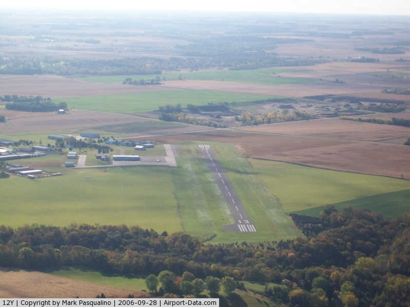
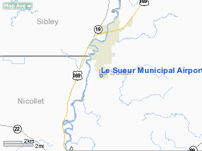
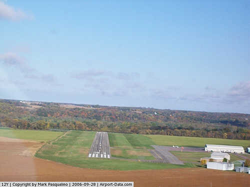
Le Sueur Municipal Airport |
|
 |
(Click on the photo to enlarge) |
|
 |
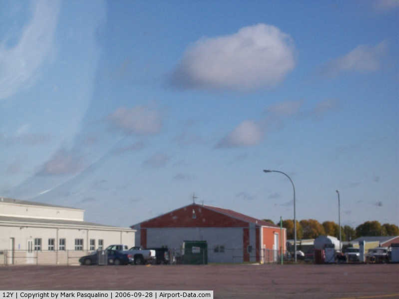
(Click on the photo to enlarge) |
|
 |
(Click on the photo to enlarge) |
Location & QuickFacts
| FAA Information Effective: | 2008-09-25 |
| Airport Identifier: | 12Y |
| Airport Status: | Operational |
| Longitude/Latitude: | 093-54-45.8670W/44-26-14.8730N
-93.912741/44.437465 (Estimated) |
| Elevation: | 868 ft / 264.57 m (Estimated) |
| Land: | 96 acres |
| From nearest city: | 2 nautical miles S of Le Sueur, MN |
| Location: | Le Sueur County, MN |
| Magnetic Variation: | 04E (1985) |
Owner & Manager
| Ownership: | Publicly owned |
| Owner: | City Of Le Sueur |
| Address: | 203 S 2nd St, Box 176
Le Sueur, MN 56058 |
| Phone number: | 507-665-6401 |
| Manager: | Dean Kunze |
| Address: | 203 S 2nd St, Box 176
Le Sueur, MN 56058 |
| Phone number: | 507-665-2266 |
Airport Operations and Facilities
| Airport Use: | Open to public |
| Wind indicator: | Yes |
| Segmented Circle: | No |
| Control Tower: | No |
| Lighting Schedule: | DUSK-DAWN
ACTVT MIRL RY 13/31, VASI RYS 13 & 31 - 122.8. |
| Beacon Color: | Clear-Green (lighted land airport) |
| Landing fee charge: | No |
| Sectional chart: | Omaha |
| Region: | AGL - Great Lakes |
| Traffic Pattern Alt: | 800 ft |
| Boundary ARTCC: | ZMP - Minneapolis |
| Tie-in FSS: | PNM - Princeton |
| FSS on Airport: | No |
| FSS Toll Free: | 1-800-WX-BRIEF |
| NOTAMs Facility: | PNM (NOTAM-d service avaliable) |
| Federal Agreements: | NGY |
Airport Communications
Airport Services
| Fuel available: | 100LL
SELF SVC FUEL AVAIL 24 HRS WITH CREDIT CARD. |
Runway Information
Runway 13/31
| Dimension: | 3005 x 75 ft / 915.9 x 22.9 m |
| Surface: | ASPH, Good Condition |
| Edge Lights: | Medium |
| |
Runway 13 |
Runway 31 |
| Longitude: | 093-55-11.9300W | 093-54-42.8000W |
| Latitude: | 44-26-37.9200N | 44-26-16.8200N |
| Elevation: | 835.00 ft | 866.00 ft |
| Traffic Pattern: | Left | Left |
| Markings: | Non-precision instrument, Good Condition | Non-precision instrument, Good Condition |
| VASI: | 2-box on left side | 2-box on left side |
| Runway End Identifier: | No | No |
| Centerline Lights: | No | No |
| Touchdown Lights: | No | No |
| Obstruction: | 10 ft trees, 201.0 ft from runway, 110 ft right of centerline
TREES +10, 190-200 FM RWY END, 110R. | 63 ft trees, 1775.0 ft from runway, 25:1 slope to clear |
|
Radio Navigation Aids
| ID |
Type |
Name |
Ch |
Freq |
Var |
Dist |
| GYL | NDB | Glencoe | | 407.00 | 03E | 20.8 nm |
| ACQ | NDB | Waseca | | 371.00 | 02E | 27.0 nm |
| HCD | NDB | Hutchinson | | 209.00 | 04E | 32.3 nm |
| JYG | NDB | St James | | 260.00 | 04E | 38.7 nm |
| MS | NDB | Narco | | 266.00 | 02E | 42.2 nm |
| PPI | NDB | Hopey | | 400.00 | 03E | 49.1 nm |
| ULM | NDB/DME | New Ulm | 050X | 272.00 | 04E | 26.2 nm |
| MKT | VOR/DME | Mankato | 045X | 110.80 | 07E | 13.1 nm |
| FOW | VOR/DME | Halfway | 049X | 111.20 | 02E | 27.2 nm |
| FCM | VOR/DME | Flying Cloud | 055X | 111.80 | 06E | 30.4 nm |
| MSP | VOR/DME | Minneapolis | 100X | 115.30 | 02E | 40.0 nm |
| FGT | VORTAC | Farmington | 104X | 115.70 | 06E | 33.4 nm |
| DWN | VORTAC | Darwin | 027X | 109.00 | 07E | 45.4 nm |
| GEP | VORTAC | Gopher | 120X | 117.30 | 06E | 48.4 nm |
| MSP | VOT | Minneapolis St Paul | | 111.00 | | 40.1 nm |
| STP | VOT | St Paul | | 114.40 | | 47.4 nm |
Images and information placed above are from
http://www.airport-data.com/airport/12Y/
We thank them for the data!
| General Info
|
| Country |
United States
|
| State |
MINNESOTA
|
| FAA ID |
12Y
|
| Latitude |
44-26-14.873N
|
| Longitude |
093-54-45.867W
|
| Elevation |
868 feet
|
| Near City |
LE SUEUR
|
We don't guarantee the information is fresh and accurate. The data may
be wrong or outdated.
For more up-to-date information please refer to other sources.
|
|