 |
|
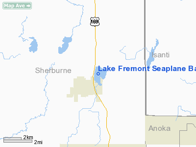
Lake Fremont Seaplane Base |
Location & QuickFacts
| FAA Information Effective: | 2008-09-25 |
| Airport Identifier: | MY48 |
| Airport Status: | Operational |
| Longitude/Latitude: | 093-34-41.8610W/45-27-26.8750N
-93.578295/45.457465 (Estimated) |
| Elevation: | 974 ft / 296.88 m (Estimated) |
| Land: | 0 acres |
| From nearest city: | 1 nautical miles NE of Zimmerman, MN |
| Location: | Sherburne County, MN |
| Magnetic Variation: | 03E (1985) |
Owner & Manager
| Ownership: | Privately owned |
| Owner: | Gerald F. Gombold |
| Address: | Po Box 124
Zimmerman, MN 55398 |
| Phone number: | 612-856-2849 |
| Address: |
|
Airport Operations and Facilities
| Airport Use: | Private
PERSONAL USE. |
| Segmented Circle: | No |
| Control Tower: | No |
| Sectional chart: | Twin Cities |
| Region: | AGL - Great Lakes |
| Boundary ARTCC: | ZMP - Minneapolis |
| Tie-in FSS: | PNM - Princeton |
| FSS on Airport: | No |
| FSS Toll Free: | 1-800-WX-BRIEF |
Runway Information
Runway N/S
| Dimension: | 7000 x 900 ft / 2133.6 x 274.3 m |
| Surface: | WATER, |
| |
Runway N |
Runway S |
| Traffic Pattern: | Left | Left |
|
Radio Navigation Aids
| ID |
Type |
Name |
Ch |
Freq |
Var |
Dist |
| PNM | NDB | Princeton | | 368.00 | 03E | 6.6 nm |
| CBG | NDB | Cambridge | | 350.00 | 03E | 14.6 nm |
| JMR | NDB | Mora | | 327.00 | 03E | 29.1 nm |
| ROS | NDB | Rush City | | 282.00 | 02E | 29.9 nm |
| OEO | NDB | Osceola | | 233.00 | 01E | 38.6 nm |
| MS | NDB | Narco | | 266.00 | 02E | 43.2 nm |
| LXL | NDB | Little Falls | | 359.00 | 03E | 43.6 nm |
| PPI | NDB | Hopey | | 400.00 | 03E | 44.3 nm |
| GYL | NDB | Glencoe | | 407.00 | 03E | 47.1 nm |
| RNH | NDB | New Richmond | | 257.00 | 02E | 47.9 nm |
| XCR | NDB | Ripley | | 404.00 | 03E | 49.2 nm |
| HCD | NDB | Hutchinson | | 209.00 | 04E | 49.7 nm |
| STC | VOR/DME | St Cloud | 058X | 112.10 | 03E | 21.0 nm |
| MSP | VOR/DME | Minneapolis | 100X | 115.30 | 02E | 36.7 nm |
| FCM | VOR/DME | Flying Cloud | 055X | 111.80 | 06E | 38.3 nm |
| GEP | VORTAC | Gopher | 120X | 117.30 | 06E | 20.6 nm |
| DWN | VORTAC | Darwin | 027X | 109.00 | 07E | 43.2 nm |
| MSP | VOT | Minneapolis St Paul | | 111.00 | | 37.7 nm |
| STP | VOT | St Paul | | 114.40 | | 38.0 nm |
Remarks
- PROVIDED ONLY THE N/S SEALANE IS USED.
Images and information placed above are from
http://www.airport-data.com/airport/MY48/
We thank them for the data!
| General Info
|
| Country |
United States
|
| State |
MINNESOTA
|
| FAA ID |
MY48
|
| Latitude |
45-27-26.875N
|
| Longitude |
093-34-41.861W
|
| Elevation |
974 feet
|
| Near City |
ZIMMERMAN
|
We don't guarantee the information is fresh and accurate. The data may
be wrong or outdated.
For more up-to-date information please refer to other sources.
|
|


