 |
|
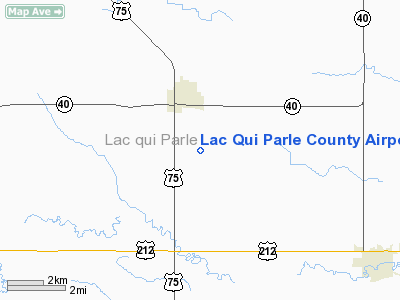
Lac Qui Parle County Airport |
Location & QuickFacts
| FAA Information Effective: | 2008-09-25 |
| Airport Identifier: | DXX |
| Airport Status: | Operational |
| Longitude/Latitude: | 096-10-39.8500W/44-59-10.4640N
-96.177736/44.986240 (Estimated) |
| Elevation: | 1082 ft / 329.79 m (Surveyed) |
| Land: | 257 acres |
| From nearest city: | 2 nautical miles SE of Madison, MN |
| Location: | Lac Qui Parle County, MN |
| Magnetic Variation: | 06E (1985) |
Owner & Manager
| Ownership: | Publicly owned |
| Owner: | Cities Of Madison & Dawson & County
ALSO CITY OF DAWSON AND LAC QUI PARLE COUNTY. |
| Address: | 406 Sixth Ave.
Madison, MN 56256-0175 |
| Phone number: | 320-598-3467 |
| Manager: | Mark Borgerson |
| Address: | Po Box 175
Madison, MN 56256-0175 |
| Phone number: | 320-598-3467 |
Airport Operations and Facilities
| Airport Use: | Open to public |
| Wind indicator: | Yes |
| Segmented Circle: | No |
| Control Tower: | No |
| Lighting Schedule: | DUSK-DAWN
ACTVT MIRL RY 13/31 - CTAF. |
| Beacon Color: | Clear-Green (lighted land airport) |
| Landing fee charge: | No |
| Sectional chart: | Twin Cities |
| Region: | AGL - Great Lakes |
| Boundary ARTCC: | ZMP - Minneapolis |
| Tie-in FSS: | PNM - Princeton |
| FSS on Airport: | No |
| FSS Toll Free: | 1-800-WX-BRIEF |
| NOTAMs Facility: | DXX (NOTAM-d service avaliable) |
| Federal Agreements: | NGY |
Airport Communications
| CTAF: | 122.800 |
| Unicom: | 122.800 |
Airport Services
| Fuel available: | 100LL |
| Airframe Repair: | MAJOR
FOR AIRFRAME AND PWR PLANT REPAIRS CALL 320-598-3467. |
| Power Plant Repair: | MAJOR |
Runway Information
Runway 08/26
| Dimension: | 3033 x 135 ft / 924.5 x 41.1 m |
| Surface: | TURF, Fair Condition |
| |
Runway 08 |
Runway 26 |
| Longitude: | 096-10-56.1510W | 096-10-14.1500W |
| Latitude: | 44-59-09.3640N | 44-59-09.3630N |
| Alignment: | 90 | 127 |
| Traffic Pattern: | Left | Left |
|
Runway 13/31
| Dimension: | 3301 x 75 ft / 1006.1 x 22.9 m |
| Surface: | ASPH, Good Condition |
| Edge Lights: | Medium |
| |
Runway 13 |
Runway 31 |
| Longitude: | 096-10-59.0000W | 096-10-29.4830W |
| Latitude: | 44-59-23.9310N | 44-58-58.9530N |
| Elevation: | 1082.00 ft | 1077.00 ft |
| Alignment: | 127 | 127 |
| Traffic Pattern: | Left | Left |
| Markings: | Non-precision instrument, Good Condition
RY 13/31 MARKINGS FADED, RY BLEACHED. | Non-precision instrument, Good Condition |
| Obstruction: | 14 ft road, 850.0 ft from runway, 46:1 slope to clear | 35 ft pline, 1400.0 ft from runway, 430 ft left of centerline, 34:1 slope to clear |
|
Radio Navigation Aids
| ID |
Type |
Name |
Ch |
Freq |
Var |
Dist |
| DXX | NDB | Dawson/madison | | 341.00 | 06E | 0.1 nm |
| AQP | NDB | Appleton | | 356.00 | 05E | 16.2 nm |
| VVV | NDB | Ortonville | | 332.00 | 05E | 21.6 nm |
| BBB | NDB | Benson | | 239.00 | 05E | 30.3 nm |
| MVE | VOR/DME | Montevideo | 053X | 111.60 | 05E | 19.8 nm |
| MML | VOR/DME | Marshall | 047X | 111.00 | 05E | 35.7 nm |
| MOX | VOR/DME | Morris | 033X | 109.60 | 05E | 35.9 nm |
| BDH | VOR/DME | Willmar | 84X | 113.70 | 04E | 45.3 nm |
| ILL | VOR/DME | Willmar | 084X | 113.70 | 04E | 46.8 nm |
| BKX | VOR/DME | Brookings | 025X | 108.80 | 06E | 49.3 nm |
| ATY | VORTAC | Watertown | 113X | 116.60 | 09E | 41.0 nm |
Remarks
- RY 08/26 NOT PLOWED WINTER MONTHS.
Images and information placed above are from
http://www.airport-data.com/airport/DXX/
We thank them for the data!
| General Info
|
| Country |
United States
|
| State |
MINNESOTA
|
| FAA ID |
DXX
|
| Latitude |
44.986240
44° 59' 10.46" N
|
| Longitude |
-96.177736
096° 10' 39.85" W
|
| Elevation |
1082 feet
330 meters
|
| Magnetic Variation |
003° E (01/06)
|
| Beacon |
Yes
|
| Operating Agency |
U.S.CIVIL AIRPORT WHEREIN PERMIT COVERS USE BY TRANSIT MILITARY AIRCRAFT
|
| Daylight Saving Time |
Second Sunday in March at 0200 to first Sunday in November at 0200 local time (Exception Arizona and that portion of Indiana in the Eastern Time Zone)
|
We don't guarantee the information is fresh and accurate. The data may
be wrong or outdated.
For more up-to-date information please refer to other sources.
|
|


