 |
|
Location & QuickFacts
| FAA Information Effective: | 2008-09-25 |
| Airport Identifier: | MN31 |
| Airport Status: | Operational |
| Longitude/Latitude: | 094-34-44.9730W/45-03-43.8640N
-94.579159/45.062184 (Estimated) |
| Elevation: | 1205 ft / 367.28 m (Estimated) |
| Land: | 11 acres |
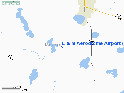
| From nearest city: | 4 nautical miles SW of Litchfield, MN |
| Location: | Meeker County, MN |
| Magnetic Variation: | 04E (1990) |
Owner & Manager
| Ownership: | Privately owned |
| Owner: | Edward J. Baumer |
| Address: | 59253 220th St
Litchfield, MN 55355 |
| Phone number: | 302-693-9524 |
| Manager: | Edward J. Baumer |
| Address: | 59253 220th St
Litchfield, MN 55355 |
| Phone number: | 302-693-9524 |
Airport Operations and Facilities
| Airport Use: | Private |
| Wind indicator: | Yes |
| Segmented Circle: | No |
| Control Tower: | No |
| Sectional chart: | Twin Cities |
| Region: | AGL - Great Lakes |
| Boundary ARTCC: | ZMP - Minneapolis |
| Tie-in FSS: | PNM - Princeton |
| FSS Toll Free: | 1-800-WX-BRIEF |
Runway Information
Runway 18/36
| Dimension: | 2480 x 50 ft / 755.9 x 15.2 m |
| Surface: | TURF, Good Condition |
| |
Runway 18 |
Runway 36 |
| Traffic Pattern: | Left | Left |
| Displaced threshold: | 300.00 ft | 0.00 ft |
| Obstruction: | 15 ft road | |
|
Radio Navigation Aids
| ID |
Type |
Name |
Ch |
Freq |
Var |
Dist |
| HCD | NDB | Hutchinson | | 209.00 | 04E | 14.9 nm |
| GYL | NDB | Glencoe | | 407.00 | 03E | 27.7 nm |
| GHW | NDB | Glenwood | | 346.00 | 03E | 46.9 nm |
| BBB | NDB | Benson | | 239.00 | 05E | 48.1 nm |
| ULM | NDB/DME | New Ulm | 050X | 272.00 | 04E | 44.9 nm |
| ILL | VOR/DME | Willmar | 084X | 113.70 | 04E | 22.0 nm |
| BDH | VOR/DME | Willmar | 84X | 113.70 | 04E | 23.5 nm |
| STC | VOR/DME | St Cloud | 058X | 112.10 | 03E | 36.6 nm |
| RWF | VOR/DME | Redwood Falls | 080X | 113.30 | 07E | 42.8 nm |
| MVE | VOR/DME | Montevideo | 053X | 111.60 | 05E | 48.4 nm |
| FCM | VOR/DME | Flying Cloud | 055X | 111.80 | 06E | 49.8 nm |
| DWN | VORTAC | Darwin | 027X | 109.00 | 07E | 5.5 nm |
Remarks
- PRVDD THE AREA 125' EITHER SIDE OF THE RY CL & 200' FM EITHER END OF THE RY END BE CLEAR OF ANY OBST. ANY OBST IN RY APCH SLOPE SFC BE LOWERED OR REMOVED. OTHERWISEE RY THRS SHOULD BE DSPLCD & CLEARLY MKD SO AS TO PRVD A 20:1 APCH CLNC OVER ALL OBST.
Images and information placed above are from
http://www.airport-data.com/airport/MN31/
We thank them for the data!
| General Info
|
| Country |
United States
|
| State |
MINNESOTA
|
| FAA ID |
MN31
|
| Latitude |
45-03-43.864N
|
| Longitude |
094-34-44.973W
|
| Elevation |
1205 feet
|
| Near City |
LITCHFIELD
|
We don't guarantee the information is fresh and accurate. The data may
be wrong or outdated.
For more up-to-date information please refer to other sources.
|
|


