 |
|
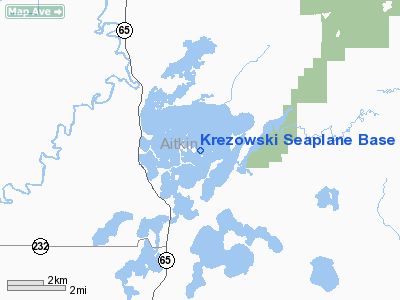
Location & QuickFacts
| FAA Information Effective: | 2008-09-25 |
| Airport Identifier: | MN75 |
| Airport Status: | Operational |
| Longitude/Latitude: | 093-16-56.4100W/46-45-29.4100N
-93.282336/46.758169 (Estimated) |
| Elevation: | 1214 ft / 370.03 m (Estimated) |
| Land: | 5000 acres |
| From nearest city: | 8 nautical miles N of Mcgregor, MN |
| Location: | Aitkin County, MN |
| Magnetic Variation: | 02E (2000) |
Owner & Manager
| Ownership: | Privately owned |
| Owner: | Mark Krezowski |
| Address: | 19858 508th Lane
Mcgregor, MN 55760 |
| Phone number: | 218-426-3280 |
| Manager: | Mark Krezowski |
| Address: | 19858 508th Lane
Mcgregor, MN 55760 |
| Phone number: | 218-426-3280 |
Airport Operations and Facilities
| Airport Use: | Private |
| Segmented Circle: | No |
| Control Tower: | No |
| Sectional chart: | Twin Cities |
| Region: | AGL - Great Lakes |
| Boundary ARTCC: | ZMP - Minneapolis |
| Tie-in FSS: | PNM - Princeton |
| FSS Toll Free: | 1-800-WX-BRIEF |
Runway Information
Runway 05W/23W
| Dimension: | 10000 x 500 ft / 3048.0 x 152.4 m |
| Surface: | WATER, |
| |
Runway 05W |
Runway 23W |
| Traffic Pattern: | Left | Left |
|
Runway 14W/32W
| Dimension: | 10000 x 500 ft / 3048.0 x 152.4 m |
| Surface: | WATER, |
| |
Runway 14W |
Runway 32W |
| Traffic Pattern: | Left | Left |
|
Radio Navigation Aids
| ID |
Type |
Name |
Ch |
Freq |
Var |
Dist |
| AIT | NDB | Aitkin | | 397.00 | 03E | 20.6 nm |
| MZH | NDB | Moose Lake | | 362.00 | 02E | 28.5 nm |
| COQ | NDB | Cloquet | | 335.00 | 03E | 32.3 nm |
| DL | NDB | Pykla | | 379.00 | 02E | 38.5 nm |
| XVG | NDB | Longville | | 392.00 | 04E | 40.5 nm |
| PWC | NDB | Pine River | | 330.00 | 03E | 45.4 nm |
| SUW | NDB | Bong | | 260.00 | 01E | 48.7 nm |
| LKI | TACAN | Lakeside | 011X | | 05E | 45.5 nm |
| GPZ | VOR/DME | Grand Rapids | 051X | 111.40 | 06E | 25.8 nm |
| HIB | VOR/DME | Hibbing | 045X | 110.80 | 02E | 40.3 nm |
| BRD | VORTAC | Brainerd | 116X | 116.90 | 03E | 39.4 nm |
| DLH | VORTAC | Duluth | 073X | 112.60 | 05E | 44.5 nm |
Remarks
- 150 FT LOOKOUT FIRE TOWER 1 NM SOUTH OF SEAPLANE BASE.
- 400 FT CELL TOWER (1700 FT MSL) 2NM SOUTH.
- PRVDD CLEAR 20:1 APCHS AND REFERENCE FAR 91.115 WATER OPNS.
Images and information placed above are from
http://www.airport-data.com/airport/MN75/
We thank them for the data!
| General Info
|
| Country |
United States
|
| State |
MINNESOTA
|
| FAA ID |
MN75
|
| Latitude |
46-45-29.410N
|
| Longitude |
093-16-56.410W
|
| Elevation |
1216 feet
|
| Near City |
MCGREGOR
|
We don't guarantee the information is fresh and accurate. The data may
be wrong or outdated.
For more up-to-date information please refer to other sources.
|
|


