 |
|
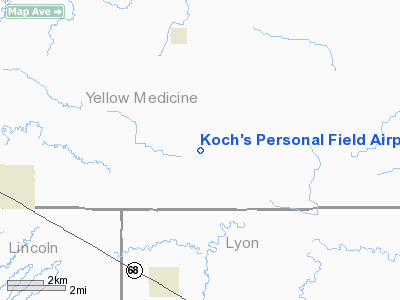
Koch's Personal Field Airport |
Location & QuickFacts
| FAA Information Effective: | 2008-09-25 |
| Airport Identifier: | MY04 |
| Airport Status: | Operational |
| Longitude/Latitude: | 096-02-14.1210W/44-39-35.8600N
-96.037256/44.659961 (Estimated) |
| Elevation: | 1130 ft / 344.42 m (Estimated) |
| Land: | 0 acres |
| From nearest city: | 4 nautical miles N of Taunton, MN |
| Location: | Lyon County, MN |
| Magnetic Variation: | 05E (1985) |
Owner & Manager
| Ownership: | Privately owned |
| Owner: | Mrs. George J. Koch |
| Address: |
Taunton, MN 56291 |
| Phone number: | 507-296-4590 |
| Manager: | Mrs. George J. Koch |
| Address: |
Taunton, MN 56291 |
| Phone number: | 507-296-4590 |
Airport Operations and Facilities
| Airport Use: | Private
PERSONAL USE. |
| Segmented Circle: | No |
| Control Tower: | No |
| Sectional chart: | Twin Cities |
| Region: | AGL - Great Lakes |
| Boundary ARTCC: | ZMP - Minneapolis |
| Tie-in FSS: | PNM - Princeton |
| FSS on Airport: | No |
| FSS Toll Free: | 1-800-WX-BRIEF |
Runway Information
Runway E/W
| Dimension: | 2200 x 75 ft / 670.6 x 22.9 m |
| Surface: | TURF, |
| |
Runway E |
Runway W |
| Traffic Pattern: | Left | Left |
|
Radio Navigation Aids
| ID |
Type |
Name |
Ch |
Freq |
Var |
Dist |
| DXX | NDB | Dawson/madison | | 341.00 | 06E | 20.4 nm |
| AQP | NDB | Appleton | | 356.00 | 05E | 34.2 nm |
| VVV | NDB | Ortonville | | 332.00 | 05E | 41.9 nm |
| BBB | NDB | Benson | | 239.00 | 05E | 43.3 nm |
| PQN | NDB/DME | Pipestone | 028X | 284.00 | 06E | 42.0 nm |
| MML | VOR/DME | Marshall | 047X | 111.00 | 05E | 15.6 nm |
| MVE | VOR/DME | Montevideo | 053X | 111.60 | 05E | 23.4 nm |
| BKX | VOR/DME | Brookings | 025X | 108.80 | 06E | 39.7 nm |
| RWF | VOR/DME | Redwood Falls | 080X | 113.30 | 07E | 40.6 nm |
| BDH | VOR/DME | Willmar | 84X | 113.70 | 04E | 47.5 nm |
| ILL | VOR/DME | Willmar | 084X | 113.70 | 04E | 48.8 nm |
Images and information placed above are from
http://www.airport-data.com/airport/MY04/
We thank them for the data!
| General Info
|
| Country |
United States
|
| State |
MINNESOTA
|
| FAA ID |
MY04
|
| Latitude |
44-39-35.860N
|
| Longitude |
096-02-14.121W
|
| Elevation |
1130 feet
|
| Near City |
TAUNTON
|
We don't guarantee the information is fresh and accurate. The data may
be wrong or outdated.
For more up-to-date information please refer to other sources.
|
|


