 |
|
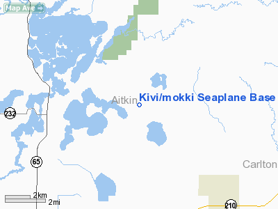
Location & QuickFacts
| FAA Information Effective: | 2008-09-25 |
| Airport Identifier: | 17MN |
| Airport Status: | Operational |
| Longitude/Latitude: | 093-12-36.8020W/46-43-00.8090N
-93.210223/46.716891 (Estimated) |
| Elevation: | 1224 ft / 373.08 m (Estimated) |
| Land: | 0 acres |
| From nearest city: | 8 nautical miles NE of Mc Gregor, MN |
| Location: | Aitkin County, MN |
| Magnetic Variation: | 03E (1985) |
Owner & Manager
| Ownership: | Privately owned |
| Owner: | John Ingebrigtson |
| Address: | Hcr 3 Box 360
Mc Gregor, MN 55427 |
| Phone number: | 218-426-3954 |
| Manager: | John Ingebrigtson |
| Address: | Hcr 3 Box 360
Mc Gregor, MN 55369 |
| Phone number: | 218-426-3954 |
Airport Operations and Facilities
| Airport Use: | Private
PERSONAL USE. |
| Wind indicator: | Yes |
| Segmented Circle: | No |
| Control Tower: | No |
| Sectional chart: | Green Bay |
| Region: | AGL - Great Lakes |
| Boundary ARTCC: | ZMP - Minneapolis |
| Tie-in FSS: | PNM - Princeton |
| FSS on Airport: | No |
| FSS Toll Free: | 1-800-WX-BRIEF |
Airport Services
Runway Information
Runway 12/30
| Dimension: | 5000 x 3000 ft / 1524.0 x 914.4 m |
| Surface: | WATER, |
| |
Runway 12 |
Runway 30 |
| Traffic Pattern: | Left | Left |
|
Radio Navigation Aids
| ID |
Type |
Name |
Ch |
Freq |
Var |
Dist |
| AIT | NDB | Aitkin | | 397.00 | 03E | 21.7 nm |
| MZH | NDB | Moose Lake | | 362.00 | 02E | 24.7 nm |
| COQ | NDB | Cloquet | | 335.00 | 03E | 29.2 nm |
| DL | NDB | Pykla | | 379.00 | 02E | 36.0 nm |
| XVG | NDB | Longville | | 392.00 | 04E | 44.2 nm |
| SUW | NDB | Bong | | 260.00 | 01E | 45.6 nm |
| PWC | NDB | Pine River | | 330.00 | 03E | 48.4 nm |
| JMR | NDB | Mora | | 327.00 | 03E | 49.7 nm |
| LKI | TACAN | Lakeside | 011X | | 05E | 42.9 nm |
| GPZ | VOR/DME | Grand Rapids | 051X | 111.40 | 06E | 29.2 nm |
| HIB | VOR/DME | Hibbing | 045X | 110.80 | 02E | 40.8 nm |
| BRD | VORTAC | Brainerd | 116X | 116.90 | 03E | 40.4 nm |
| DLH | VORTAC | Duluth | 073X | 112.60 | 05E | 41.8 nm |
Images and information placed above are from
http://www.airport-data.com/airport/17MN/
We thank them for the data!
| General Info
|
| Country |
United States
|
| State |
MINNESOTA
|
| FAA ID |
17MN
|
| Latitude |
46-43-00.809N
|
| Longitude |
093-12-36.802W
|
| Elevation |
1224 feet
|
| Near City |
MC GREGOR
|
We don't guarantee the information is fresh and accurate. The data may
be wrong or outdated.
For more up-to-date information please refer to other sources.
|
|


