 |
|
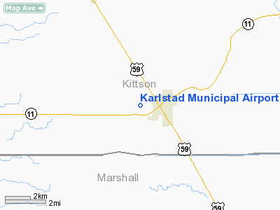
Karlstad Municipal Airport |
Location & QuickFacts
| FAA Information Effective: | 2008-09-25 |
| Airport Identifier: | 23D |
| Airport Status: | Operational |
| Longitude/Latitude: | 096-32-31.1520W/48-34-44.9150N
-96.541987/48.579143 (Estimated) |
| Elevation: | 1025 ft / 312.42 m (Estimated) |
| Land: | 120 acres |
| From nearest city: | 1 nautical miles W of Karlstad, MN |
| Location: | Kittson County, MN |
| Magnetic Variation: | 06E (1985) |
Owner & Manager
| Ownership: | Publicly owned |
| Owner: | City Of Karlstad |
| Address: | Box 299
Karlstad, MN 56732 |
| Phone number: | 218-436-2178 |
| Manager: | Wayne Ruud |
| Address: | Box 299
Karlstad, MN 56732 |
| Phone number: | 218-436-2178 |
Airport Operations and Facilities
| Airport Use: | Open to public |
| Wind indicator: | Yes |
| Segmented Circle: | No |
| Control Tower: | No |
| Lighting Schedule: | DUSK-DAWN |
| Landing fee charge: | No |
| Sectional chart: | Twin Cities |
| Region: | AGL - Great Lakes |
| Boundary ARTCC: | ZMP - Minneapolis |
| Tie-in FSS: | PNM - Princeton |
| FSS on Airport: | No |
| FSS Toll Free: | 1-800-WX-BRIEF |
| NOTAMs Facility: | PNM (NOTAM-d service avaliable) |
Airport Communications
Airport Services
Runway Information
Runway 17/35
| Dimension: | 2606 x 159 ft / 794.3 x 48.5 m |
| Surface: | TURF, Good Condition |
| Edge Lights: | Non-standard lighting system
RWY 17/35 NSTD LIRL; 400 FEET BETWEEN LIGHTS. |
| |
Runway 17 |
Runway 35 |
| Longitude: | 096-32-34.5200W | 096-32-27.7900W |
| Latitude: | 48-34-57.5700N | 48-34-32.2500N |
| Elevation: | 1025.00 ft | 1024.00 ft |
| Traffic Pattern: | Left | Left |
| Obstruction: | 27 ft tree, 180.0 ft from runway, 142 ft right of centerline, 6:1 slope to clear | 14 ft road, 135.0 ft from runway, 130 ft left of centerline, 9:1 slope to clear |
|
Radio Navigation Aids
| ID |
Type |
Name |
Ch |
Freq |
Var |
Dist |
| PFT | NDB | Piney Pinecreek | | 342.00 | 05E | 33.4 nm |
| CKN | NDB | Crookston | | 400.00 | 07E | 44.6 nm |
| TVF | VOR/DME | Thief River Falls | 021X | 108.40 | 08E | 33.8 nm |
| ROX | VOR/DME | Roseau | 025X | 108.80 | 05E | 37.5 nm |
| GFK | VOR/DME | Grand Forks | 090X | 114.30 | 09E | 45.5 nm |
| HML | VORTAC | Humboldt | 071X | 112.40 | 09E | 28.7 nm |
Remarks
- TWY MARKERS ARE NON-FRANGIBLE.
- ESTAB PRIOR TO 1959.
Images and information placed above are from
http://www.airport-data.com/airport/23D/
We thank them for the data!
| General Info
|
| Country |
United States
|
| State |
MINNESOTA
|
| FAA ID |
23D
|
| Latitude |
48-34-44.915N
|
| Longitude |
096-32-31.152W
|
| Elevation |
1025 feet
|
| Near City |
KARLSTAD
|
We don't guarantee the information is fresh and accurate. The data may
be wrong or outdated.
For more up-to-date information please refer to other sources.
|
|


