 |
|
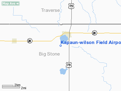
Kapaun - Wilson Field Airport |
Location & QuickFacts
| FAA Information Effective: | 2008-09-25 |
| Airport Identifier: | 4MN5 |
| Airport Status: | Operational |
| Longitude/Latitude: | 096-27-05.2200W/45-33-01.8670N
-96.451450/45.550519 (Estimated) |
| Elevation: | 1122 ft / 341.99 m (Surveyed) |
| Land: | 20 acres |
| From nearest city: | 2 nautical miles SW of Graceville, MN |
| Location: | Big Stone County, MN |
| Magnetic Variation: | 06E (1985) |
Owner & Manager
| Ownership: | Publicly owned |
| Owner: | City Of Graceville |
| Address: | P0 Box 156
Graceville, MN 56240 |
| Phone number: | 320-748-7911 |
| Manager: | Scott Bauer |
| Address: | Po Box 156
Graceville, MN 56240 |
| Phone number: | 320-748-7911 |
Airport Operations and Facilities
| Airport Use: | Private |
| Segmented Circle: | No |
| Control Tower: | No |
| Landing fee charge: | No |
| Sectional chart: | Twin Cities |
| Region: | AGL - Great Lakes |
| Boundary ARTCC: | ZMP - Minneapolis |
| Tie-in FSS: | PNM - Princeton |
| FSS on Airport: | No |
| FSS Toll Free: | 1-800-WX-BRIEF |
Runway Information
Runway 17/35
| Dimension: | 2250 x 100 ft / 685.8 x 30.5 m |
| Surface: | TURF, Good Condition |
| |
Runway 17 |
Runway 35 |
| Longitude: | 096-27-05.2200W | 096-27-05.2200W |
| Latitude: | 45-33-14.1900N | 45-32-49.5500N |
| Elevation: | 1115.00 ft | 1122.00 ft |
| Traffic Pattern: | Left | Left |
| Runway End Identifier: | No | No |
| Centerline Lights: | No | No |
| Touchdown Lights: | No | No |
|
Radio Navigation Aids
| ID |
Type |
Name |
Ch |
Freq |
Var |
Dist |
| ETH | NDB | Wheaton | | 326.00 | 05E | 14.6 nm |
| VVV | NDB | Ortonville | | 332.00 | 05E | 15.0 nm |
| AQP | NDB | Appleton | | 356.00 | 05E | 26.9 nm |
| DXX | NDB | Dawson/madison | | 341.00 | 06E | 35.9 nm |
| BBB | NDB | Benson | | 239.00 | 05E | 36.4 nm |
| BWP | NDB | Breckenridge-wahpeton | | 233.00 | 05E | 42.2 nm |
| GHW | NDB | Glenwood | | 346.00 | 03E | 48.0 nm |
| MOX | VOR/DME | Morris | 033X | 109.60 | 05E | 20.3 nm |
| FFM | VOR/DME | Fergus Falls | 041X | 110.40 | 05E | 46.1 nm |
| MVE | VOR/DME | Montevideo | 053X | 111.60 | 05E | 46.7 nm |
| ATY | VORTAC | Watertown | 113X | 116.60 | 09E | 45.1 nm |
Images and information placed above are from
http://www.airport-data.com/airport/4MN5/
We thank them for the data!
| General Info
|
| Country |
United States
|
| State |
MINNESOTA
|
| FAA ID |
4MN5
|
| Latitude |
45-33-01.867N
|
| Longitude |
096-27-05.220W
|
| Elevation |
1122 feet
|
| Near City |
GRACEVILLE
|
We don't guarantee the information is fresh and accurate. The data may
be wrong or outdated.
For more up-to-date information please refer to other sources.
|
|


