 |
|
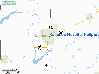
Kanabec Hospital Heliport |
Location & QuickFacts
| FAA Information Effective: | 2008-09-25 |
| Airport Identifier: | MN43 |
| Airport Status: | Operational |
| Longitude/Latitude: | 093-17-23.8050W/45-52-27.8510N
-93.289946/45.874403 (Estimated) |
| Elevation: | 1005 ft / 306.32 m (Estimated) |
| Land: | 0 acres |
| From nearest city: | 0 nautical miles E of Mora, MN |
| Location: | Kanabec County, MN |
| Magnetic Variation: | 02E (1985) |
Owner & Manager
| Ownership: | Privately owned |
| Owner: | Kanabec Hospital |
| Address: | 301 S. Hwy 65
Mora, MN 55051 |
| Phone number: | 612-679-1212 |
| Manager: | Randy Ulseth |
| Address: | 301 S. Hwy 65
Mora, MN 55051 |
| Phone number: | 320-225-3315 |
Airport Operations and Facilities
| Airport Use: | Private
MEDICAL USE. |
| Wind indicator: | Yes |
| Segmented Circle: | No |
| Control Tower: | No |
| Lighting Schedule: | PHONE REQ
FOR PERIMETER & OBSTRUCTION LGTS CALL 612-679-1212. |
| Sectional chart: | Twin Cities |
| Region: | AGL - Great Lakes |
| Boundary ARTCC: | ZMP - Minneapolis |
| Tie-in FSS: | PNM - Princeton |
| FSS on Airport: | No |
| FSS Toll Free: | 1-800-WX-BRIEF |
Runway Information
Helipad H1
| Dimension: | 50 x 50 ft / 15.2 x 15.2 m |
| Surface: | CONC, |
| |
Runway H1 |
Runway |
| Traffic Pattern: | Left | Left |
|
Radio Navigation Aids
| ID |
Type |
Name |
Ch |
Freq |
Var |
Dist |
| JMR | NDB | Mora | | 327.00 | 03E | 1.3 nm |
| ROS | NDB | Rush City | | 282.00 | 02E | 17.6 nm |
| CBG | NDB | Cambridge | | 350.00 | 03E | 19.1 nm |
| PNM | NDB | Princeton | | 368.00 | 03E | 22.9 nm |
| MZH | NDB | Moose Lake | | 362.00 | 02E | 38.3 nm |
| BXR | NDB | Big Doctor | | 203.00 | 02E | 38.8 nm |
| OEO | NDB | Osceola | | 233.00 | 01E | 42.3 nm |
| AIT | NDB | Aitkin | | 397.00 | 03E | 43.5 nm |
| LXL | NDB | Little Falls | | 359.00 | 03E | 44.2 nm |
| XCR | NDB | Ripley | | 404.00 | 03E | 45.7 nm |
| RYM | TACAN | Camp Ripley | 048X | | 03E | 46.3 nm |
| STC | VOR/DME | St Cloud | 058X | 112.10 | 03E | 37.7 nm |
| RZN | VOR/DME | Siren | 031X | 109.40 | 02E | 38.5 nm |
| BRD | VORTAC | Brainerd | 116X | 116.90 | 03E | 41.9 nm |
| GEP | VORTAC | Gopher | 120X | 117.30 | 06E | 43.9 nm |
Remarks
- (E111-1) ALL APCH/DEP OPNS CONDUCTED 025 DEG TO 045 DEG AND/TO FM 165 DEG FM CNTR OF PAD; TKOF/LNDG AREA MKD; NON-OBSTRUCTION WIND INDICATOR MAINTAINED NEXT TO TKOF/LNDG AREA.
- PRVDD RADIO TWR ON TOP OF HOSPITAL IS OBSTRUCTION LGTD; TREES 165 DEG & 100' SE OF PAD & TREE 215 DEG & 25' SW OF PAD BE REMOVED/LOWERED OR LGTD; CLOTHESLINE & POLES N OF PAD BE REMOVED; POWERLINES NE OF PAD ARE MKD & LGTD;
Images and information placed above are from
http://www.airport-data.com/airport/MN43/
We thank them for the data!
| General Info
|
| Country |
United States
|
| State |
MINNESOTA
|
| FAA ID |
MN43
|
| Latitude |
45-52-27.851N
|
| Longitude |
093-17-23.805W
|
| Elevation |
1005 feet
|
| Near City |
MORA
|
We don't guarantee the information is fresh and accurate. The data may
be wrong or outdated.
For more up-to-date information please refer to other sources.
|
|


