 |
|
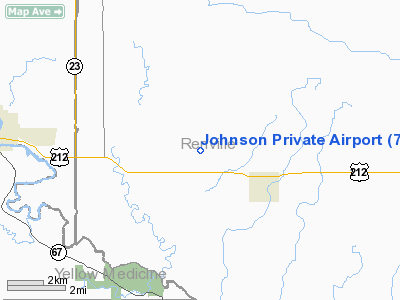
Location & QuickFacts
| FAA Information Effective: | 2008-09-25 |
| Airport Identifier: | 7MN0 |
| Airport Status: | Operational |
| Longitude/Latitude: | 095-23-43.0490W/44-47-59.8490N
-95.395291/44.799958 (Estimated) |
| Elevation: | 1020 ft / 310.90 m (Estimated) |
| Land: | 0 acres |
| From nearest city: | 2 nautical miles WN of Sacred Heart, MN |
| Location: | Renville County, MN |
| Magnetic Variation: | 05E (1985) |
Owner & Manager
| Ownership: | Privately owned |
| Owner: | John A. Johnson |
| Address: |
Sacred Heart, MN 56285 |
| Phone number: | 320-765-2273 |
| Manager: | Doug Johnson |
| Address: |
|
| Phone number: | 320-765-2339 |
Airport Operations and Facilities
| Airport Use: | Private |
| Wind indicator: | Yes |
| Segmented Circle: | No |
| Control Tower: | No |
| Sectional chart: | Twin Cities |
| Region: | AGL - Great Lakes |
| Boundary ARTCC: | ZMP - Minneapolis |
| Tie-in FSS: | PNM - Princeton |
| FSS on Airport: | No |
| FSS Toll Free: | 1-800-WX-BRIEF |
Airport Services
Runway Information
Runway N/S
| Dimension: | 3400 x 60 ft / 1036.3 x 18.3 m |
| Surface: | TURF, |
| |
Runway N |
Runway S |
| Traffic Pattern: | Left | Left |
|
Radio Navigation Aids
| ID |
Type |
Name |
Ch |
Freq |
Var |
Dist |
| BBB | NDB | Benson | | 239.00 | 05E | 33.5 nm |
| DXX | NDB | Dawson/madison | | 341.00 | 06E | 35.2 nm |
| AQP | NDB | Appleton | | 356.00 | 05E | 36.7 nm |
| HCD | NDB | Hutchinson | | 209.00 | 04E | 43.3 nm |
| ULM | NDB/DME | New Ulm | 050X | 272.00 | 04E | 48.1 nm |
| MVE | VOR/DME | Montevideo | 053X | 111.60 | 05E | 17.0 nm |
| BDH | VOR/DME | Willmar | 84X | 113.70 | 04E | 22.2 nm |
| RWF | VOR/DME | Redwood Falls | 080X | 113.30 | 07E | 23.0 nm |
| ILL | VOR/DME | Willmar | 084X | 113.70 | 04E | 23.1 nm |
| MML | VOR/DME | Marshall | 047X | 111.00 | 05E | 28.0 nm |
| DWN | VORTAC | Darwin | 027X | 109.00 | 07E | 43.6 nm |
Remarks
- DUE TO OBSTNS IN THE VICINITY OF ARPT WHICH HAVE A SIGNIFICANT EFFECT ON CONDUCTING SAFE AERONAUTICAL OPNS.
Images and information placed above are from
http://www.airport-data.com/airport/7MN0/
We thank them for the data!
| General Info
|
| Country |
United States
|
| State |
MINNESOTA
|
| FAA ID |
7MN0
|
| Latitude |
44-47-59.849N
|
| Longitude |
095-23-43.049W
|
| Elevation |
1020 feet
|
| Near City |
SACRED HEART
|
We don't guarantee the information is fresh and accurate. The data may
be wrong or outdated.
For more up-to-date information please refer to other sources.
|
|


