 |
|
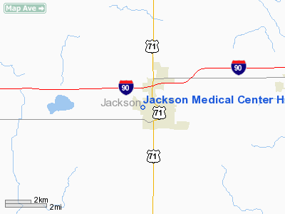
Jackson Medical Center Heliport |
Location & QuickFacts
| FAA Information Effective: | 2008-09-25 |
| Airport Identifier: | 1MN9 |
| Airport Status: | Operational |
| Longitude/Latitude: | 095-00-15.7700W/43-37-28.8500N
-95.004381/43.624681 (Estimated) |
| Elevation: | 1450 ft / 441.96 m (Estimated) |
| Land: | 0 acres |
| From nearest city: | 0 nautical miles W of Jackson, MN |
| Location: | Jackson County, MN |
| Magnetic Variation: | 04E (1995) |
Owner & Manager
| Ownership: | Privately owned |
| Owner: | City Of Jackson |
| Address: | 80 W Ashly St
Jackson, MN 56143 |
| Phone number: | 507-847-4410 |
| Manager: | Jim Hunt |
| Address: | 1430 N Hwy
Jackson, MN 56143 |
| Phone number: | 507-847-2420 |
Airport Operations and Facilities
| Airport Use: | Private |
| Wind indicator: | Yes |
| Segmented Circle: | No |
| Control Tower: | No |
| Sectional chart: | Omaha |
| Region: | AGL - Great Lakes |
| Boundary ARTCC: | ZMP - Minneapolis |
| Tie-in FSS: | PNM - Princeton |
| FSS Toll Free: | 1-800-WX-BRIEF |
Runway Information
Helipad H1
| Dimension: | 45 x 45 ft / 13.7 x 13.7 m |
| Surface: | CONC, |
| |
Runway H1 |
Runway |
| Traffic Pattern: | Left | Left |
|
Radio Navigation Aids
| ID |
Type |
Name |
Ch |
Freq |
Var |
Dist |
| MJQ | NDB | Jackson | | 353.00 | 04E | 1.6 nm |
| MWM | NDB | Windom | | 203.00 | 03E | 17.7 nm |
| PUF | NDB | Puff | | 345.00 | 04E | 20.1 nm |
| JYG | NDB | St James | | 260.00 | 04E | 29.2 nm |
| LTU | NDB | Little Sioux | | 326.00 | 05E | 30.4 nm |
| EGQ | NDB | Emmetsburg | | 410.00 | 04E | 34.0 nm |
| ISB | NDB | Sibley | | 269.00 | 05E | 36.1 nm |
| SBU | NDB | Blue Earth | | 332.00 | 04E | 39.5 nm |
| SHL | NDB | Sheldon | | 338.00 | 05E | 43.8 nm |
| AXA | NDB | Algona | | 403.00 | 03E | 45.7 nm |
| ULM | NDB/DME | New Ulm | 050X | 272.00 | 04E | 47.1 nm |
| EST | VOR | Estherville | | 110.40 | 07E | 17.2 nm |
| OTG | VOR/DME | Worthington | 043X | 110.60 | 08E | 25.2 nm |
| FRM | VOR/DME | Fairmont | 039X | 110.20 | 07E | 25.3 nm |
| SPW | VOR/DME | Spencer | 037X | 110.00 | 05E | 29.1 nm |
| DDL | VOR/DME | Sheldon | 023X | 108.60 | 05E | 43.9 nm |
Remarks
- PRVDD ALL APCH/DEP FM 270-205, AREA IS MKD & LGTD.
Images and information placed above are from
http://www.airport-data.com/airport/1MN9/
We thank them for the data!
| General Info
|
| Country |
United States
|
| State |
MINNESOTA
|
| FAA ID |
1MN9
|
| Latitude |
43-37-28.850N
|
| Longitude |
095-00-15.770W
|
| Elevation |
1450 feet
|
| Near City |
JACKSON
|
We don't guarantee the information is fresh and accurate. The data may
be wrong or outdated.
For more up-to-date information please refer to other sources.
|
|


