 |
|
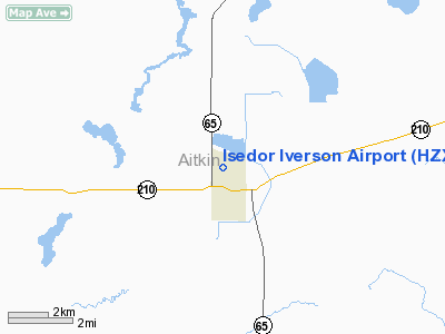
Location & QuickFacts
| FAA Information Effective: | 2008-09-25 |
| Airport Identifier: | HZX |
| Airport Status: | Operational |
| Longitude/Latitude: | 093-18-35.3200W/46-37-07.6700N
-93.309811/46.618797 (Estimated) |
| Elevation: | 1228 ft / 374.29 m (Estimated) |
| Land: | 120 acres |
| From nearest city: | 1 nautical miles N of Mc Gregor, MN |
| Location: | Aitkin County, MN |
| Magnetic Variation: | 01E (2005) |
Owner & Manager
| Ownership: | Publicly owned |
| Owner: | City Of Mc Gregor |
| Address: | P.o. Box 100
Mc Gregor, MN 55760 |
| Phone number: | 218-768-2717 |
| Manager: | Mike Zebro |
| Address: | 111 Center Ave E., Box 100
Mc Gregor, MN 55760 |
| Phone number: | 406-223-4955 |
Airport Operations and Facilities
| Airport Use: | Open to public |
| Wind indicator: | Yes |
| Segmented Circle: | Yes |
| Control Tower: | No |
| Lighting Schedule: | DUSK-DAWN
ACTVT MIRL RY 14/32 & VASI RWYS 14 & 32 - CTAF. |
| Beacon Color: | Clear-Green (lighted land airport) |
| Landing fee charge: | No |
| Sectional chart: | Twin Cities |
| Region: | AGL - Great Lakes |
| Boundary ARTCC: | ZMP - Minneapolis |
| Tie-in FSS: | PNM - Princeton |
| FSS on Airport: | No |
| FSS Toll Free: | 1-800-WX-BRIEF |
| NOTAMs Facility: | HZX (NOTAM-d service avaliable) |
Airport Communications
Airport Services
| Fuel available: | 100LLMOGAS
24 HOUR CREDIT CARD FUEL AVBL. |
Runway Information
Runway 14/32
| Dimension: | 3400 x 75 ft / 1036.3 x 22.9 m |
| Surface: | ASPH, Good Condition |
| Edge Lights: | Medium |
| |
Runway 14 |
Runway 32 |
| Longitude: | 093-18-50.9500W | 093-18-19.6900W |
| Latitude: | 46-37-20.5200N | 46-36-54.8200N |
| Elevation: | 1228.00 ft | 1226.00 ft |
| Alignment: | 127 | 127 |
| Traffic Pattern: | Left | Left |
| Markings: | Non-precision instrument, Good Condition | Non-precision instrument, Good Condition |
| VASI: | 2-box on left side | 2-box on right side |
| Runway End Identifier: | No | No |
| Obstruction: | 60 ft trees, 2500.0 ft from runway, 38:1 slope to clear | 10 ft trees, 220.0 ft from runway, 70 ft left of centerline, 2:1 slope to clear
RWY 32: TREES +30, 0-200 FM RWY END, 240L. |
|
Radio Navigation Aids
| ID |
Type |
Name |
Ch |
Freq |
Var |
Dist |
| AIT | NDB | Aitkin | | 397.00 | 03E | 15.7 nm |
| MZH | NDB | Moose Lake | | 362.00 | 02E | 24.2 nm |
| COQ | NDB | Cloquet | | 335.00 | 03E | 33.6 nm |
| DL | NDB | Pykla | | 379.00 | 02E | 41.6 nm |
| XVG | NDB | Longville | | 392.00 | 04E | 43.2 nm |
| JMR | NDB | Mora | | 327.00 | 03E | 43.8 nm |
| PWC | NDB | Pine River | | 330.00 | 03E | 44.8 nm |
| SUW | NDB | Bong | | 260.00 | 01E | 50.0 nm |
| LKI | TACAN | Lakeside | 011X | | 05E | 48.3 nm |
| GPZ | VOR/DME | Grand Rapids | 051X | 111.40 | 06E | 33.6 nm |
| HIB | VOR/DME | Hibbing | 045X | 110.80 | 02E | 48.0 nm |
| BRD | VORTAC | Brainerd | 116X | 116.90 | 03E | 33.8 nm |
| DLH | VORTAC | Duluth | 073X | 112.60 | 05E | 46.9 nm |
Remarks
- ULTRALIGHTS ON AND INVOF AIRPORT.
- ESTAB PRIOR TO 1959.
Images and information placed above are from
http://www.airport-data.com/airport/HZX/
We thank them for the data!
| General Info
|
| Country |
United States
|
| State |
MINNESOTA
|
| FAA ID |
HZX
|
| Latitude |
46-37-07.670N
|
| Longitude |
093-18-35.320W
|
| Elevation |
1228 feet
|
| Near City |
MC GREGOR
|
We don't guarantee the information is fresh and accurate. The data may
be wrong or outdated.
For more up-to-date information please refer to other sources.
|
|


