 |
|
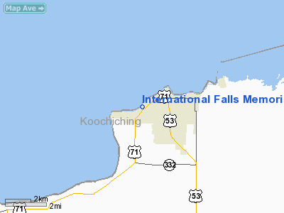
International Falls Memorial Heliport |
Location & QuickFacts
| FAA Information Effective: | 2008-09-25 |
| Airport Identifier: | MN83 |
| Airport Status: | Operational |
| Longitude/Latitude: | 093-25-54.5390W/48-35-43.7800N
-93.431816/48.595494 (Estimated) |
| Elevation: | 1110 ft / 338.33 m (Estimated) |
| Land: | 0 acres |
| From nearest city: | 1 nautical miles W of International Falls, MN |
| Location: | Koochiching County, MN |
| Magnetic Variation: | 03E (1985) |
Owner & Manager
| Ownership: | Privately owned |
| Owner: | Intl Falls Memorial Hospital |
| Address: | 1400 Hwy 71
International Falls, MN 56649-2154 |
| Phone number: | 218-283-4481 |
| Manager: | Ben Denucci |
| Address: | 1400 Hwy 71
International Falls, MN 56649-2154 |
| Phone number: | 218-283-4481 |
Airport Operations and Facilities
| Airport Use: | Private
MEDICAL USE. |
| Wind indicator: | Yes |
| Segmented Circle: | No |
| Control Tower: | No |
| Lighting Schedule: | PHONE REQ
FOR PERIMETER & OBSTRUCTION LGTS CALL 218-283-4481. |
| Sectional chart: | Twin Cities |
| Region: | AGL - Great Lakes |
| Boundary ARTCC: | ZMP - Minneapolis |
| Tie-in FSS: | PNM - Princeton |
| FSS on Airport: | No |
| FSS Toll Free: | 1-800-WX-BRIEF |
Runway Information
Helipad H1
| Dimension: | 50 x 50 ft / 15.2 x 15.2 m |
| Surface: | CONC, |
| |
Runway H1 |
Runway |
| Traffic Pattern: | Left | Left |
|
Radio Navigation Aids
| ID |
Type |
Name |
Ch |
Freq |
Var |
Dist |
| YAG | NDB | Fort Frances | | 376.00 | 02E | 7.1 nm |
| IN | NDB | Raize | | 353.00 | 06E | 9.2 nm |
| ORB | NDB | Orr | | 341.00 | 02E | 41.5 nm |
| SCG | NDB | Scott | | 385.00 | 02E | 43.2 nm |
| FOZ | NDB | Bigfork | | 345.00 | 02E | 49.6 nm |
| BDE | VOR/DME | Baudette | 053X | 111.60 | 04E | 47.3 nm |
| INL | VORTAC | International Falls | 047X | 111.00 | 06E | 2.1 nm |
Remarks
- PRVDD APCH/DEP OPNS ARE 255 DEG TO 345 DEG; TKOF/LNDG MKD; WIND INDICATOR RELOCATED 65' S OF PAD.
Images and information placed above are from
http://www.airport-data.com/airport/MN83/
We thank them for the data!
| General Info
|
| Country |
United States
|
| State |
MINNESOTA
|
| FAA ID |
MN83
|
| Latitude |
48-35-43.780N
|
| Longitude |
093-25-54.539W
|
| Elevation |
1110 feet
|
| Near City |
INTERNATIONAL FALLS
|
We don't guarantee the information is fresh and accurate. The data may
be wrong or outdated.
For more up-to-date information please refer to other sources.
|
|


