 |
|
Hutchinson Muni-butler Field Airport |
Coordinates: 44°51′36″N 094°22′57″W / 44.86°N 94.3825°W / 44.86; -94.3825
Hutchinson Municipal Airport
Butler Field |
| IATA: none – ICAO: KHCD – FAA LID: HCD |
| Summary |
| Airport type |
Public |
| Owner |
City of Hutchinson |
| Serves |
Hutchinson, Minnesota |
| Elevation AMSL |
1,060 ft / 323 m |
| Runways |
| Direction |
Length |
Surface |
| ft |
m |
| 15/33 |
4,000 |
1,219 |
Asphalt |
| Statistics (2007) |
| Aircraft operations |
12,395 |
| Source: Federal Aviation Administration |
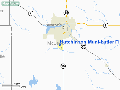
Hutchinson Municipal Airport (ICAO: KHCD, FAA LID: HCD), also known as Butler Field, is a public airport located two miles (3 km) south of the central business district of Hutchinson, a city in McLeod County, Minnesota, United States. It is owned by the City of Hutchinson. The airport is home to the Civil Air Patrol and LifeLink Emergency Air Transport.
Although most U.S. airports use the same three-letter location identifier for the FAA and IATA, Hutchinson Municipal Airport is assigned HCD by the FAA but has no designation from the IATA.
Facilities and aircraft
Hutchinson Municipal Airport covers an area of 160 acres (65 ha) which contains one asphalt paved runway (15/33) measuring 4,000 x 75 ft (1,219 x 23 m). For the 12-month period ending July 31, 2007, the airport had 12,395 aircraft operations, an average of 33 per day: 98% general aviation, 2% air taxi and <1% military.
The above content comes from Wikipedia and is published under free licenses – click here to read more.
Location & QuickFacts
| FAA Information Effective: | 2008-09-25 |
| Airport Identifier: | HCD |
| Airport Status: | Operational |
| Longitude/Latitude: | 094-22-57.0000W/44-51-35.6000N
-94.382500/44.859889 (Estimated) |
| Elevation: | 1062 ft / 323.70 m (Surveyed) |
| Land: | 160 acres |
| From nearest city: | 2 nautical miles S of Hutchinson, MN |
| Location: | Mc Leod County, MN |
| Magnetic Variation: | 04E (1995) |
Owner & Manager
| Ownership: | Publicly owned |
| Owner: | City Of Hutchinson |
| Address: | 111 Hassan St
Hutchinson, MN 55350 |
| Phone number: | 320-587-5151 |
| Manager: | John Olson |
| Address: | 111 Hassan St
Hutchinson, MN 55350 |
| Phone number: | 320-234-4473 |
Airport Operations and Facilities
| Airport Use: | Open to public |
| Wind indicator: | Yes |
| Segmented Circle: | No |
| Control Tower: | No |
| Lighting Schedule: | DUSK-DAWN
ACTVT MIRL RY 15/33; REIL RYS 15 & 33; PAPI RYS 15 & 33 - CTAF. |
| Beacon Color: | Clear-Green (lighted land airport) |
| Landing fee charge: | No |
| Sectional chart: | Twin Cities |
| Region: | AGL - Great Lakes |
| Boundary ARTCC: | ZMP - Minneapolis |
| Tie-in FSS: | PNM - Princeton |
| FSS on Airport: | No |
| FSS Toll Free: | 1-800-WX-BRIEF |
| NOTAMs Facility: | HCD (NOTAM-d service avaliable) |
| Federal Agreements: | NY1 |
Airport Communications
| CTAF: | 122.800 |
| Unicom: | 122.800 |
Airport Services
| Fuel available: | 100LL
FUEL AVBL 24 HRS WITH CREDIT CARD. |
| Airframe Repair: | MAJOR |
| Power Plant Repair: | MAJOR |
| Bottled Oxygen: | NONE |
| Bulk Oxygen: | NONE |
Runway Information
Runway 15/33
| Dimension: | 4000 x 75 ft / 1219.2 x 22.9 m |
| Surface: | ASPH, Good Condition |
| Edge Lights: | Medium |
| |
Runway 15 |
Runway 33 |
| Longitude: | 094-23-09.8546W | 094-22-44.1859W |
| Latitude: | 44-51-53.0730N | 44-51-18.0487N |
| Elevation: | 1055.00 ft | 1062.00 ft |
| Alignment: | 127 | 127 |
| Traffic Pattern: | Left | Left |
| Markings: | Non-precision instrument, Good Condition | Non-precision instrument, Good Condition |
| Crossing Height: | 40.00 ft | 40.00 ft |
| VASI: | 4-light PAPI on left side | 4-light PAPI on left side |
| Visual Glide Angle: | 3.00° | 3.00° |
| Runway End Identifier: | Yes | Yes |
| Centerline Lights: | No | No |
| Touchdown Lights: | No | No |
| Obstruction: | , 50:1 slope to clear | 130 ft trees, 3450.0 ft from runway, 200 ft left of centerline, 25:1 slope to clear |
|
Radio Navigation Aids
| ID |
Type |
Name |
Ch |
Freq |
Var |
Dist |
| HCD | NDB | Hutchinson | | 209.00 | 04E | 0.2 nm |
| GYL | NDB | Glencoe | | 407.00 | 03E | 14.0 nm |
| ULM | NDB/DME | New Ulm | 050X | 272.00 | 04E | 33.0 nm |
| ILL | VOR/DME | Willmar | 084X | 113.70 | 04E | 33.9 nm |
| BDH | VOR/DME | Willmar | 84X | 113.70 | 04E | 35.2 nm |
| FCM | VOR/DME | Flying Cloud | 055X | 111.80 | 06E | 39.5 nm |
| RWF | VOR/DME | Redwood Falls | 080X | 113.30 | 07E | 39.7 nm |
| MKT | VOR/DME | Mankato | 045X | 110.80 | 07E | 43.4 nm |
| STC | VOR/DME | St Cloud | 058X | 112.10 | 03E | 43.7 nm |
| MSP | VOR/DME | Minneapolis | 100X | 115.30 | 02E | 48.9 nm |
| DWN | VORTAC | Darwin | 027X | 109.00 | 07E | 14.0 nm |
| GEP | VORTAC | Gopher | 120X | 117.30 | 06E | 46.2 nm |
| MSP | VOT | Minneapolis St Paul | | 111.00 | | 49.8 nm |
Remarks
- GCO AVBL ON FREQ 121.725 THRU MINNEAPOLIS ARTCC & FLT SVCS.
Images and information placed above are from
http://www.airport-data.com/airport/HCD/
We thank them for the data!
| General Info
|
| Country |
United States
|
| State |
MINNESOTA
|
| FAA ID |
HCD
|
| Latitude |
44-51-35.560N
|
| Longitude |
094-22-57.020W
|
| Elevation |
1060 feet
|
| Near City |
HUTCHINSON
|
We don't guarantee the information is fresh and accurate. The data may
be wrong or outdated.
For more up-to-date information please refer to other sources.
|
|


