|
|
| Houston County Airport |
| IATA: none – ICAO: KCHU – FAA LID: CHU |
| Summary |
| Airport type |
Public |
| Owner |
Houston County |
| Location |
Caledonia, Minnesota |
| Elevation AMSL |
1,179 ft / 359 m |
| Coordinates |
43°35′47″N 091°30′14″W / 43.59639°N 91.50389°W / 43.59639; -91.50389 |
| Runways |
| Direction |
Length |
Surface |
| ft |
m |
| 13/31 |
3,499 |
1,066 |
Asphalt |
| Statistics (2006) |
| Aircraft operations |
3,500 |
| Based aircraft |
10 |
| Source: Federal Aviation Administration |
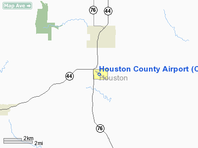
Houston County Airport (ICAO: KCHU, FAA LID: CHU) is a public use airport located three miles (5 km) south of the central business district of Caledonia, a city in Houston County, Minnesota, United States. It is owned by Houston County. It serves general aviation for Caledonia and surrounding towns including Spring Grove and Houston. There is no scheduled air service.
Although most U.S. airports use the same three-letter location identifier for the FAA and IATA, Houston County Airport is assigned CHU by the FAA but has no designation from the IATA (which assigned CHU to Chuathbaluk Airport in Chuathbaluk, Alaska).
Facilities and aircraft
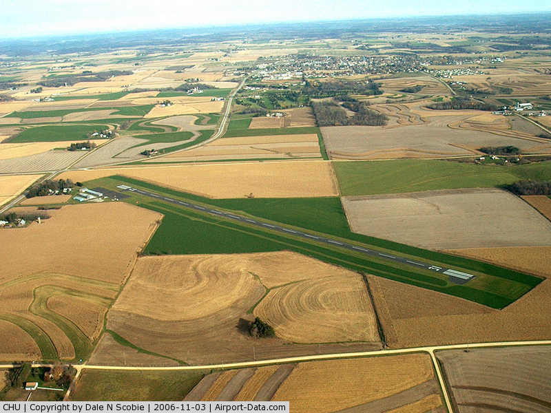
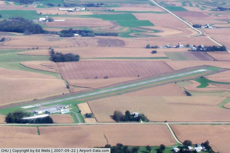
Houston County Airport covers an area of 52 acres (21 ha) which contains one asphalt paved runway, 13/31, measuring 3,499 x 77 ft (1,066 x 23 m).
For the 12-month period ending May 31, 2006, the airport had 3,500 aircraft operations, 100% of which are general aviation.
The above content comes from Wikipedia and is published under free licenses – click here to read more.
|
 |
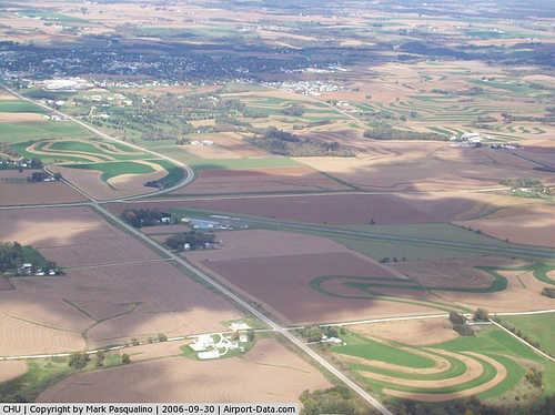
(Click on the photo to enlarge) |
|
 |
(Click on the photo to enlarge) |
|
 |
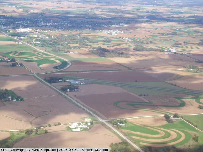
(Click on the photo to enlarge) |
Location & QuickFacts
| FAA Information Effective: | 2008-09-25 |
| Airport Identifier: | CHU |
| Airport Status: | Operational |
| Longitude/Latitude: | 091-30-14.2070W/43-35-46.8910N
-91.503946/43.596359 (Estimated) |
| Elevation: | 1179 ft / 359.36 m (Surveyed) |
| Land: | 52 acres |
| From nearest city: | 3 nautical miles S of Caledonia, MN |
| Location: | Houston County, MN |
| Magnetic Variation: | 01E (1995) |
Owner & Manager
| Ownership: | Publicly owned |
| Owner: | Houston County |
| Address: | 304 So Marshall Street
Caledonia, MN 55921 |
| Phone number: | 507-725-5803 |
| Manager: | Tom Molling |
| Address: | 1124 E Washington St
Caledonia, MN 55921 |
| Phone number: | 507-725-3925 |
Airport Operations and Facilities
| Airport Use: | Open to public |
| Wind indicator: | Yes |
| Segmented Circle: | No |
| Control Tower: | No |
| Lighting Schedule: | DUSK-DAWN
ACTVT MIRL RY 13/31 - CTAF. |
| Beacon Color: | Clear-Green (lighted land airport) |
| Landing fee charge: | No |
| Sectional chart: | Chicago |
| Region: | AGL - Great Lakes |
| Boundary ARTCC: | ZMP - Minneapolis |
| Tie-in FSS: | PNM - Princeton |
| FSS on Airport: | No |
| FSS Toll Free: | 1-800-WX-BRIEF |
| NOTAMs Facility: | PNM (NOTAM-d service avaliable) |
| Federal Agreements: | NY1 |
Airport Communications
Airport Services
| Fuel available: | 100LL
24 HR CREDIT CARD SVC AVBL. |
| Airframe Repair: | NONE |
| Power Plant Repair: | NONE |
| Bottled Oxygen: | NONE |
| Bulk Oxygen: | NONE |
Runway Information
Runway 13/31
| Dimension: | 3499 x 77 ft / 1066.5 x 23.5 m |
| Surface: | ASPH, Good Condition
ALLIGATOR CRACKING, LOOSE AGGREGATE. |
| Weight Limit: | Single wheel: 10000 lbs. |
| Edge Lights: | Medium |
| |
Runway 13 |
Runway 31 |
| Longitude: | 091-30-31.0230W | 091-29-57.4220W |
| Latitude: | 43-35-59.1590N | 43-35-34.7090N |
| Elevation: | 1175.00 ft | 1179.00 ft |
| Alignment: | 127 | 127 |
| Traffic Pattern: | Left | Left |
| Markings: | Non-precision instrument, Good Condition
RWY 13 /31 MARKINGS FADED, NO HOLD LINE AT RWY 31 | Non-precision instrument, Good Condition |
| Obstruction: | 10 ft tree, 225.0 ft from runway, 225 ft left of centerline, 2:1 slope to clear
RWY 13 +10 FT TREES 130 FT FM RY END 225 L. | 16 ft pline, 750.0 ft from runway, 350 ft left of centerline, 34:1 slope to clear |
|
Radio Navigation Aids
| ID |
Type |
Name |
Ch |
Freq |
Var |
Dist |
| CHU | NDB | Caledonia | | 209.00 | 03E | 0.8 nm |
| DEH | NDB | Decorah | | 236.00 | 01E | 21.8 nm |
| CJJ | NDB | Cresco | | 293.00 | 02E | 30.7 nm |
| XWY | NDB | West Union | | 278.00 | 02E | 41.1 nm |
| CMY | NDB | Mccoy | | 412.00 | 00E | 42.7 nm |
| BCK | NDB | Black River Falls | | 362.00 | 00E | 48.7 nm |
| LSE | VOR/DME | La Crosse | 021X | 108.40 | 02E | 20.0 nm |
| ONA | VOR/DME | Winona | 051X | 111.40 | 01E | 30.1 nm |
| RST | VOR/DME | Rochester | 057X | 112.00 | 05E | 48.8 nm |
| ODI | VORTAC | Nodine | 126X | 117.90 | 01E | 19.1 nm |
| UKN | VORTAC | Waukon | 113X | 116.60 | 05E | 19.1 nm |
Remarks
- TURF TAXIWAY RUTTED, UNUSABLE AT SOUTH END.
Images and information placed above are from
http://www.airport-data.com/airport/CHU/
We thank them for the data!
| General Info
|
| Country |
United States
|
| State |
MINNESOTA
|
| FAA ID |
CHU
|
| Latitude |
43-35-46.891N
|
| Longitude |
091-30-14.207W
|
| Elevation |
1179 feet
|
| Near City |
CALEDONIA
|
We don't guarantee the information is fresh and accurate. The data may
be wrong or outdated.
For more up-to-date information please refer to other sources.
|
|