 |
|
Location & QuickFacts
| FAA Information Effective: | 2008-09-25 |
| Airport Identifier: | 6MN3 |
| Airport Status: | Operational |
| Longitude/Latitude: | 093-25-00.8250W/44-54-59.8700N
-93.416896/44.916631 (Estimated) |
| Elevation: | 918 ft / 279.81 m (Estimated) |
| Land: | 0 acres |
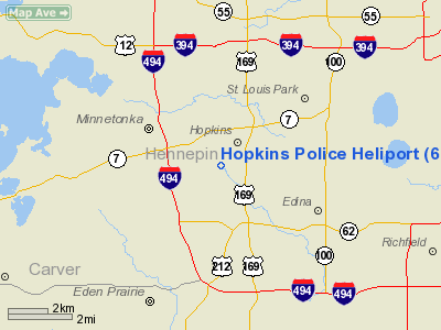
| From nearest city: | 0 nautical miles N of Hopkins, MN |
| Location: | Hennepin County, MN |
| Magnetic Variation: | 03E (1985) |
Owner & Manager
| Ownership: | Publicly owned |
| Owner: | City Of Hopkins |
| Address: | 1010-1st St South
Hopkins, MN 55343 |
| Phone number: | 612-938-8885 |
| Manager: | Earl L. Johnson, Chief |
| Address: | 1010-1st St South
Hopkins, MN 55343 |
| Phone number: | 612-938-8885 |
Airport Operations and Facilities
| Airport Use: | Private
PERSONAL USE. |
| Wind indicator: | No |
| Segmented Circle: | No |
| Control Tower: | No |
| Landing fee charge: | No |
| Sectional chart: | Twin Cities |
| Region: | AGL - Great Lakes |
| Boundary ARTCC: | ZMP - Minneapolis |
| Tie-in FSS: | PNM - Princeton |
| FSS on Airport: | No |
| FSS Toll Free: | 1-800-WX-BRIEF |
Runway Information
Helipad H1
| Dimension: | 1000 x 900 ft / 304.8 x 274.3 m |
| Surface: | TURF, |
| |
Runway H1 |
Runway |
| Traffic Pattern: | Left | Left |
|
Radio Navigation Aids
| ID |
Type |
Name |
Ch |
Freq |
Var |
Dist |
| MS | NDB | Narco | | 266.00 | 02E | 14.9 nm |
| PPI | NDB | Hopey | | 400.00 | 03E | 20.4 nm |
| GYL | NDB | Glencoe | | 407.00 | 03E | 30.0 nm |
| OEO | NDB | Osceola | | 233.00 | 01E | 38.9 nm |
| CBG | NDB | Cambridge | | 350.00 | 03E | 39.1 nm |
| PNM | NDB | Princeton | | 368.00 | 03E | 39.8 nm |
| RNH | NDB | New Richmond | | 257.00 | 02E | 40.0 nm |
| HCD | NDB | Hutchinson | | 209.00 | 04E | 41.3 nm |
| AHH | NDB | Ameron | | 278.00 | 01E | 49.5 nm |
| FCM | VOR/DME | Flying Cloud | 055X | 111.80 | 06E | 5.7 nm |
| MSP | VOR/DME | Minneapolis | 100X | 115.30 | 02E | 7.8 nm |
| FOW | VOR/DME | Halfway | 049X | 111.20 | 02E | 42.9 nm |
| STC | VOR/DME | St Cloud | 058X | 112.10 | 03E | 46.7 nm |
| MKT | VOR/DME | Mankato | 045X | 110.80 | 07E | 46.9 nm |
| GEP | VORTAC | Gopher | 120X | 117.30 | 06E | 13.9 nm |
| FGT | VORTAC | Farmington | 104X | 115.70 | 06E | 19.9 nm |
| DWN | VORTAC | Darwin | 027X | 109.00 | 07E | 45.3 nm |
| MSP | VOT | Minneapolis St Paul | | 111.00 | | 8.8 nm |
| STP | VOT | St Paul | | 114.40 | | 15.3 nm |
Remarks
- PRVDD INGRESS/EGRESS ROUTE IS ESTABD FROM 180 DEG FROM HELIPORT & OPNS CONDUCTED DALGT ONLY.
Images and information placed above are from
http://www.airport-data.com/airport/6MN3/
We thank them for the data!
| General Info
|
| Country |
United States
|
| State |
MINNESOTA
|
| FAA ID |
6MN3
|
| Latitude |
44-54-59.870N
|
| Longitude |
093-25-00.825W
|
| Elevation |
918 feet
|
| Near City |
HOPKINS
|
We don't guarantee the information is fresh and accurate. The data may
be wrong or outdated.
For more up-to-date information please refer to other sources.
|
|


