 |
|
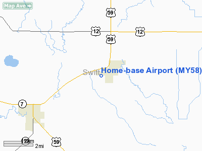
Location & QuickFacts
| FAA Information Effective: | 2008-09-25 |
| Airport Identifier: | MY58 |
| Airport Status: | Operational |
| Longitude/Latitude: | 095-55-31.1580W/45-14-19.8600N
-95.925322/45.238850 (Estimated) |
| Elevation: | 1020 ft / 310.90 m (Estimated) |
| Land: | 0 acres |
| From nearest city: | 4 nautical miles NE of Holloway, MN |
| Location: | Swift County, MN |
| Magnetic Variation: | 05E (1985) |
Owner & Manager
| Ownership: | Privately owned |
| Owner: | Garold Van Winkle |
| Address: | Route 1, Box 10
Appleton, MN 56208 |
| Phone number: | 612-289-1728 |
| Address: |
|
| Phone number: | 612-289-1728 |
Airport Operations and Facilities
| Airport Use: | Private
PERSONAL USE. |
| Wind indicator: | Yes |
| Segmented Circle: | No |
| Control Tower: | No |
| Landing fee charge: | No |
| Sectional chart: | Twin Cities |
| Region: | AGL - Great Lakes |
| Boundary ARTCC: | ZMP - Minneapolis |
| Tie-in FSS: | PNM - Princeton |
| FSS on Airport: | No |
| FSS Toll Free: | 1-800-WX-BRIEF |
Runway Information
Runway 09/27
| Dimension: | 2640 x 150 ft / 804.7 x 45.7 m |
| Surface: | TURF, |
| |
Runway 09 |
Runway 27 |
| Traffic Pattern: | Left | Left |
| Obstruction: | | 50 ft pline, 150.0 ft from runway |
|
Radio Navigation Aids
| ID |
Type |
Name |
Ch |
Freq |
Var |
Dist |
| AQP | NDB | Appleton | | 356.00 | 05E | 3.6 nm |
| BBB | NDB | Benson | | 239.00 | 05E | 12.8 nm |
| DXX | NDB | Dawson/madison | | 341.00 | 06E | 18.7 nm |
| VVV | NDB | Ortonville | | 332.00 | 05E | 21.3 nm |
| GHW | NDB | Glenwood | | 346.00 | 03E | 35.3 nm |
| ETH | NDB | Wheaton | | 326.00 | 05E | 41.9 nm |
| EE | NDB | Tamie | | 374.00 | 04E | 42.3 nm |
| MVE | VOR/DME | Montevideo | 053X | 111.60 | 05E | 18.4 nm |
| MOX | VOR/DME | Morris | 033X | 109.60 | 05E | 19.7 nm |
| BDH | VOR/DME | Willmar | 84X | 113.70 | 04E | 34.6 nm |
| ILL | VOR/DME | Willmar | 084X | 113.70 | 04E | 36.1 nm |
| MML | VOR/DME | Marshall | 047X | 111.00 | 05E | 47.7 nm |
Remarks
- FILED FOR RECORD PURPOSES ONLY.
Images and information placed above are from
http://www.airport-data.com/airport/MY58/
We thank them for the data!
| General Info
|
| Country |
United States
|
| State |
MINNESOTA
|
| FAA ID |
MY58
|
| Latitude |
45-14-19.860N
|
| Longitude |
095-55-31.158W
|
| Elevation |
1020 feet
|
| Near City |
HOLLOWAY
|
We don't guarantee the information is fresh and accurate. The data may
be wrong or outdated.
For more up-to-date information please refer to other sources.
|
|


