|
|
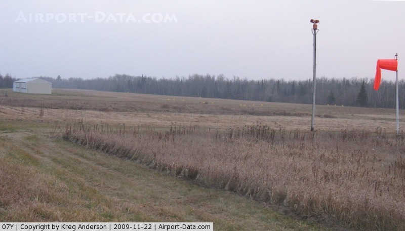
Hill City-quadna Mountain Airport |
|
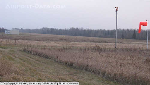 |
(Click on the photo to enlarge) |
Location & QuickFacts
| FAA Information Effective: | 2008-09-25 |
| Airport Identifier: | 07Y |
| Airport Status: | Operational |
| Longitude/Latitude: | 093-35-50.8000W/46-57-20.9000N
-93.597444/46.955806 (Estimated) |
| Elevation: | 1289 ft / 392.89 m (Estimated) |
| Land: | 58 acres |
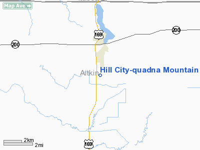
| From nearest city: | 2 nautical miles S of Hill City, MN |
| Location: | Aitkin County, MN |
| Magnetic Variation: | 03E (1985) |
Owner & Manager
| Ownership: | Publicly owned |
| Owner: | City Of Hill City |
| Address: | 111 Henrietta Ave, Box 160
Hill City, MN 55748 |
| Phone number: | 218-697-2301 |
| Manager: | Diana Gillson |
| Address: | 111 Henrietta Ave, Box 160
Hill City, MN 55748 |
| Phone number: | 218-697-2301 |
Airport Operations and Facilities
| Airport Use: | Open to public |
| Wind indicator: | Yes |
| Segmented Circle: | No |
| Control Tower: | No |
| Lighting Schedule: | DUSK-DAWN |
| Beacon Color: | Clear (unlighted land airport) |
| Landing fee charge: | No |
| Sectional chart: | Twin Cities |
| Region: | AGL - Great Lakes |
| Boundary ARTCC: | ZMP - Minneapolis |
| Tie-in FSS: | PNM - Princeton |
| FSS on Airport: | No |
| FSS Toll Free: | 1-800-WX-BRIEF |
| NOTAMs Facility: | PNM (NOTAM-d service avaliable) |
Airport Communications
Airport Services
Runway Information
Runway 16/34
| Dimension: | 2850 x 150 ft / 868.7 x 45.7 m |
| Surface: | TURF, Good Condition |
| |
Runway 16 |
Runway 34 |
| Longitude: | 093-35-57.3900W | 093-35-44.2000W |
| Latitude: | 46-57-34.2200N | 46-57-07.5700N |
| Traffic Pattern: | Right | Left |
| Runway End Identifier: | No | No |
| Centerline Lights: | No | No |
| Touchdown Lights: | No | No |
| Obstruction: | 5 ft trees, 3.0 ft from runway, 115 ft right of centerline | 5 ft trees, 50.0 ft from runway, 75 ft right of centerline, 10:1 slope to clear |
|
Radio Navigation Aids
| ID |
Type |
Name |
Ch |
Freq |
Var |
Dist |
| AIT | NDB | Aitkin | | 397.00 | 03E | 24.8 nm |
| XVG | NDB | Longville | | 392.00 | 04E | 25.1 nm |
| PWC | NDB | Pine River | | 330.00 | 03E | 35.2 nm |
| MZH | NDB | Moose Lake | | 362.00 | 02E | 46.1 nm |
| COQ | NDB | Cloquet | | 335.00 | 03E | 47.6 nm |
| FOZ | NDB | Bigfork | | 345.00 | 02E | 49.8 nm |
| GPZ | VOR/DME | Grand Rapids | 051X | 111.40 | 06E | 13.3 nm |
| HIB | VOR/DME | Hibbing | 045X | 110.80 | 02E | 42.0 nm |
| BRD | VORTAC | Brainerd | 116X | 116.90 | 03E | 40.6 nm |
Remarks
Images and information placed above are from
http://www.airport-data.com/airport/07Y/
We thank them for the data!
| General Info
|
| Country |
United States
|
| State |
MINNESOTA
|
| FAA ID |
07Y
|
| Latitude |
46-57-19.827N
|
| Longitude |
093-35-48.827W
|
| Elevation |
1289 feet
|
| Near City |
HILL CITY
|
We don't guarantee the information is fresh and accurate. The data may
be wrong or outdated.
For more up-to-date information please refer to other sources.
|
|