 |
|
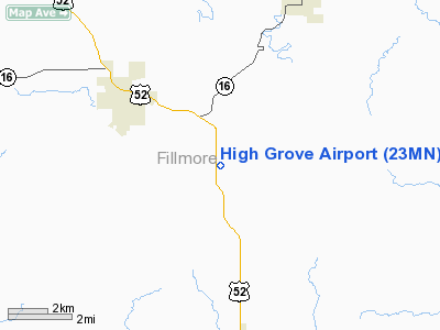
Location & QuickFacts
| FAA Information Effective: | 2008-09-25 |
| Airport Identifier: | 23MN |
| Airport Status: | Operational |
| Longitude/Latitude: | 092-01-19.5710W/43-38-27.8730N
-92.022103/43.641076 (Estimated) |
| Elevation: | 1240 ft / 377.95 m (Estimated) |
| Land: | 0 acres |
| From nearest city: | 4 nautical miles SE of Preston, MN |
| Location: | Fillmore County, MN |
| Magnetic Variation: | 02E (1985) |
Owner & Manager
| Ownership: | Privately owned |
| Owner: | Paul A. Lunde |
| Address: | 20068 Us 52
Preston, MN 55965 |
| Phone number: | 507-765-2406 |
| Manager: | Paul A. Lunde |
| Address: | 20068 Us 52
Preston, MN 55965 |
| Phone number: | 507-765-2406 |
Airport Operations and Facilities
| Airport Use: | Private
PERSONAL USE. |
| Wind indicator: | No |
| Segmented Circle: | No |
| Control Tower: | No |
| Landing fee charge: | No |
| Sectional chart: | Chicago |
| Region: | AGL - Great Lakes |
| Boundary ARTCC: | ZMP - Minneapolis |
| Tie-in FSS: | PNM - Princeton |
| FSS on Airport: | No |
| FSS Toll Free: | 1-800-WX-BRIEF |
Runway Information
Runway 09/27
| Dimension: | 1500 x 100 ft / 457.2 x 30.5 m |
| Surface: | TURF, |
| |
Runway 09 |
Runway 27 |
| Traffic Pattern: | Left | Left |
|
Radio Navigation Aids
| ID |
Type |
Name |
Ch |
Freq |
Var |
Dist |
| CJJ | NDB | Cresco | | 293.00 | 02E | 17.2 nm |
| CHU | NDB | Caledonia | | 209.00 | 03E | 23.4 nm |
| DEH | NDB | Decorah | | 236.00 | 01E | 25.3 nm |
| CCY | NDB | Charles City | | 375.00 | 03E | 42.9 nm |
| XWY | NDB | West Union | | 278.00 | 02E | 43.2 nm |
| IY | NDB | Chukk | | 417.00 | 03E | 43.4 nm |
| RST | VOR/DME | Rochester | 057X | 112.00 | 05E | 26.4 nm |
| ONA | VOR/DME | Winona | 051X | 111.40 | 01E | 29.5 nm |
| LSE | VOR/DME | La Crosse | 021X | 108.40 | 02E | 36.1 nm |
| JAY | VOR/DME | Austin | 019X | 108.20 | 03E | 39.3 nm |
| ODI | VORTAC | Nodine | 126X | 117.90 | 01E | 29.1 nm |
| UKN | VORTAC | Waukon | 113X | 116.60 | 05E | 30.3 nm |
Remarks
- FILED FOR RECORD PURPOSES ONLY.
Images and information placed above are from
http://www.airport-data.com/airport/23MN/
We thank them for the data!
| General Info
|
| Country |
United States
|
| State |
MINNESOTA
|
| FAA ID |
23MN
|
| Latitude |
43-38-27.873N
|
| Longitude |
092-01-19.571W
|
| Elevation |
1240 feet
|
| Near City |
PRESTON
|
We don't guarantee the information is fresh and accurate. The data may
be wrong or outdated.
For more up-to-date information please refer to other sources.
|
|


