 |
|
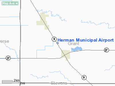
Location & QuickFacts
| FAA Information Effective: | 2008-09-25 |
| Airport Identifier: | 06Y |
| Airport Status: | Operational |
| Longitude/Latitude: | 096-09-38.2120W/45-49-47.8580N
-96.160614/45.829961 (Estimated) |
| Elevation: | 1068 ft / 325.53 m (Surveyed) |
| Land: | 100 acres |
| From nearest city: | 2 nautical miles NW of Herman, MN |
| Location: | Grant County, MN |
| Magnetic Variation: | 05E (1985) |
Owner & Manager
| Ownership: | Publicly owned |
| Owner: | City Of Herman |
| Address: | City Hall, Po Box 241
Herman, MN 56248 |
| Phone number: | 320-677-2297 |
| Manager: | John Aanden |
| Address: | 303 Fifth St E.
Herman, MN 56248 |
| Phone number: | 320-677-2746 |
Airport Operations and Facilities
| Airport Use: | Open to public |
| Wind indicator: | Yes |
| Segmented Circle: | No |
| Control Tower: | No |
| Lighting Schedule: | DUSK-DAWN |
| Beacon Color: | Clear-Green (lighted land airport) |
| Landing fee charge: | No |
| Sectional chart: | Twin Cities |
| Region: | AGL - Great Lakes |
| Traffic Pattern Alt: | 800 ft |
| Boundary ARTCC: | ZMP - Minneapolis |
| Tie-in FSS: | PNM - Princeton |
| FSS on Airport: | No |
| FSS Toll Free: | 1-800-WX-BRIEF |
| NOTAMs Facility: | PNM (NOTAM-d service avaliable) |
Airport Communications
Airport Services
| Fuel available: | 100LL
FOR FUEL CALL (320) 677-2746. |
| Airframe Repair: | NONE |
| Power Plant Repair: | NONE |
| Bottled Oxygen: | NONE |
| Bulk Oxygen: | NONE |
Runway Information
Runway 14/32
| Dimension: | 2997 x 60 ft / 913.5 x 18.3 m |
| Surface: | ASPH, Good Condition |
| Edge Lights: | Low
RWY 14/32: NON-STD LIRL; SPACING. |
| |
Runway 14 |
Runway 32 |
| Longitude: | 096-09-48.8400W | 096-09-26.5800W |
| Latitude: | 45-49-59.4400N | 45-49-34.2800N |
| Elevation: | 1055.00 ft | 1068.00 ft |
| Traffic Pattern: | Left | Left |
| Markings: | Basic, Good Condition | Basic, Good Condition |
| Runway End Identifier: | No | No |
| Centerline Lights: | No | No |
| Touchdown Lights: | No | No |
| Obstruction: | , 50:1 slope to clear | 56 ft trees, 2200.0 ft from runway, 150 ft right of centerline, 35:1 slope to clear |
|
Radio Navigation Aids
| ID |
Type |
Name |
Ch |
Freq |
Var |
Dist |
| ETH | NDB | Wheaton | | 326.00 | 05E | 16.4 nm |
| BWP | NDB | Breckenridge-wahpeton | | 233.00 | 05E | 31.0 nm |
| VVV | NDB | Ortonville | | 332.00 | 05E | 33.6 nm |
| EE | NDB | Tamie | | 374.00 | 04E | 35.9 nm |
| AQP | NDB | Appleton | | 356.00 | 05E | 36.7 nm |
| GHW | NDB | Glenwood | | 346.00 | 03E | 37.1 nm |
| BBB | NDB | Benson | | 239.00 | 05E | 37.1 nm |
| MOX | VOR/DME | Morris | 033X | 109.60 | 05E | 17.8 nm |
| FFM | VOR/DME | Fergus Falls | 041X | 110.40 | 05E | 27.6 nm |
| AXN | VOR/DME | Alexandria | 075X | 112.80 | 07E | 39.6 nm |
Remarks
- ULTRALIGHTS ON & INVOF ARPT.
Images and information placed above are from
http://www.airport-data.com/airport/06Y/
We thank them for the data!
| General Info
|
| Country |
United States
|
| State |
MINNESOTA
|
| FAA ID |
06Y
|
| Latitude |
45-49-47.858N
|
| Longitude |
096-09-38.212W
|
| Elevation |
1068 feet
|
| Near City |
HERMAN
|
We don't guarantee the information is fresh and accurate. The data may
be wrong or outdated.
For more up-to-date information please refer to other sources.
|
|


