 |
|
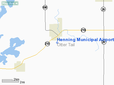
Henning Municipal Airport |
Location & QuickFacts
| FAA Information Effective: | 2008-09-25 |
| Airport Identifier: | 05Y |
| Airport Status: | Operational |
| Longitude/Latitude: | 095-26-22.1370W/46-18-13.8600N
-95.439482/46.303850 (Estimated) |
| Elevation: | 1455 ft / 443.48 m (Surveyed) |
| Land: | 34 acres |
| From nearest city: | 1 nautical miles S of Henning, MN |
| Location: | Otter Tail County, MN |
| Magnetic Variation: | 05E (1985) |
Owner & Manager
| Ownership: | Publicly owned |
| Owner: | City Of Henning |
| Address: | Po Box 55
Henning, MN 56551 |
| Phone number: | 218-583-2402 |
| Manager: | Tony Thalman |
| Address: | 405 Douglas Ave, Po Box 376
Henning, MN 56551 |
| Phone number: | 218-583-2270 |
Airport Operations and Facilities
| Airport Use: | Open to public |
| Wind indicator: | Yes |
| Segmented Circle: | No |
| Control Tower: | No |
| Lighting Schedule: | DUSK-DAWN |
| Beacon Color: | Clear-Green (lighted land airport) |
| Landing fee charge: | No |
| Sectional chart: | Twin Cities |
| Region: | AGL - Great Lakes |
| Traffic Pattern Alt: | 2250 ft |
| Boundary ARTCC: | ZMP - Minneapolis |
| Tie-in FSS: | PNM - Princeton |
| FSS on Airport: | No |
| FSS Toll Free: | 1-800-WX-BRIEF |
| NOTAMs Facility: | PNM (NOTAM-d service avaliable) |
Airport Communications
Airport Services
| Fuel available: | 100LL
FUEL AVAILABLE 24 HRS WITH CREDIT CARD. |
| Airframe Repair: | NONE |
| Power Plant Repair: | NONE |
| Bottled Oxygen: | NONE |
| Bulk Oxygen: | NONE |
Runway Information
Runway 17/35
| Dimension: | 3280 x 200 ft / 999.7 x 61.0 m |
| Surface: | TURF, Good Condition |
| Edge Lights: | Non-standard lighting system
NSTD LIRL; SPACING. |
| |
Runway 17 |
Runway 35 |
| Longitude: | 095-26-32.1300W | 095-26-32.1300W |
| Latitude: | 46-18-30.1500N | 46-17-58.5700N |
| Elevation: | 1440.00 ft | 1455.00 ft |
| Traffic Pattern: | Left | Left |
| Obstruction: | 42 ft trees, 1025.0 ft from runway, 200 ft left of centerline, 24:1 slope to clear | 34 ft pline, 1135.0 ft from runway, 33:1 slope to clear |
|
Radio Navigation Aids
| ID |
Type |
Name |
Ch |
Freq |
Var |
Dist |
| SAZ | NDB | Staples | | 257.00 | 04E | 26.7 nm |
| EE | NDB | Tamie | | 374.00 | 04E | 31.3 nm |
| PK | NDB | Spida | | 269.00 | 04E | 37.2 nm |
| GHW | NDB | Glenwood | | 346.00 | 03E | 40.0 nm |
| XCR | NDB | Ripley | | 404.00 | 03E | 47.6 nm |
| BWP | NDB | Breckenridge-wahpeton | | 233.00 | 05E | 48.5 nm |
| RYM | TACAN | Camp Ripley | 048X | | 03E | 46.9 nm |
| AXN | VOR/DME | Alexandria | 075X | 112.80 | 07E | 22.5 nm |
| FFM | VOR/DME | Fergus Falls | 041X | 110.40 | 05E | 29.8 nm |
| DTL | VOR/DME | Detroit Lakes | 049X | 111.20 | 05E | 36.4 nm |
| PKD | VOR/DME | Park Rapids | 043X | 110.60 | 04E | 38.8 nm |
| MOX | VOR/DME | Morris | 033X | 109.60 | 05E | 49.6 nm |
Remarks
- ULTRALIGHTS ON & INVOF ARPT.
- ESTBLD PRIOR TO 1959.
Images and information placed above are from
http://www.airport-data.com/airport/05Y/
We thank them for the data!
| General Info
|
| Country |
United States
|
| State |
MINNESOTA
|
| FAA ID |
05Y
|
| Latitude |
46-18-13.860N
|
| Longitude |
095-26-22.137W
|
| Elevation |
1455 feet
|
| Near City |
HENNING
|
We don't guarantee the information is fresh and accurate. The data may
be wrong or outdated.
For more up-to-date information please refer to other sources.
|
|


