 |
|
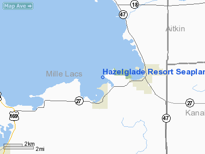
Hazelglade Resort Seaplane Base |
Location & QuickFacts
| FAA Information Effective: | 2008-09-25 |
| Airport Identifier: | MY22 |
| Airport Status: | Operational |
| Longitude/Latitude: | 093-31-15.8620W/46-08-29.8420N
-93.521073/46.141623 (Estimated) |
| Elevation: | 1250 ft / 381.00 m (Estimated) |
| Land: | 0 acres |
| From nearest city: | 2 nautical miles N of Wahkon, MN |
| Location: | Mille Lacs County, MN |
| Magnetic Variation: | 03E (1985) |
Owner & Manager
| Ownership: | Privately owned |
| Owner: | Dr Dale I. Erickson |
| Address: | 1100 Circle High Drive
Burnsville, MN 55337 |
| Phone number: | 612-435-5549 |
| Manager: | Dr Dale I. Erickson |
| Address: | 1100 Circle High Drive
Burnsville, MN 55337 |
| Phone number: | 612-435-5549 |
Airport Operations and Facilities
| Airport Use: | Private
PERSONAL USE. |
| Segmented Circle: | No |
| Control Tower: | No |
| Sectional chart: | Twin Cities |
| Region: | AGL - Great Lakes |
| Boundary ARTCC: | ZMP - Minneapolis |
| Tie-in FSS: | PNM - Princeton |
| FSS on Airport: | No |
| FSS Toll Free: | 1-800-WX-BRIEF |
Runway Information
Runway E/W
| Dimension: | 2500 x 2500 ft / 762.0 x 762.0 m |
| Surface: | WATER, |
| |
Runway E |
Runway W |
| Traffic Pattern: | Left | Left |
|
Runway N/S
| Dimension: | 2500 x 2500 ft / 762.0 x 762.0 m |
| Surface: | WATER, |
| |
Runway N |
Runway S |
| Traffic Pattern: | Left | Left |
|
Runway NW/SE
| Dimension: | 2100 x 2000 ft / 640.1 x 609.6 m |
| Surface: | WATER, |
| |
Runway NW |
Runway SE |
| Traffic Pattern: | Left | Left |
|
Radio Navigation Aids
| ID |
Type |
Name |
Ch |
Freq |
Var |
Dist |
| JMR | NDB | Mora | | 327.00 | 03E | 18.4 nm |
| AIT | NDB | Aitkin | | 397.00 | 03E | 25.2 nm |
| MZH | NDB | Moose Lake | | 362.00 | 02E | 34.0 nm |
| XCR | NDB | Ripley | | 404.00 | 03E | 34.5 nm |
| PNM | NDB | Princeton | | 368.00 | 03E | 34.9 nm |
| ROS | NDB | Rush City | | 282.00 | 02E | 35.7 nm |
| LXL | NDB | Little Falls | | 359.00 | 03E | 36.1 nm |
| CBG | NDB | Cambridge | | 350.00 | 03E | 36.7 nm |
| RYM | TACAN | Camp Ripley | 048X | | 03E | 34.9 nm |
| STC | VOR/DME | St Cloud | 058X | 112.10 | 03E | 42.1 nm |
| BRD | VORTAC | Brainerd | 116X | 116.90 | 03E | 24.4 nm |
Images and information placed above are from
http://www.airport-data.com/airport/MY22/
We thank them for the data!
| General Info
|
| Country |
United States
|
| State |
MINNESOTA
|
| FAA ID |
MY22
|
| Latitude |
46-08-29.842N
|
| Longitude |
093-31-15.862W
|
| Elevation |
1250 feet
|
| Near City |
WAHKON
|
We don't guarantee the information is fresh and accurate. The data may
be wrong or outdated.
For more up-to-date information please refer to other sources.
|
|


