 |
|
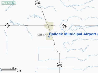
Hallock Municipal Airport |
Location & QuickFacts
| FAA Information Effective: | 2008-09-25 |
| Airport Identifier: | HCO |
| Airport Status: | Operational |
| Longitude/Latitude: | 096-56-34.8110W/48-45-09.8330N
-96.943003/48.752731 (Estimated) |
| Elevation: | 819 ft / 249.63 m (Surveyed) |
| Land: | 339 acres |
| From nearest city: | 1 nautical miles S of Hallock, MN |
| Location: | Kittson County, MN |
| Magnetic Variation: | 05E (2000) |
Owner & Manager
| Ownership: | Publicly owned |
| Owner: | City Of Hallock |
| Address: | Po Box 336
Hallock, MN 56728 |
| Phone number: | 218-843-2737 |
| Manager: | Jeremy Seng |
| Address: | 2462 - 310th Ave
Hallock, MN 56728 |
| Phone number: | 218-843-2076 |
Airport Operations and Facilities
| Airport Use: | Open to public |
| Wind indicator: | Yes |
| Segmented Circle: | Yes |
| Control Tower: | No |
| Lighting Schedule: | DUSK-DAWN
ACTVT MIRL RY 13/31; REIL RYS 13 & 31 - CTAF. |
| Beacon Color: | Clear-Green (lighted land airport) |
| Landing fee charge: | No |
| Sectional chart: | Twin Cities |
| Region: | AGL - Great Lakes |
| Boundary ARTCC: | ZMP - Minneapolis |
| Tie-in FSS: | PNM - Princeton |
| FSS on Airport: | No |
| FSS Toll Free: | 1-800-WX-BRIEF |
| NOTAMs Facility: | HCO (NOTAM-d service avaliable) |
| Federal Agreements: | NGY |
Airport Communications
| CTAF: | 122.800 |
| Unicom: | 122.800 |
Airport Services
| Fuel available: | 100LL
FUEL AVAIL 24 HRS WITH CREDIT CARD. |
| Bottled Oxygen: | NONE |
| Bulk Oxygen: | NONE |
Runway Information
Runway 13/31
| Dimension: | 4007 x 75 ft / 1221.3 x 22.9 m |
| Surface: | ASPH, Good Condition |
| Weight Limit: | Single wheel: 30000 lbs.
Dual wheel: 36000 lbs.
Dual tandem wheel: 65000 lbs. |
| Edge Lights: | Medium |
| |
Runway 13 |
Runway 31 |
| Longitude: | 096-56-54.0700W | 096-56-15.5460W |
| Latitude: | 48-45-24.9900N | 48-44-54.7540N |
| Elevation: | 817.00 ft | 819.00 ft |
| Alignment: | 127 | 127 |
| Traffic Pattern: | Left | Left |
| Markings: | Non-precision instrument, Good Condition | Non-precision instrument, Good Condition |
| Crossing Height: | 31.00 ft | 30.00 ft |
| VASI: | 2-box on left side | 2-box on left side |
| Visual Glide Angle: | 3.00° | 3.00° |
| Runway End Identifier: | Yes | Yes |
|
Radio Navigation Aids
| ID |
Type |
Name |
Ch |
Freq |
Var |
Dist |
| PFT | NDB | Piney Pinecreek | | 342.00 | 05E | 40.7 nm |
| GFK | VOR/DME | Grand Forks | 090X | 114.30 | 09E | 48.9 nm |
| ROX | VOR/DME | Roseau | 025X | 108.80 | 05E | 49.8 nm |
| HML | VORTAC | Humboldt | 071X | 112.40 | 09E | 9.8 nm |
Remarks
- ULTRALIGHT TRAFFIC ON & INVOF ARPT.
Images and information placed above are from
http://www.airport-data.com/airport/HCO/
We thank them for the data!
| General Info
|
| Country |
United States
|
| State |
MINNESOTA
|
| FAA ID |
HCO
|
| Latitude |
48-45-09.833N
|
| Longitude |
096-56-34.811W
|
| Elevation |
819 feet
|
| Near City |
HALLOCK
|
We don't guarantee the information is fresh and accurate. The data may
be wrong or outdated.
For more up-to-date information please refer to other sources.
|
|


