 |
|
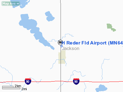
Location & QuickFacts
| FAA Information Effective: | 2008-09-25 |
| Airport Identifier: | MN64 |
| Airport Status: | Operational |
| Longitude/Latitude: | 095-10-20.9800W/43-41-44.8520N
-95.172494/43.695792 (Estimated) |
| Elevation: | 1504 ft / 458.42 m (Surveyed) |
| Land: | 0 acres |
| From nearest city: | 1 nautical miles N of Lakefield, MN |
| Location: | Jackson County, MN |
| Magnetic Variation: | 05E (1985) |
Owner & Manager
| Ownership: | Privately owned |
| Address: |
|
| Manager: | Henry Reder |
| Address: |
Lakefield, MN 56150 |
| Phone number: | 507-662-5006 |
Airport Operations and Facilities
| Airport Use: | Private |
| Wind indicator: | Yes |
| Segmented Circle: | No |
| Control Tower: | No |
| Landing fee charge: | No |
| Sectional chart: | Omaha |
| Region: | AGL - Great Lakes |
| Boundary ARTCC: | ZMP - Minneapolis |
| Tie-in FSS: | PNM - Princeton |
| FSS on Airport: | No |
| FSS Toll Free: | 1-800-WX-BRIEF |
Airport Services
| Airframe Repair: | NONE |
| Power Plant Repair: | NONE |
Runway Information
Runway 18/36
| Dimension: | 2200 x 75 ft / 670.6 x 22.9 m |
| Surface: | TURF, |
| |
Runway 18 |
Runway 36 |
| Traffic Pattern: | Left | Left |
|
Radio Navigation Aids
| ID |
Type |
Name |
Ch |
Freq |
Var |
Dist |
| MJQ | NDB | Jackson | | 353.00 | 04E | 8.6 nm |
| MWM | NDB | Windom | | 203.00 | 03E | 13.1 nm |
| PUF | NDB | Puff | | 345.00 | 04E | 28.1 nm |
| JYG | NDB | St James | | 260.00 | 04E | 32.0 nm |
| ISB | NDB | Sibley | | 269.00 | 05E | 32.0 nm |
| LTU | NDB | Little Sioux | | 326.00 | 05E | 34.2 nm |
| SHL | NDB | Sheldon | | 338.00 | 05E | 40.9 nm |
| EGQ | NDB | Emmetsburg | | 410.00 | 04E | 41.1 nm |
| SBU | NDB | Blue Earth | | 332.00 | 04E | 47.2 nm |
| ULM | NDB/DME | New Ulm | 050X | 272.00 | 04E | 47.4 nm |
| EST | VOR | Estherville | | 110.40 | 07E | 25.4 nm |
| OTG | VOR/DME | Worthington | 043X | 110.60 | 08E | 18.0 nm |
| SPW | VOR/DME | Spencer | 037X | 110.00 | 05E | 32.1 nm |
| FRM | VOR/DME | Fairmont | 039X | 110.20 | 07E | 32.7 nm |
| DDL | VOR/DME | Sheldon | 023X | 108.60 | 05E | 41.0 nm |
| RWF | VOR/DME | Redwood Falls | 080X | 113.30 | 07E | 46.4 nm |
Images and information placed above are from
http://www.airport-data.com/airport/MN64/
We thank them for the data!
| General Info
|
| Country |
United States
|
| State |
MINNESOTA
|
| FAA ID |
MN64
|
| Latitude |
43-41-44.852N
|
| Longitude |
095-10-20.980W
|
| Elevation |
1504 feet
|
| Near City |
LAKEFIELD
|
We don't guarantee the information is fresh and accurate. The data may
be wrong or outdated.
For more up-to-date information please refer to other sources.
|
|


