 |
|
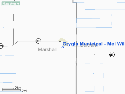
Grygla Municipal - Mel Wilkens Field Airport |
Location & QuickFacts
| FAA Information Effective: | 2008-09-25 |
| Airport Identifier: | 3G2 |
| Airport Status: | Operational |
| Longitude/Latitude: | 095-37-33.5000W/48-17-38.7000N
-95.625972/48.294083 (Estimated) |
| Elevation: | 1177 ft / 358.75 m (Estimated) |
| Land: | 78 acres |
| From nearest city: | 1 nautical miles SW of Grygla, MN |
| Location: | Marshall County, MN |
| Magnetic Variation: | 04E (1995) |
Owner & Manager
| Ownership: | Publicly owned |
| Owner: | City Of Grygla |
| Address: | 219 W Beltrami, Box 76
Grygla, MN 56727 |
| Phone number: | 218-294-6292 |
| Manager: | Carter Torgerson |
| Address: | Box 11
Grygla, MN 56727 |
| Phone number: | 218-294-6728 |
Airport Operations and Facilities
| Airport Use: | Open to public |
| Wind indicator: | Yes |
| Segmented Circle: | No |
| Control Tower: | No |
| Lighting Schedule: | DUSK-DAWN |
| Sectional chart: | Twin Cities |
| Region: | AGL - Great Lakes |
| Boundary ARTCC: | ZMP - Minneapolis |
| Tie-in FSS: | PNM - Princeton |
| FSS Toll Free: | 1-800-WX-BRIEF |
| NOTAMs Facility: | PNM (NOTAM-d service avaliable) |
Airport Communications
Airport Services
Runway Information
Runway 17/35
| Dimension: | 3437 x 92 ft / 1047.6 x 28.0 m |
| Surface: | TURF, Good Condition |
| Edge Lights: | Low |
| |
Runway 17 |
Runway 35 |
| Longitude: | 095-37-35.8800W | 095-37-31.1300W |
| Latitude: | 48-17-55.5800N | 48-17-21.8100N |
| Traffic Pattern: | Left | Left |
| Obstruction: | 31 ft trees, 1400.0 ft from runway, 45:1 slope to clear | , 50:1 slope to clear |
|
Radio Navigation Aids
| ID |
Type |
Name |
Ch |
Freq |
Var |
Dist |
| FSE | NDB | Fosston | | 224.00 | 05E | 42.7 nm |
| PFT | NDB | Piney Pinecreek | | 342.00 | 05E | 44.3 nm |
| CKN | NDB | Crookston | | 400.00 | 07E | 48.2 nm |
| TVF | VOR/DME | Thief River Falls | 021X | 108.40 | 08E | 26.2 nm |
| ROX | VOR/DME | Roseau | 025X | 108.80 | 05E | 33.8 nm |
| BDE | VOR/DME | Baudette | 053X | 111.60 | 04E | 48.1 nm |
| BJI | VORTAC | Bemidji | 023X | 108.60 | 04E | 49.5 nm |
Remarks
- ULTRALIGHT TRAFFIC ON & INVOF ARPT.
- PRVDD CLEAR 20:1 APCH & CLEAR RY SAFETY AREA.
Images and information placed above are from
http://www.airport-data.com/airport/3G2/
We thank them for the data!
| General Info
|
| Country |
United States
|
| State |
MINNESOTA
|
| FAA ID |
3G2
|
| Latitude |
48-17-48.000N
|
| Longitude |
095-37-38.000W
|
| Elevation |
1177 feet
|
| Near City |
GRYGLA
|
We don't guarantee the information is fresh and accurate. The data may
be wrong or outdated.
For more up-to-date information please refer to other sources.
|
|


