|
|
Glenwood Municipal Airport |
|
 |
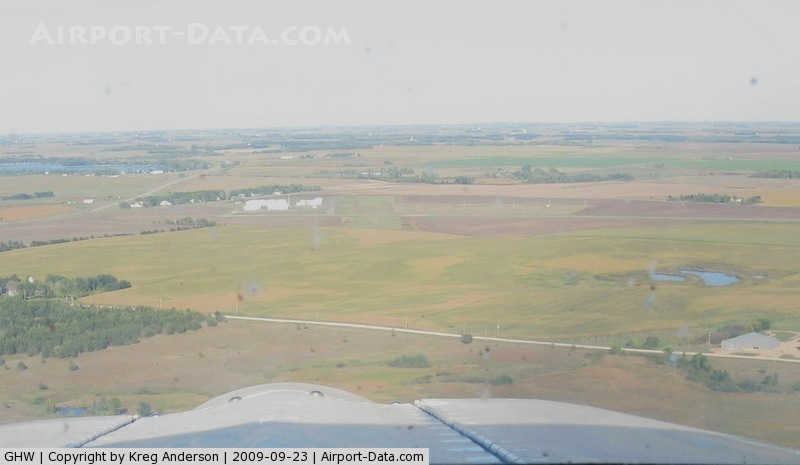
(Click on the photo to enlarge) |
|
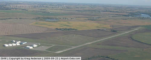 |
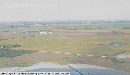
(Click on the photo to enlarge) |
Location & QuickFacts
| FAA Information Effective: | 2008-09-25 |
| Airport Identifier: | GHW |
| Airport Status: | Operational |
| Longitude/Latitude: | 095-19-13.5500W/45-38-38.0100N
-95.320431/45.643892 (Estimated) |
| Elevation: | 1393 ft / 424.59 m (Surveyed) |
| Land: | 330 acres |
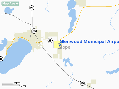
| From nearest city: | 3 nautical miles E of Glenwood, MN |
| Location: | Pope County, MN |
| Magnetic Variation: | 04E (2000) |
Owner & Manager
| Ownership: | Publicly owned |
| Owner: | City Of Glenwood |
| Address: | 137 E Minnesota
Glenwood, MN 56334 |
| Phone number: | 320-634-5433 |
| Manager: | Dave Minke |
| Address: | 137 E. Minnesota
Glenwood, MN 56334 |
| Phone number: | 320-634-5433 |
Airport Operations and Facilities
| Airport Use: | Open to public |
| Wind indicator: | Yes |
| Segmented Circle: | No |
| Control Tower: | No |
| Lighting Schedule: | DUSK-DAWN |
| Beacon Color: | Clear-Green (lighted land airport) |
| Landing fee charge: | No |
| Sectional chart: | Twin Cities |
| Region: | AGL - Great Lakes |
| Boundary ARTCC: | ZMP - Minneapolis |
| Tie-in FSS: | PNM - Princeton |
| FSS on Airport: | No |
| FSS Toll Free: | 1-800-WX-BRIEF |
| NOTAMs Facility: | GHW (NOTAM-d service avaliable) |
| Federal Agreements: | N1 |
Airport Communications
Airport Services
| Fuel available: | 100LL
FOR FUEL CALL (320) 634-4772. |
| Bottled Oxygen: | NONE |
| Bulk Oxygen: | NONE |
Runway Information
Runway 05/23
| Dimension: | 2801 x 209 ft / 853.7 x 63.7 m |
| Surface: | TURF, Good Condition |
| |
Runway 05 |
Runway 23 |
| Longitude: | 095-19-31.1200W | 095-18-58.1190W |
| Latitude: | 45-38-39.8630N | 45-38-54.8640N |
| Elevation: | 1380.00 ft | 1393.00 ft |
| Alignment: | 57 | 127 |
| Traffic Pattern: | Left | Left |
| Markings: | Nonstandard,
05/23 MKD WITH 'A' FRAMES. | Nonstandard, |
| Runway End Identifier: | No | No |
| Centerline Lights: | No | No |
| Touchdown Lights: | No | No |
| Obstruction: | , 50:1 slope to clear | 10 ft tree, 40.0 ft from runway, 80 ft left of centerline, 4:1 slope to clear |
|
Runway 15/33
| Dimension: | 4500 x 75 ft / 1371.6 x 22.9 m |
| Surface: | ASPH, Fair Condition |
| Edge Lights: | Low |
| |
Runway 15 |
Runway 33 |
| Longitude: | 095-19-22.5910W | 095-19-03.1800W |
| Latitude: | 45-38-53.3320N | 45-38-11.0400N |
| Elevation: | 1390.00 ft | 1372.00 ft |
| Alignment: | 127 | 127 |
| Traffic Pattern: | Left | Left |
| Markings: | Non-precision instrument, Poor Condition
15/33 NRS FADED. | Non-precision instrument, Poor Condition |
| Crossing Height: | 33.00 ft | 25.00 ft |
| VASI: | 4-light PAPI on left side | 4-light PAPI on left side |
| Visual Glide Angle: | 3.00° | 3.00° |
| Runway End Identifier: | No | No |
| Centerline Lights: | No | No |
| Touchdown Lights: | No | No |
|
Radio Navigation Aids
| ID |
Type |
Name |
Ch |
Freq |
Var |
Dist |
| EE | NDB | Tamie | | 374.00 | 04E | 8.9 nm |
| BBB | NDB | Benson | | 239.00 | 05E | 23.6 nm |
| AQP | NDB | Appleton | | 356.00 | 05E | 38.3 nm |
| LXL | NDB | Little Falls | | 359.00 | 03E | 45.0 nm |
| XCR | NDB | Ripley | | 404.00 | 03E | 48.5 nm |
| SAZ | NDB | Staples | | 257.00 | 04E | 49.3 nm |
| RYM | TACAN | Camp Ripley | 048X | | 03E | 48.5 nm |
| AXN | VOR/DME | Alexandria | 075X | 112.80 | 07E | 19.3 nm |
| MOX | VOR/DME | Morris | 033X | 109.60 | 05E | 27.7 nm |
| BDH | VOR/DME | Willmar | 84X | 113.70 | 04E | 32.7 nm |
| ILL | VOR/DME | Willmar | 084X | 113.70 | 04E | 33.1 nm |
| MVE | VOR/DME | Montevideo | 053X | 111.60 | 05E | 43.6 nm |
| DWN | VORTAC | Darwin | 027X | 109.00 | 07E | 49.6 nm |
Remarks
- RY 05/23 CLSD WINTER MONTHS.
- DEER ON & INVOF ARPT.
- GCO AVBL ON FREQ 121.725 THRU MINNEAPOLIS ARTCC & FLT SVCS.
Images and information placed above are from
http://www.airport-data.com/airport/GHW/
We thank them for the data!
| General Info
|
| Country |
United States
|
| State |
MINNESOTA
|
| FAA ID |
GHW
|
| Latitude |
45-38-38.010N
|
| Longitude |
095-19-13.550W
|
| Elevation |
1393 feet
|
| Near City |
GLENWOOD
|
We don't guarantee the information is fresh and accurate. The data may
be wrong or outdated.
For more up-to-date information please refer to other sources.
|
|