 |
|
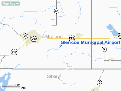
Glencoe Municipal Airport |
Location & QuickFacts
| FAA Information Effective: | 2008-09-25 |
| Airport Identifier: | GYL |
| Airport Status: | Operational |
| Longitude/Latitude: | 094-04-52.3550W/44-45-21.7550N
-94.081210/44.756043 (Estimated) |
| Elevation: | 992 ft / 302.36 m (Surveyed) |
| Land: | 30 acres |
| From nearest city: | 3 nautical miles SE of Glencoe, MN |
| Location: | Mc Leod County, MN |
| Magnetic Variation: | 03E (2000) |
Owner & Manager
| Ownership: | Publicly owned |
| Owner: | City Of Glencoe |
| Address: | 630 10th St East
Glencoe, MN 55336 |
| Phone number: | 320-864-5586 |
| Manager: | Mark Larson |
| Address: | 630 10th St East
Glencoe, MN 55336 |
| Phone number: | 320-864-5586 |
Airport Operations and Facilities
| Airport Use: | Open to public |
| Wind indicator: | Yes |
| Segmented Circle: | No |
| Control Tower: | No |
| Lighting Schedule: | RDO-CTL
ACTVT MIRL RY 13/31 - CTAF. |
| Landing fee charge: | No |
| Sectional chart: | Twin Cities |
| Region: | AGL - Great Lakes |
| Traffic Pattern Alt: | 800 ft |
| Boundary ARTCC: | ZMP - Minneapolis |
| Tie-in FSS: | PNM - Princeton |
| FSS on Airport: | No |
| FSS Toll Free: | 1-800-WX-BRIEF |
| NOTAMs Facility: | GYL (NOTAM-d service avaliable) |
Airport Communications
| CTAF: | 122.800 |
| Unicom: | 122.800 |
Airport Services
| Fuel available: | 100LL
FUEL AVAIL 24 HRS WITH CREDIT CARD. |
| Power Plant Repair: | NONE |
| Bottled Oxygen: | NONE |
| Bulk Oxygen: | NONE |
Runway Information
Runway 13/31
| Dimension: | 3300 x 75 ft / 1005.8 x 22.9 m |
| Surface: | ASPH, Good Condition |
| Edge Lights: | Medium |
| |
Runway 13 |
Runway 31 |
| Longitude: | 094-05-09.6500W | 094-04-35.0600W |
| Latitude: | 44-45-32.4100N | 44-45-11.1000N |
| Elevation: | 992.00 ft | 990.00 ft |
| Alignment: | 127 | 127 |
| Traffic Pattern: | Left | Left |
| Markings: | Non-precision instrument, Good Condition | Non-precision instrument, Good Condition |
| Runway End Identifier: | No | No |
| Touchdown Lights: | No | No |
| Obstruction: | 67 ft trees, 2500.0 ft from runway, 200 ft left of centerline, 34:1 slope to clear | 30 ft trees, 250.0 ft from runway, 230 ft left of centerline, 1:1 slope to clear |
|
Radio Navigation Aids
| ID |
Type |
Name |
Ch |
Freq |
Var |
Dist |
| GYL | NDB | Glencoe | | 407.00 | 03E | 0.3 nm |
| HCD | NDB | Hutchinson | | 209.00 | 04E | 14.2 nm |
| MS | NDB | Narco | | 266.00 | 02E | 42.4 nm |
| ACQ | NDB | Waseca | | 371.00 | 02E | 47.1 nm |
| PPI | NDB | Hopey | | 400.00 | 03E | 49.1 nm |
| ULM | NDB/DME | New Ulm | 050X | 272.00 | 04E | 31.8 nm |
| FCM | VOR/DME | Flying Cloud | 055X | 111.80 | 06E | 27.0 nm |
| MKT | VOR/DME | Mankato | 045X | 110.80 | 07E | 33.0 nm |
| MSP | VOR/DME | Minneapolis | 100X | 115.30 | 02E | 37.0 nm |
| FOW | VOR/DME | Halfway | 049X | 111.20 | 02E | 45.0 nm |
| STC | VOR/DME | St Cloud | 058X | 112.10 | 03E | 47.7 nm |
| RWF | VOR/DME | Redwood Falls | 080X | 113.30 | 07E | 48.1 nm |
| ILL | VOR/DME | Willmar | 084X | 113.70 | 04E | 48.1 nm |
| BDH | VOR/DME | Willmar | 84X | 113.70 | 04E | 49.5 nm |
| DWN | VORTAC | Darwin | 027X | 109.00 | 07E | 25.5 nm |
| GEP | VORTAC | Gopher | 120X | 117.30 | 06E | 38.2 nm |
| FGT | VORTAC | Farmington | 104X | 115.70 | 06E | 39.1 nm |
| MSP | VOT | Minneapolis St Paul | | 111.00 | | 37.7 nm |
| STP | VOT | St Paul | | 114.40 | | 44.9 nm |
Remarks
- DEER ON & INVOF OF RY DUSK TO DAWN
- ULTRALIGHTS ON & INVOF ARPT.
Images and information placed above are from
http://www.airport-data.com/airport/GYL/
We thank them for the data!
| General Info
|
| Country |
United States
|
| State |
MINNESOTA
|
| FAA ID |
GYL
|
| Latitude |
44-45-21.755N
|
| Longitude |
094-04-52.355W
|
| Elevation |
992 feet
|
| Near City |
GLENCOE
|
We don't guarantee the information is fresh and accurate. The data may
be wrong or outdated.
For more up-to-date information please refer to other sources.
|
|


