 |
|
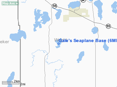
Location & QuickFacts
| FAA Information Effective: | 2008-09-25 |
| Airport Identifier: | 6MN5 |
| Airport Status: | Operational |
| Longitude/Latitude: | 094-09-44.9360W/45-12-27.8720N
-94.162482/45.207742 (Estimated) |
| Elevation: | 1011 ft / 308.15 m (Estimated) |
| Land: | 0 acres |
| From nearest city: | 2 nautical miles NW of French Lake, MN |
| Location: | Wright County, MN |
| Magnetic Variation: | 03E (1995) |
Owner & Manager
| Ownership: | Privately owned |
| Owner: | Gale Putnam |
| Address: | 13752 42nd St Nw
Annandale, MN 55302 |
| Phone number: | 417-527-2181 |
| Manager: | Gale Putnam |
| Address: | 13752 42nd St Nw
Annandale, MN 55302 |
| Phone number: | 417-527-2181 |
Airport Operations and Facilities
| Airport Use: | Private |
| Segmented Circle: | No |
| Control Tower: | No |
| Sectional chart: | Twin Cities |
| Region: | AGL - Great Lakes |
| Boundary ARTCC: | ZMP - Minneapolis |
| Tie-in FSS: | PNM - Princeton |
| FSS Toll Free: | 1-800-WX-BRIEF |
Runway Information
Runway 16W/34W
| Dimension: | 4000 x 2000 ft / 1219.2 x 609.6 m |
| Surface: | WATER, |
| |
Runway 16W |
Runway 34W |
| Traffic Pattern: | Left | Left |
|
Radio Navigation Aids
| ID |
Type |
Name |
Ch |
Freq |
Var |
Dist |
| HCD | NDB | Hutchinson | | 209.00 | 04E | 23.1 nm |
| GYL | NDB | Glencoe | | 407.00 | 03E | 27.1 nm |
| PNM | NDB | Princeton | | 368.00 | 03E | 31.8 nm |
| CBG | NDB | Cambridge | | 350.00 | 03E | 43.4 nm |
| LXL | NDB | Little Falls | | 359.00 | 03E | 45.2 nm |
| STC | VOR/DME | St Cloud | 058X | 112.10 | 03E | 21.0 nm |
| FCM | VOR/DME | Flying Cloud | 055X | 111.80 | 06E | 37.8 nm |
| ILL | VOR/DME | Willmar | 084X | 113.70 | 04E | 39.7 nm |
| BDH | VOR/DME | Willmar | 84X | 113.70 | 04E | 41.2 nm |
| MSP | VOR/DME | Minneapolis | 100X | 115.30 | 02E | 43.5 nm |
| DWN | VORTAC | Darwin | 027X | 109.00 | 07E | 14.3 nm |
| GEP | VORTAC | Gopher | 120X | 117.30 | 06E | 33.7 nm |
| MSP | VOT | Minneapolis St Paul | | 111.00 | | 44.7 nm |
| STP | VOT | St Paul | | 114.40 | | 49.5 nm |
Remarks
- PRVDD CLEAR 20:1 APCHS & REF FAR 91.115 RIGHT-OF-WAY RULES, WATER OPERATIONS.
Images and information placed above are from
http://www.airport-data.com/airport/6MN5/
We thank them for the data!
| General Info
|
| Country |
United States
|
| State |
MINNESOTA
|
| FAA ID |
6MN5
|
| Latitude |
45-12-27.872N
|
| Longitude |
094-09-44.936W
|
| Elevation |
1011 feet
|
| Near City |
FRENCH LAKE
|
We don't guarantee the information is fresh and accurate. The data may
be wrong or outdated.
For more up-to-date information please refer to other sources.
|
|


