 |
|
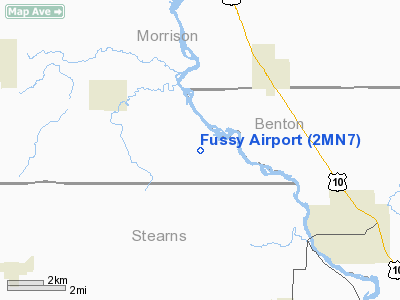
Location & QuickFacts
| FAA Information Effective: | 2008-09-25 |
| Airport Identifier: | 2MN7 |
| Airport Status: | Operational |
| Longitude/Latitude: | 094-20-26.9900W/45-47-29.8700N
-94.340831/45.791631 (Estimated) |
| Elevation: | 1100 ft / 335.28 m (Estimated) |
| Land: | 0 acres |
| From nearest city: | 1 nautical miles SE of North Prairie, MN |
| Location: | Morrison County, MN |
| Magnetic Variation: | 03E (1995) |
Owner & Manager
| Ownership: | Privately owned |
| Owner: | Bernie Fussy |
| Address: | 15498 20th St.
Bowlus, MN 56314 |
| Phone number: | 320-584-5635 |
| Manager: | Bernie Fussy |
| Address: | 15498 20th St
Bowlus, MN 56314 |
| Phone number: | 320-584-5635 |
Airport Operations and Facilities
| Airport Use: | Private |
| Wind indicator: | Yes
WINDSOCK NORTH OF RY. |
| Segmented Circle: | No |
| Control Tower: | No |
| Sectional chart: | Twin Cities |
| Region: | AGL - Great Lakes |
| Boundary ARTCC: | ZMP - Minneapolis |
| Tie-in FSS: | PNM - Princeton |
| FSS on Airport: | No |
| FSS Toll Free: | 1-800-WX-BRIEF |
Runway Information
Runway 09/27
| Dimension: | 2300 x 80 ft / 701.0 x 24.4 m |
| Surface: | TURF, |
| |
Runway 09 |
Runway 27 |
| Traffic Pattern: | Left | Left |
|
Radio Navigation Aids
| ID |
Type |
Name |
Ch |
Freq |
Var |
Dist |
| LXL | NDB | Little Falls | | 359.00 | 03E | 9.5 nm |
| XCR | NDB | Ripley | | 404.00 | 03E | 17.2 nm |
| PNM | NDB | Princeton | | 368.00 | 03E | 33.7 nm |
| EE | NDB | Tamie | | 374.00 | 04E | 40.4 nm |
| SAZ | NDB | Staples | | 257.00 | 04E | 40.4 nm |
| GHW | NDB | Glenwood | | 346.00 | 03E | 42.0 nm |
| JMR | NDB | Mora | | 327.00 | 03E | 45.3 nm |
| CBG | NDB | Cambridge | | 350.00 | 03E | 47.4 nm |
| RYM | TACAN | Camp Ripley | 048X | | 03E | 18.0 nm |
| STC | VOR/DME | St Cloud | 058X | 112.10 | 03E | 18.8 nm |
| AXN | VOR/DME | Alexandria | 075X | 112.80 | 07E | 38.6 nm |
| BRD | VORTAC | Brainerd | 116X | 116.90 | 03E | 35.9 nm |
| DWN | VORTAC | Darwin | 027X | 109.00 | 07E | 42.6 nm |
Remarks
- PRVDD OBSTNS IN RY APCH SLOPE LOWERED/REMOVED FOR 20:1; 125 FT EITHER SIDE OF RY CNTRLN & 200 FT OFF RY ENDS CLEAR OF OBSTNS; RY SAFETY AREA 60 FT EITHER SIDE OF RY & 240 FT OFF END OF RY CLEARED & GRADED.
Images and information placed above are from
http://www.airport-data.com/airport/2MN7/
We thank them for the data!
| General Info
|
| Country |
United States
|
| State |
MINNESOTA
|
| FAA ID |
2MN7
|
| Latitude |
45-47-29.870N
|
| Longitude |
094-20-26.990W
|
| Elevation |
1100 feet
|
| Near City |
NORTH PRAIRIE
|
We don't guarantee the information is fresh and accurate. The data may
be wrong or outdated.
For more up-to-date information please refer to other sources.
|
|


