 |
|
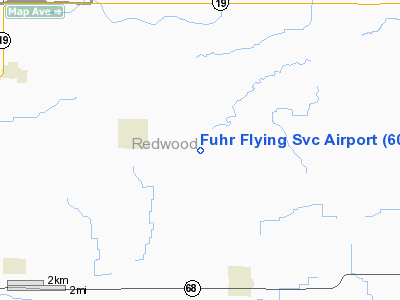
Location & QuickFacts
| FAA Information Effective: | 2008-09-25 |
| Airport Identifier: | 60MN |
| Airport Status: | Operational |
| Longitude/Latitude: | 095-17-01.0050W/44-28-04.8480N
-95.283613/44.468013 (Estimated) |
| Elevation: | 1070 ft / 326.14 m (Estimated) |
| Land: | 0 acres |
| From nearest city: | 3 nautical miles E of Seaforth, MN |
| Location: | Redwood County, MN |
| Magnetic Variation: | 05E (1985) |
Owner & Manager
| Ownership: | Privately owned |
| Owner: | David L. Fuhr |
| Address: | 25338 290th St
Wabasso, MN 56293 |
| Phone number: | 507-984-5414 |
| Manager: | David L. Fuhr |
| Address: | Circle Lane Farms
Wabasso, MN 56293 |
| Phone number: | 507-644-5419 |
Airport Operations and Facilities
| Airport Use: | Private
PERSONAL USE. |
| Wind indicator: | Yes |
| Segmented Circle: | No |
| Control Tower: | No |
| Sectional chart: | Twin Cities |
| Region: | AGL - Great Lakes |
| Boundary ARTCC: | ZMP - Minneapolis |
| Tie-in FSS: | PNM - Princeton |
| FSS on Airport: | No |
| FSS Toll Free: | 1-800-WX-BRIEF |
Airport Services
Runway Information
Runway N/S
| Dimension: | 2600 x 100 ft / 792.5 x 30.5 m |
| Surface: | TURF, |
| |
Runway N |
Runway S |
| Traffic Pattern: | Left | Left |
| Obstruction: | 15 ft wires, 50.0 ft from runway | |
|
Radio Navigation Aids
| ID |
Type |
Name |
Ch |
Freq |
Var |
Dist |
| MWM | NDB | Windom | | 203.00 | 03E | 34.4 nm |
| JYG | NDB | St James | | 260.00 | 04E | 42.8 nm |
| HCD | NDB | Hutchinson | | 209.00 | 04E | 45.0 nm |
| DXX | NDB | Dawson/madison | | 341.00 | 06E | 49.2 nm |
| ULM | NDB/DME | New Ulm | 050X | 272.00 | 04E | 34.9 nm |
| RWF | VOR/DME | Redwood Falls | 080X | 113.30 | 07E | 6.7 nm |
| MML | VOR/DME | Marshall | 047X | 111.00 | 05E | 23.2 nm |
| MVE | VOR/DME | Montevideo | 053X | 111.60 | 05E | 35.4 nm |
| BDH | VOR/DME | Willmar | 84X | 113.70 | 04E | 39.6 nm |
| ILL | VOR/DME | Willmar | 084X | 113.70 | 04E | 39.9 nm |
Images and information placed above are from
http://www.airport-data.com/airport/60MN/
We thank them for the data!
| General Info
|
| Country |
United States
|
| State |
MINNESOTA
|
| FAA ID |
60MN
|
| Latitude |
44-28-04.848N
|
| Longitude |
095-17-01.005W
|
| Elevation |
1070 feet
|
| Near City |
SEAFORTH
|
We don't guarantee the information is fresh and accurate. The data may
be wrong or outdated.
For more up-to-date information please refer to other sources.
|
|


