 |
|
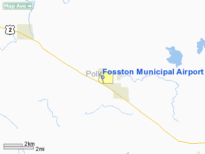
Fosston Municipal Airport |
Location & QuickFacts
| FAA Information Effective: | 2008-09-25 |
| Airport Identifier: | FSE |
| Airport Status: | Operational |
| Longitude/Latitude: | 095-46-24.5960W/47-35-34.1530N
-95.773499/47.592820 (Estimated) |
| Elevation: | 1277 ft / 389.23 m (Surveyed) |
| Land: | 294 acres |
| From nearest city: | 1 nautical miles NW of Fosston, MN |
| Location: | Polk County, MN |
| Magnetic Variation: | 05E (1990) |
Owner & Manager
| Ownership: | Publicly owned |
| Owner: | City Of Fosston |
| Address: | City Hall, 220 East First Street
Fosston, MN 56542 |
| Phone number: | 218-435-1959 |
| Manager: | Chuck Lucken |
| Address: | 220 East First Street
Fosston, MN 56542 |
| Phone number: | 218-435-1959 |
Airport Operations and Facilities
| Airport Use: | Open to public |
| Wind indicator: | Yes |
| Segmented Circle: | Yes |
| Control Tower: | No |
| Lighting Schedule: | DUSK-DAWN
MIRL RY 16/34 PRESET LOW INTST TO INCR INTST & ACTVT PAPI & REIL RYS 16 & 34 - CTAF. |
| Beacon Color: | Clear-Green (lighted land airport) |
| Landing fee charge: | No |
| Sectional chart: | Twin Cities |
| Region: | AGL - Great Lakes |
| Boundary ARTCC: | ZMP - Minneapolis |
| Tie-in FSS: | PNM - Princeton |
| FSS on Airport: | No |
| FSS Toll Free: | 1-800-WX-BRIEF |
| NOTAMs Facility: | FSE (NOTAM-d service avaliable) |
| Federal Agreements: | NGY |
Airport Communications
Airport Services
| Fuel available: | 100LL
SELF SERVICE FUEL AVBL WITH CREDIT CARD. |
Runway Information
Runway 16/34
| Dimension: | 3501 x 75 ft / 1067.1 x 22.9 m |
| Surface: | ASPH, Fair Condition |
| Weight Limit: | Single wheel: 12500 lbs. |
| Edge Lights: | Non-standard lighting system
RY 34 LGTS NOT AMBER LAST HALF RY LENGTH. |
| |
Runway 16 |
Runway 34 |
| Longitude: | 095-46-30.1180W | 095-46-19.0030W |
| Latitude: | 47-35-51.0490N | 47-35-17.3230N |
| Elevation: | 1265.00 ft | 1277.00 ft |
| Alignment: | 127 | 127 |
| Traffic Pattern: | Left | Left |
| Markings: | Non-precision instrument, Poor Condition
RY 16/34 MARKINGS FADED, PATCHED AREAS NOT PAINTED. | Non-precision instrument, Good Condition |
| Crossing Height: | 25.00 ft | 25.00 ft |
| VASI: | 4-light PAPI on left side | 4-light PAPI on left side |
| Visual Glide Angle: | 2.80° | 2.80° |
| Runway End Identifier: | Yes | Yes |
| Obstruction: | 33 ft trees, 1300.0 ft from runway, 300 ft right of centerline, 33:1 slope to clear | 19 ft road, 891.0 ft from runway, 36:1 slope to clear |
|
Radio Navigation Aids
| ID |
Type |
Name |
Ch |
Freq |
Var |
Dist |
| FSE | NDB | Fosston | | 224.00 | 05E | 0.2 nm |
| CKN | NDB | Crookston | | 400.00 | 07E | 37.2 nm |
| TVF | VOR/DME | Thief River Falls | 021X | 108.40 | 08E | 33.1 nm |
| DTL | VOR/DME | Detroit Lakes | 049X | 111.20 | 05E | 46.3 nm |
| BJI | VORTAC | Bemidji | 023X | 108.60 | 04E | 30.4 nm |
Remarks
- AUTO TFC OCNLLY ON ARPT TO/FROM PVT SEAPLANE DOCK NW OF ARPT.
- PVT SEAPLANE FACILITY NW OF ARPT.
- GCO AVBL ON FREQ 121.725 THRU MINNEAPOLIS ARTCC & FLT SVCS.
Images and information placed above are from
http://www.airport-data.com/airport/FSE/
We thank them for the data!
| General Info
|
| Country |
United States
|
| State |
MINNESOTA
|
| FAA ID |
FSE
|
| Latitude |
47-35-34.153N
|
| Longitude |
095-46-24.596W
|
| Elevation |
1277 feet
|
| Near City |
FOSSTON
|
We don't guarantee the information is fresh and accurate. The data may
be wrong or outdated.
For more up-to-date information please refer to other sources.
|
|


