 |
|
|
 |
(Click on the photo to enlarge) |
|
 |
(Click on the photo to enlarge) |
Location & QuickFacts
| FAA Information Effective: | 2008-09-25 |
| Airport Identifier: | 25D |
| Airport Status: | Operational |
| Longitude/Latitude: | 092-59-39.7870W/45-14-51.8840N
-92.994385/45.247746 (Estimated) |
| Elevation: | 925 ft / 281.94 m (Surveyed) |
| Land: | 330 acres |
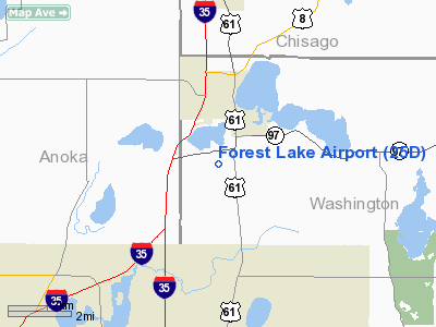
| From nearest city: | 2 nautical miles SW of Forest Lake, MN |
| Location: | Washington County, MN |
| Magnetic Variation: | 03E (1985) |
Owner & Manager
| Ownership: | Publicly owned |
| Owner: | City Of Forest Lake |
| Address: | 220 North Lake St., 229 North Lake St
Forest Lake, MN 55025 |
| Phone number: | 651-464-3550 |
| Manager: | Charles Robinson |
| Address: | 220 North Lake St.
Forest Lake, MN 55025 |
| Phone number: | 651-464-3550 |
Airport Operations and Facilities
| Airport Use: | Open to public |
| Wind indicator: | Yes |
| Segmented Circle: | No |
| Control Tower: | No |
| Lighting Schedule: | DUSK-DAWN |
| Beacon Color: | Clear-Green (lighted land airport) |
| Landing fee charge: | No |
| Sectional chart: | Green Bay |
| Region: | AGL - Great Lakes |
| Traffic Pattern Alt: | 1000 ft |
| Boundary ARTCC: | ZMP - Minneapolis |
| Tie-in FSS: | PNM - Princeton |
| FSS on Airport: | No |
| FSS Toll Free: | 1-800-WX-BRIEF |
| NOTAMs Facility: | PNM (NOTAM-d service avaliable) |
Airport Communications
| CTAF: | 122.700 |
| Unicom: | 122.700 |
Airport Services
| Fuel available: | 100LL
FUEL AVBL 24 HRS SELF SERVICE WITH CREDIT CARD. |
| Airframe Repair: | MAJOR |
| Bottled Oxygen: | NONE |
| Bulk Oxygen: | NONE |
Runway Information
Runway 13/31
| Dimension: | 2650 x 150 ft / 807.7 x 45.7 m |
| Surface: | TURF, Good Condition |
| Edge Lights: | Low |
| |
Runway 13 |
Runway 31 |
| Longitude: | 092-59-51.3500W | 092-59-31.2300W |
| Latitude: | 45-15-04.4200N | 45-14-43.3400N |
| Elevation: | 920.00 ft | 920.00 ft |
| Traffic Pattern: | Left | Left |
| Obstruction: | 48 ft trees, 550.0 ft from runway, 175 ft right of centerline, 11:1 slope to clear | 114 ft pline, 3100.0 ft from runway, 350 ft left of centerline, 27:1 slope to clear |
|
Radio Navigation Aids
| ID |
Type |
Name |
Ch |
Freq |
Var |
Dist |
| OEO | NDB | Osceola | | 233.00 | 01E | 13.5 nm |
| RNH | NDB | New Richmond | | 257.00 | 02E | 20.4 nm |
| CBG | NDB | Cambridge | | 350.00 | 03E | 21.8 nm |
| PPI | NDB | Hopey | | 400.00 | 03E | 22.6 nm |
| MS | NDB | Narco | | 266.00 | 02E | 25.7 nm |
| AHH | NDB | Ameron | | 278.00 | 01E | 26.4 nm |
| ROS | NDB | Rush City | | 282.00 | 02E | 27.0 nm |
| PNM | NDB | Princeton | | 368.00 | 03E | 32.1 nm |
| JMR | NDB | Mora | | 327.00 | 03E | 40.3 nm |
| BXR | NDB | Big Doctor | | 203.00 | 02E | 43.4 nm |
| UBE | NDB | Cumberland | | 375.00 | 01E | 45.8 nm |
| MSP | VOR/DME | Minneapolis | 100X | 115.30 | 02E | 23.5 nm |
| FCM | VOR/DME | Flying Cloud | 055X | 111.80 | 06E | 32.1 nm |
| RZN | VOR/DME | Siren | 031X | 109.40 | 02E | 43.2 nm |
| STC | VOR/DME | St Cloud | 058X | 112.10 | 03E | 48.4 nm |
| GEP | VORTAC | Gopher | 120X | 117.30 | 06E | 17.2 nm |
| FGT | VORTAC | Farmington | 104X | 115.70 | 06E | 37.9 nm |
| STP | VOT | St Paul | | 114.40 | | 18.7 nm |
| MSP | VOT | Minneapolis St Paul | | 111.00 | | 23.8 nm |
Remarks
- PRVDD RAMP IS RELCTD OUTSIDE OF THE APCH SLOPE TO RWY 13.
Images and information placed above are from
http://www.airport-data.com/airport/25D/
We thank them for the data!
| General Info
|
| Country |
United States
|
| State |
MINNESOTA
|
| FAA ID |
25D
|
| Latitude |
45-14-51.884N
|
| Longitude |
092-59-39.787W
|
| Elevation |
925 feet
|
| Near City |
FOREST LAKE
|
We don't guarantee the information is fresh and accurate. The data may
be wrong or outdated.
For more up-to-date information please refer to other sources.
|
|


