|
|
|
 |
(Click on the photo to enlarge) |
|
 |
(Click on the photo to enlarge) |
|
 |
(Click on the photo to enlarge) |
|
 |
(Click on the photo to enlarge) |
|
 |
(Click on the photo to enlarge) |
|
 |
(Click on the photo to enlarge) |
|
 |
(Click on the photo to enlarge) |
|
 |
(Click on the photo to enlarge) |
|
 |
(Click on the photo to enlarge) |
|
 |
(Click on the photo to enlarge) |
|
 |
(Click on the photo to enlarge) |
|
 |
(Click on the photo to enlarge) |
|
 |
(Click on the photo to enlarge) |
|
 |
(Click on the photo to enlarge) |
|
 |
(Click on the photo to enlarge) |
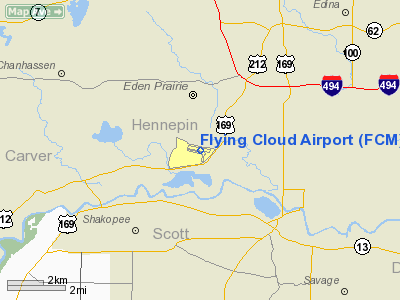
Location & QuickFacts
| FAA Information Effective: | 2008-09-25 |
| Airport Identifier: | FCM |
| Airport Status: | Operational |
| Longitude/Latitude: | 093-27-25.7270W/44-49-38.0680N
-93.457146/44.827241 (Estimated) |
| Elevation: | 906 ft / 276.15 m (Surveyed) |
| Land: | 543 acres |
| From nearest city: | 11 nautical miles SW of Minneapolis, MN |
| Location: | Hennepin County, MN |
| Magnetic Variation: | 03E (1985) |
Owner & Manager
| Ownership: | Publicly owned |
| Owner: | Metropolitan Airport Cmsn |
| Address: | 6040 28th Ave S
Minneapolis, MN 55450 |
| Phone number: | 952-726-8100 |
| Manager: | Joseph Harris
ADDNL PHONE 952-941-3545. |
| Address: | 6040 28th Ave S.
Minneapolis, MN 55450 |
| Phone number: | 763-717-0001 |
Airport Operations and Facilities
| Airport Use: | Open to public |
| Wind indicator: | Yes |
| Segmented Circle: | No |
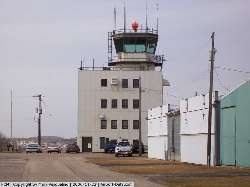
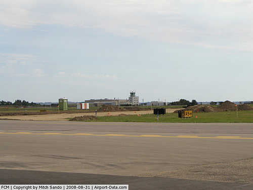
| Control Tower: | Yes |
| Lighting Schedule: | DUSK-DAWN
WHEN ATCT CLSD ACTVT MIRL RY 18/36 & HIRL RY 10R/28L; MALSR RY 10R; REIL RYS, 28L, 18, & 36; VASI RYS 10R, 28L, 18 & 36 - 118.1. MIRL RY 10L/28R ACTVTD ONLY WHEN RY 10R/28L CLSD. |
| Beacon Color: | Clear-Green (lighted land airport) |
| Landing fee charge: | No |
| Sectional chart: | Twin Cities |
| Region: | AGL - Great Lakes |
| Traffic Pattern Alt: | 1000 ft |
| Boundary ARTCC: | ZMP - Minneapolis |
| Tie-in FSS: | PNM - Princeton |
| FSS on Airport: | No |
| FSS Toll Free: | 1-800-WX-BRIEF |
| NOTAMs Facility: | FCM (NOTAM-d service avaliable) |
| Federal Agreements: | NGY |
Airport Communications
| CTAF: | 118.100 |
| Unicom: | 122.950 |
Airport Services
| Fuel available: | 100LLA
SELF SERVE FUEL AVAIL 24 HRS. |
| Airframe Repair: | MAJOR |
| Power Plant Repair: | MAJOR |
| Bottled Oxygen: | HIGH/LOW |
Runway Information
Runway 10L/28R
| Dimension: | 3599 x 75 ft / 1097.0 x 22.9 m |
| Surface: | ASPH, Good Condition |
| Weight Limit: | Single wheel: 12500 lbs. |
| Edge Lights: | Medium |
| |
Runway 10L |
Runway 28R |
| Longitude: | 093-27-50.1070W | 093-27-01.0980W |
| Latitude: | 44-49-46.2310N | 44-49-39.4350N |
| Elevation: | 906.00 ft | 899.00 ft |
| Alignment: | 101 | 127 |
| Traffic Pattern: | Left | Right |
| Markings: | Non-precision instrument, Good Condition | Non-precision instrument, Good Condition |
| Runway End Identifier: | No | No |
| Obstruction: | , 50:1 slope to clear | 17 ft road, 811.0 ft from runway, 35:1 slope to clear |
|
Runway 10R/28L
| Dimension: | 3909 x 75 ft / 1191.5 x 22.9 m |
| Surface: | ASPH, Good Condition |
| Weight Limit: | Single wheel: 30000 lbs. |
| Edge Lights: | High |
| |
Runway 10R |
Runway 28L |
| Longitude: | 093-27-58.0520W | 093-27-04.8190W |
| Latitude: | 44-49-42.2970N | 44-49-34.9220N |
| Elevation: | 905.00 ft | 898.00 ft |
| Alignment: | 101 | 127 |
| ILS Type: | ILS
| |
| Traffic Pattern: | Right | Left |
| Markings: | Precision instrument, Good Condition | Non-precision instrument, Good Condition |
| Crossing Height: | 41.00 ft | 45.00 ft |
| Displaced threshold: | 0.00 ft | 200.00 ft |
| VASI: | 4-box on left side | 4-box on left side |
| Visual Glide Angle: | 3.00° | 3.00° |
| Approach lights: | MALSR | |
| Runway End Identifier: | No | Yes |
| Obstruction: | , 50:1 slope to clear | 20 ft bldg, 220.0 ft from runway, 325 ft left of centerline, 1:1 slope to clear
BLDG +25, 350 FM DSPLCD THLD, 415L, APCH RATIO 14:1 TO DSPLCD THLD.
BLDG +25, 150 FM END, 415L. |
|
Runway 18/36
| Dimension: | 2691 x 75 ft / 820.2 x 22.9 m |
| Surface: | ASPH, Good Condition |
| Weight Limit: | Single wheel: 12500 lbs. |
| Edge Lights: | Medium |
| |
Runway 18 |
Runway 36 |
| Longitude: | 093-27-15.6880W | 093-27-19.5980W |
| Latitude: | 44-49-44.1450N | 44-49-17.7210N |
| Elevation: | 899.00 ft | 905.00 ft |
| Alignment: | 127 | 6 |
| Traffic Pattern: | Left | Left |
| Markings: | Non-precision instrument, Good Condition | Non-precision instrument, Good Condition |
| Crossing Height: | 37.00 ft | 31.00 ft |
| VASI: | 4-box on left side | 4-box on left side |
| Visual Glide Angle: | 3.00° | 3.00° |
| Runway End Identifier: | Yes | Yes |
| Obstruction: | 44 ft tree, 930.0 ft from runway, 170 ft right of centerline, 16:1 slope to clear | 15 ft road, 210.0 ft from runway, 250 ft right of centerline
+ 8 FT FENCE, 100 FT FM RY END, 200 FT R, LGTD. |
|
Radio Navigation Aids
| ID |
Type |
Name |
Ch |
Freq |
Var |
Dist |
| MS | NDB | Narco | | 266.00 | 02E | 15.6 nm |
| PPI | NDB | Hopey | | 400.00 | 03E | 22.1 nm |
| GYL | NDB | Glencoe | | 407.00 | 03E | 27.1 nm |
| HCD | NDB | Hutchinson | | 209.00 | 04E | 39.5 nm |
| OEO | NDB | Osceola | | 233.00 | 01E | 43.7 nm |
| RNH | NDB | New Richmond | | 257.00 | 02E | 43.7 nm |
| CBG | NDB | Cambridge | | 350.00 | 03E | 44.7 nm |
| PNM | NDB | Princeton | | 368.00 | 03E | 44.8 nm |
| ACQ | NDB | Waseca | | 371.00 | 02E | 45.7 nm |
| MSP | VOR/DME | Minneapolis | 100X | 115.30 | 02E | 10.3 nm |
| FOW | VOR/DME | Halfway | 049X | 111.20 | 02E | 37.6 nm |
| MKT | VOR/DME | Mankato | 045X | 110.80 | 07E | 41.4 nm |
| FGT | VORTAC | Farmington | 104X | 115.70 | 06E | 16.6 nm |
| GEP | VORTAC | Gopher | 120X | 117.30 | 06E | 19.5 nm |
| DWN | VORTAC | Darwin | 027X | 109.00 | 07E | 45.2 nm |
| MSP | VOT | Minneapolis St Paul | | 111.00 | | 10.9 nm |
| STP | VOT | St Paul | | 114.40 | | 18.3 nm |
Remarks
- DEER AND WATERFOWL ON AND INVOF ARPT.
- ARPT CLSD TO: JETS NOT MEETING FAR 36, JET TRNG & ACFT WEIGHING MORE THAN 60000 LBS GWT.
- ULTRALIGHT OPNS PROHIBITED.
- MAINTENANCE RUN-UPS ARE PROHIBITED BTN 2200-0700.
- WHEN ATCT CLSD SNOW REMOVAL OPERATORS MONITOR 118.1.
- FOR NOISE ABATEMENT PROCEDURES CALL 612-725-6327. ACFT PLEASE FOLLOW VOLUNTARY NOISE ABATEMENT PROCEDURES AS PUBLISHED & RY 10R/28L IS THE PREFERRED NOISE ABATEMENT RY.
Images and information placed above are from
http://www.airport-data.com/airport/FCM/
We thank them for the data!
| General Info
|
| Country |
United States
|
| State |
MINNESOTA
|
| FAA ID |
FCM
|
| Latitude |
44-49-38.068N
|
| Longitude |
093-27-25.727W
|
| Elevation |
906 feet
|
| Near City |
MINNEAPOLIS
|
We don't guarantee the information is fresh and accurate. The data may
be wrong or outdated.
For more up-to-date information please refer to other sources.
|
|