 |
|
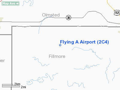
Location & QuickFacts
| FAA Information Effective: | 2008-09-25 |
| Airport Identifier: | 2C4 |
| Airport Status: | Operational |
| Longitude/Latitude: | 092-20-12.7000W/43-49-00.2000N
-92.336861/43.816722 (Estimated) |
| Elevation: | 1300 ft / 396.24 m (Estimated) |
| Land: | 15 acres |
| From nearest city: | 8 nautical miles W of Chatfield, MN |
| Location: | Fillmore County, MN |
| Magnetic Variation: | 02E (1985) |
Owner & Manager
| Ownership: | Privately owned |
| Owner: | Wes Anderson |
| Address: | 31957 Co. Rd. 38
Chatfield, MN 55923 |
| Phone number: | 507-867-4075 |
| Manager: | Wes Anderson |
| Address: | 31957 Co. Rd. 38
Chatfield, MN 55923 |
| Phone number: | 507-273-2123 |
Airport Operations and Facilities
| Airport Use: | Open to public |
| Wind indicator: | Yes |
| Segmented Circle: | No |
| Control Tower: | No |
| Landing fee charge: | No |
| Sectional chart: | Chicago |
| Region: | AGL - Great Lakes |
| Boundary ARTCC: | ZMP - Minneapolis |
| Tie-in FSS: | PNM - Princeton |
| FSS on Airport: | No |
| FSS Toll Free: | 1-800-WX-BRIEF |
| NOTAMs Facility: | PNM (NOTAM-d service avaliable) |
Airport Communications
Airport Services
Runway Information
Runway 09/27
| Dimension: | 3000 x 150 ft / 914.4 x 45.7 m |
| Surface: | TURF, Good Condition |
| |
Runway 09 |
Runway 27 |
| Longitude: | 092-20-33.1100W | 092-19-52.1900W |
| Latitude: | 43-49-00.3800N | 43-49-00.0100N |
| Traffic Pattern: | Left | Left |
| Obstruction: | , 50:1 slope to clear | 15 ft road, 375.0 ft from runway, 25:1 slope to clear |
|
Radio Navigation Aids
| ID |
Type |
Name |
Ch |
Freq |
Var |
Dist |
| CJJ | NDB | Cresco | | 293.00 | 02E | 28.5 nm |
| CHU | NDB | Caledonia | | 209.00 | 03E | 39.3 nm |
| DEH | NDB | Decorah | | 236.00 | 01E | 41.7 nm |
| IY | NDB | Chukk | | 417.00 | 03E | 44.4 nm |
| CCY | NDB | Charles City | | 375.00 | 03E | 46.5 nm |
| RST | VOR/DME | Rochester | 057X | 112.00 | 05E | 11.5 nm |
| JAY | VOR/DME | Austin | 019X | 108.20 | 03E | 29.2 nm |
| ONA | VOR/DME | Winona | 051X | 111.40 | 01E | 31.5 nm |
| AEL | VOR/DME | Albert Lea | 035X | 109.80 | 05E | 45.6 nm |
| LSE | VOR/DME | La Crosse | 021X | 108.40 | 02E | 47.0 nm |
| ODI | VORTAC | Nodine | 126X | 117.90 | 01E | 38.1 nm |
| UKN | VORTAC | Waukon | 113X | 116.60 | 05E | 47.5 nm |
Remarks
- ULTRALIGHT TRAFFIC ON & INVOF ARPT.
- ARPT CLSD INDEFLY.
Images and information placed above are from
http://www.airport-data.com/airport/2C4/
We thank them for the data!
| General Info
|
| Country |
United States
|
| State |
MINNESOTA
|
| FAA ID |
2C4
|
| Latitude |
43-49-10.868N
|
| Longitude |
092-20-00.603W
|
| Elevation |
1300 feet
|
| Near City |
CHATFIELD
|
We don't guarantee the information is fresh and accurate. The data may
be wrong or outdated.
For more up-to-date information please refer to other sources.
|
|


