 |
|
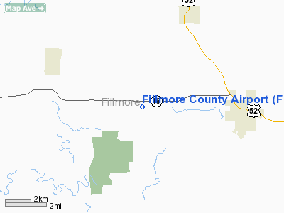
Location & QuickFacts
| FAA Information Effective: | 2008-09-25 |
| Airport Identifier: | FKA |
| Airport Status: | Operational |
| Longitude/Latitude: | 092-10-47.0440W/43-40-36.3360N
-92.179734/43.676760 (Estimated) |
| Elevation: | 1276 ft / 388.92 m (Surveyed) |
| Land: | 90 acres |
| From nearest city: | 4 nautical miles W of Preston, MN |
| Location: | Fillmore County, MN |
| Magnetic Variation: | 01E (2000) |
Owner & Manager
| Ownership: | Publicly owned |
| Owner: | County Of Fillmore |
| Address: | Courthouse
Preston, MN 55965 |
| Phone number: | 507-765-4566 |
| Manager: | Larry Tammel |
| Address: | Rt 2 Box 195
Preston, MN 55965 |
| Phone number: | 507-937-3000 |
Airport Operations and Facilities
| Airport Use: | Open to public |
| Wind indicator: | Yes |
| Segmented Circle: | No |
| Control Tower: | No |
| Lighting Schedule: | DUSK-DAWN
ACTVT MIRL RY 11/29; VASI RYS 11 & 29 - CTAF. |
| Beacon Color: | Clear-Green (lighted land airport) |
| Landing fee charge: | No |
| Sectional chart: | Chicago |
| Region: | AGL - Great Lakes |
| Boundary ARTCC: | ZMP - Minneapolis |
| Tie-in FSS: | PNM - Princeton |
| FSS on Airport: | No |
| FSS Toll Free: | 1-800-WX-BRIEF |
| NOTAMs Facility: | FKA (NOTAM-d service avaliable) |
| Federal Agreements: | NGY |
Airport Communications
Airport Services
| Airframe Repair: | NONE |
| Power Plant Repair: | NONE |
| Bottled Oxygen: | NONE |
| Bulk Oxygen: | NONE |
Runway Information
Runway 11/29
| Dimension: | 4000 x 75 ft / 1219.2 x 22.9 m |
| Surface: | ASPH, Good Condition |
| Edge Lights: | Medium |
| |
Runway 11 |
Runway 29 |
| Longitude: | 092-11-13.5870W | 092-10-21.5860W |
| Latitude: | 43-40-41.8710N | 43-40-29.8710N |
| Elevation: | 1274.00 ft | 1276.00 ft |
| Alignment: | 108 | 127 |
| Traffic Pattern: | Left | Left |
| Markings: | Non-precision instrument, Fair Condition | Non-precision instrument, Fair Condition |
| Crossing Height: | 25.00 ft | 25.00 ft |
| VASI: | 2-box on left side | 2-box on left side |
| Visual Glide Angle: | 3.00° | 3.00° |
| Obstruction: | 48 ft trees, 2000.0 ft from runway, 37:1 slope to clear | 17 ft road, 760.0 ft from runway, 32:1 slope to clear |
|
Radio Navigation Aids
| ID |
Type |
Name |
Ch |
Freq |
Var |
Dist |
| CJJ | NDB | Cresco | | 293.00 | 02E | 18.8 nm |
| CHU | NDB | Caledonia | | 209.00 | 03E | 30.5 nm |
| DEH | NDB | Decorah | | 236.00 | 01E | 30.9 nm |
| IY | NDB | Chukk | | 417.00 | 03E | 40.5 nm |
| CCY | NDB | Charles City | | 375.00 | 03E | 41.1 nm |
| XWY | NDB | West Union | | 278.00 | 02E | 47.4 nm |
| RST | VOR/DME | Rochester | 057X | 112.00 | 05E | 19.2 nm |
| ONA | VOR/DME | Winona | 051X | 111.40 | 01E | 31.6 nm |
| JAY | VOR/DME | Austin | 019X | 108.20 | 03E | 32.8 nm |
| LSE | VOR/DME | La Crosse | 021X | 108.40 | 02E | 41.8 nm |
| ODI | VORTAC | Nodine | 126X | 117.90 | 01E | 34.0 nm |
| UKN | VORTAC | Waukon | 113X | 116.60 | 05E | 36.8 nm |
Remarks
- ULTRALIGHTS ON & INVOF ARPT.
Images and information placed above are from
http://www.airport-data.com/airport/FKA/
We thank them for the data!
| General Info
|
| Country |
United States
|
| State |
MINNESOTA
|
| FAA ID |
FKA
|
| Latitude |
43-40-36.336N
|
| Longitude |
092-10-47.044W
|
| Elevation |
1276 feet
|
| Near City |
PRESTON
|
We don't guarantee the information is fresh and accurate. The data may
be wrong or outdated.
For more up-to-date information please refer to other sources.
|
|


