 |
|
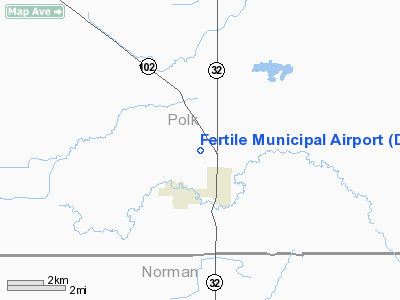
Fertile Municipal Airport |
Location & QuickFacts
| FAA Information Effective: | 2008-09-25 |
| Airport Identifier: | D14 |
| Airport Status: | Operational |
| Longitude/Latitude: | 096-17-31.2000W/47-33-06.8800N
-96.292000/47.551911 (Estimated) |
| Elevation: | 1135 ft / 345.95 m (Surveyed) |
| Land: | 130 acres |
| From nearest city: | 1 nautical miles NW of Fertile, MN |
| Location: | Polk County, MN |
| Magnetic Variation: | 05E (1985) |
Owner & Manager
| Ownership: | Publicly owned |
| Owner: | City Of Fertile |
| Address: | Po Box 628
Fertile, MN 56540 |
| Phone number: | 218-945-3136 |
| Manager: | Sharon Edlund |
| Address: | Po Box 628
Fertile, MN 56540 |
| Phone number: | 218-945-3136
PHONE AT ARPT 218-945-6516 |
Airport Operations and Facilities
| Airport Use: | Open to public |
| Wind indicator: | Yes |
| Segmented Circle: | No |
| Control Tower: | No |
| Lighting Schedule: | DUSK-DAWN
ACTVT LIRL RY 14/32; VASI RYS 14 & 32 - CTAF. |
| Beacon Color: | Clear-Green (lighted land airport) |
| Landing fee charge: | No |
| Sectional chart: | Twin Cities |
| Region: | AGL - Great Lakes |
| Traffic Pattern Alt: | 1000 ft |
| Boundary ARTCC: | ZMP - Minneapolis |
| Tie-in FSS: | PNM - Princeton |
| FSS on Airport: | No |
| FSS Toll Free: | 1-800-WX-BRIEF |
| NOTAMs Facility: | PNM (NOTAM-d service avaliable) |
Airport Communications
| CTAF: | 122.800 |
| Unicom: | 122.800 |
Airport Services
| Bottled Oxygen: | NONE |
| Bulk Oxygen: | NONE |
Runway Information
Runway 14/32
| Dimension: | 3002 x 60 ft / 915.0 x 18.3 m |
| Surface: | ASPH, Fair Condition |
| Edge Lights: | Low |
| |
Runway 14 |
Runway 32 |
| Longitude: | 096-17-44.1400W | 096-17-18.2600W |
| Latitude: | 47-33-18.8300N | 47-32-54.9300N |
| Elevation: | 1128.00 ft | 1135.00 ft |
| Alignment: | 127 | 127 |
| Traffic Pattern: | Left | Left |
| Markings: | Basic, Fair Condition
RY 14/32 MARKINGS FADED. | Basic, Fair Condition |
| VASI: | 2-box SAVASI on left side | 2-box SAVASI on left side |
| Obstruction: | , 50:1 slope to clear | 60 ft trees, 1700.0 ft from runway, 250 ft right of centerline, 25:1 slope to clear |
|
Radio Navigation Aids
| ID |
Type |
Name |
Ch |
Freq |
Var |
Dist |
| FSE | NDB | Fosston | | 224.00 | 05E | 21.3 nm |
| CKN | NDB | Crookston | | 400.00 | 07E | 21.7 nm |
| AA | NDB | Kenie | | 365.00 | 06E | 39.0 nm |
| TVF | VOR/DME | Thief River Falls | 021X | 108.40 | 08E | 31.4 nm |
| GFK | VOR/DME | Grand Forks | 090X | 114.30 | 09E | 43.5 nm |
| DTL | VOR/DME | Detroit Lakes | 049X | 111.20 | 05E | 46.7 nm |
Remarks
- BE ALERT FOR VEHICLE TRAFFIC ON TAXIWAYS.
- PRVDD OBSTNS IN RWY APCH SLOPE SFCS WHICH CANNOT BE RMVD/LWRD, THE RWY THRS ARE DSPLCD/MRKD TO PRVD MIN 20:1 APCH CLRNC OVER OBSTNS & SUFFICIENT RMNG LENGTH TO PERMIT SAFE LNDG/TKOF BY TYPE OF ACFT USING RWY.
Images and information placed above are from
http://www.airport-data.com/airport/D14/
We thank them for the data!
| General Info
|
| Country |
United States
|
| State |
MINNESOTA
|
| FAA ID |
D14
|
| Latitude |
47-32-50.875N
|
| Longitude |
096-17-15.198W
|
| Elevation |
1136 feet
|
| Near City |
FERTILE
|
We don't guarantee the information is fresh and accurate. The data may
be wrong or outdated.
For more up-to-date information please refer to other sources.
|
|


