 |
|
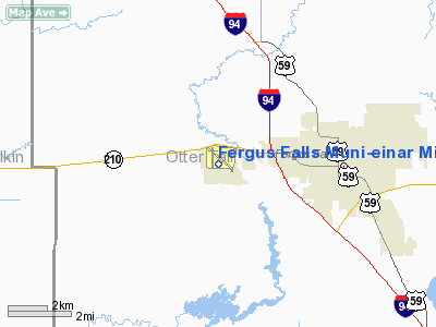
Fergus Falls Muni-einar Mickelson Fld Airport |
Fergus Falls Municipal Airport
Einar Mickelson Field |
| IATA: FFM – ICAO: KFFM |
| Summary |
| Airport type |
Public |
| Operator |
City of Fergus Falls |
| Location |
Fergus Falls, Minnesota |
| Elevation AMSL |
1,182 ft / 360.3 m |
| Coordinates |
46°17′04″N 96°09′24″W / 46.28444°N 96.15667°W / 46.28444; -96.15667Coordinates: 46°17′04″N 96°09′24″W / 46.28444°N 96.15667°W / 46.28444; -96.15667 |
| Runways |
| Direction |
Length |
Surface |
| ft |
m |
| 13/31 |
5,639 |
1,719 |
Asphalt |
| 17/35 |
3,301 |
1,006 |
Asphalt |
Fergus Falls Municipal Airport (IATA: FFM, ICAO: KFFM, FAA LID: FFM), also known as Einar Mickelson Field, is a public airport located three miles (5 km) west of the central business district (CBD) of Fergus Falls, a city in Otter Tail County, Minnesota, USA. The airport covers 731 acres (296 ha) and has two runways. It is primarily used for general aviation. The airport was formerly served by Northwest Airlink and United Express.
Cargo
- Bemidji Airlines (Minneapolis/St. Paul)
The above content comes from Wikipedia and is published under free licenses – click here to read more.
Location & QuickFacts
| FAA Information Effective: | 2008-09-25 |
| Airport Identifier: | FFM |
| Airport Status: | Operational |
| Longitude/Latitude: | 096-09-24.1000W/46-17-03.8000N
-96.156694/46.284389 (Estimated) |
| Elevation: | 1183 ft / 360.58 m (Surveyed) |
| Land: | 731 acres |
| From nearest city: | 3 nautical miles W of Fergus Falls, MN |
| Location: | Otter Tail County, MN |
| Magnetic Variation: | 05E (1995) |
Owner & Manager
| Ownership: | Publicly owned |
| Owner: | City Of Fergus Falls |
| Address: | 112 W Washington, Po Box 868
Fergus Falls, MN 56537 |
| Phone number: | 218-739-2251 |
| Manager: | Dennis Fuhrman |
| Address: | 4005 Hwy 210 W
Fergus Falls, MN 56537 |
| Phone number: | 218-739-3733 |
Airport Operations and Facilities
| Airport Use: | Open to public |
| Wind indicator: | Yes |
| Segmented Circle: | No |
| Control Tower: | No |
| Lighting Schedule: | DUSK-DAWN
ACTVT MIRL RY 13/31 & 17/35; MALSR & PAPI RY 31; REIL RY 35; REIL & PAPI RY 13 - CTAF - CTAF. |
| Beacon Color: | Clear-Green (lighted land airport) |
| Landing fee charge: | No |
| Sectional chart: | Twin Cities |
| Region: | AGL - Great Lakes |
| Boundary ARTCC: | ZMP - Minneapolis |
| Tie-in FSS: | PNM - Princeton |
| FSS on Airport: | No |
| FSS Toll Free: | 1-800-WX-BRIEF |
| NOTAMs Facility: | FFM (NOTAM-d service avaliable) |
| Federal Agreements: | NGY |
Airport Communications
| CTAF: | 122.800 |
| Unicom: | 122.800 |
Airport Services
| Fuel available: | 100LLA MOGAS |
| Airframe Repair: | MINOR |
| Power Plant Repair: | MINOR |
| Bottled Oxygen: | NONE |
| Bulk Oxygen: | NONE |
Runway Information
Runway 13/31
| Dimension: | 5639 x 100 ft / 1718.8 x 30.5 m |
| Surface: | ASPH, Good Condition |
| Weight Limit: | Single wheel: 60000 lbs.
Dual wheel: 90000 lbs. |
| Edge Lights: | Medium |
| |
Runway 13 |
Runway 31 |
| Longitude: | 096-09-44.1535W | 096-08-45.6431W |
| Latitude: | 46-17-21.4377N | 46-16-43.3281N |
| Elevation: | 1182.00 ft | 1176.00 ft |
| Alignment: | 127 | 127 |
| ILS Type: | | ILS
|
| Traffic Pattern: | Left | Left |
| Markings: | Precision instrument, Good Condition | Precision instrument, Good Condition |
| VASI: | 4-light PAPI on left side
PAPI OTS INDEFLY. | 4-light PAPI on left side
PAPI NOT COINCIDENT WITH RWY 31 ILS GLIDE SLOPE. |
| Approach lights: | | MALSR |
| Runway End Identifier: | Yes | |
| Obstruction: | 29 ft pline, 1400.0 ft from runway, 200 ft right of centerline, 41:1 slope to clear | , 50:1 slope to clear |
|
Runway 17/35
| Dimension: | 3301 x 75 ft / 1006.1 x 22.9 m |
| Surface: | ASPH, Good Condition |
| Weight Limit: | Single wheel: 16000 lbs.
Dual wheel: 22000 lbs. |
| Edge Lights: | Medium |
| |
Runway 17 |
Runway 35 |
| Longitude: | 096-09-40.0754W | 096-09-39.4594W |
| Latitude: | 46-17-22.5625N | 46-16-49.9849N |
| Elevation: | 1182.00 ft | 1157.00 ft |
| Alignment: | 127 | 127 |
| Traffic Pattern: | Left | Left |
| Markings: | Non-precision instrument, Good Condition | Non-precision instrument, Good Condition |
| Runway End Identifier: | No | Yes |
| Obstruction: | 67 ft trees, 2400.0 ft from runway, 32:1 slope to clear | 20 ft trees, 700.0 ft from runway, 165 ft right of centerline, 25:1 slope to clear
RWY 35 +10 TREE; 50 FT FROM RWY END; 190 FT L. |
|
Radio Navigation Aids
| ID |
Type |
Name |
Ch |
Freq |
Var |
Dist |
| BWP | NDB | Breckenridge-wahpeton | | 233.00 | 05E | 18.7 nm |
| ETH | NDB | Wheaton | | 326.00 | 05E | 34.2 nm |
| EE | NDB | Tamie | | 374.00 | 04E | 46.2 nm |
| FFM | VOR/DME | Fergus Falls | 041X | 110.40 | 05E | 0.3 nm |
| DTL | VOR/DME | Detroit Lakes | 049X | 111.20 | 05E | 34.4 nm |
| AXN | VOR/DME | Alexandria | 075X | 112.80 | 07E | 43.2 nm |
| MOX | VOR/DME | Morris | 033X | 109.60 | 05E | 43.9 nm |
| FAR | VORTAC | Fargo | 109X | 116.20 | 09E | 40.3 nm |
Remarks
- DEER AND WATERFOWL ON AND INVOF ARPT.
- ULTRALIGHTS ON & INVOF ARPT. ULTRALIGHT PATTERN 1800 MSL.
Images and information placed above are from
http://www.airport-data.com/airport/FFM/
We thank them for the data!
| General Info
|
| Country |
United States
|
| State |
MINNESOTA
|
| FAA ID |
FFM
|
| Latitude |
46-17-03.818N
|
| Longitude |
096-09-24.068W
|
| Elevation |
1182 feet
|
| Near City |
FERGUS FALLS
|
We don't guarantee the information is fresh and accurate. The data may
be wrong or outdated.
For more up-to-date information please refer to other sources.
|
|


