 |
|
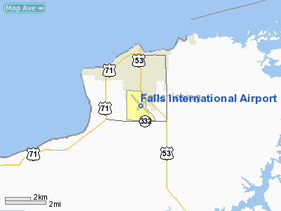
Falls International Airport |
| Falls International Airport |
 |
| IATA: INL – ICAO: KINL |
| Summary |
| Airport type |
Public |
| Operator |
City of International Falls |
| Location |
International Falls, Minnesota |
| Elevation AMSL |
1,185 ft / 361.2 m |
| Coordinates |
48°33′58″N 93°24′11″W / 48.56611°N 93.40306°W / 48.56611; -93.40306Coordinates: 48°33′58″N 93°24′11″W / 48.56611°N 93.40306°W / 48.56611; -93.40306 |
| Runways |
| Direction |
Length |
Surface |
| ft |
m |
| 13/31 |
7,400 |
2,256 |
Asphalt |
| 4/22 |
2,999 |
914 |
Asphalt |
Falls International Airport (IATA: INL, ICAO: KINL) is a public airport located just south of the city of International Falls in Koochiching County, Minnesota, USA. The airport covers 681 acres (276 ha) and has two runways. It is mostly used for general aviation but is also served by one commercial airline.
Airlines and destinations
| Airlines |
Destinations |
| Delta Connection operated by Mesaba Airlines |
Minneapolis/St. Paul |
The above content comes from Wikipedia and is published under free licenses – click here to read more.
Location & QuickFacts
| FAA Information Effective: | 2008-09-25 |
| Airport Identifier: | INL |
| Airport Status: | Operational |
| Longitude/Latitude: | 093-24-07.8000W/48-33-56.1000N
-93.402167/48.565583 (Estimated) |
| Elevation: | 1185 ft / 361.19 m (Surveyed) |
| Land: | 681 acres |
| From nearest city: | 0 nautical miles S of International Falls, MN |
| Location: | Koochiching County, MN |
| Magnetic Variation: | 03E (1985) |
Owner & Manager
| Ownership: | Publicly owned |
| Owner: | City Of Intl Falls |
| Address: | Box 392
International Falls, MN 56649 |
| Phone number: | 218-283-4461 |
| Manager: | Thor Einarson |
| Address: | 3214 2 Nd Ave E
International Falls, MN 56649 |
| Phone number: | 218-283-4461 |
Airport Operations and Facilities
| Airport Use: | Open to public |
| Wind indicator: | Yes |
| Segmented Circle: | No |
| Control Tower: | No |
| Lighting Schedule: | DUSK-DAWN
ACTVT HIRL RY 13/31; MALSR RYS 13 & 31; PAPI RYS 13 & 31 - CTAF. |
| Beacon Color: | Clear-Green (lighted land airport) |
| Landing fee charge: | No |
| Sectional chart: | Twin Cities |
| Region: | AGL - Great Lakes |
| Traffic Pattern Alt: | 1000 ft |
| Boundary ARTCC: | ZMP - Minneapolis |
| Tie-in FSS: | PNM - Princeton |
| FSS on Airport: | No |
| FSS Toll Free: | 1-800-WX-BRIEF |
| NOTAMs Facility: | INL (NOTAM-d service avaliable) |
| Certification type/date: | I A S 05/1973
PPR FOR UNSKED ACR OPNS WITH MORE THAN 30 PSGR SEATS; CALL AMGR OR OPNS 218-283-4461. ACR OPNS INVOLVING ACFT WITH MORE THAN 30 PSGRS ARE NOT AUZD IN EXCESS OF 15 MINS BEFORE OR AFTER SKEDD ARR/DEP TIMES WITHOUT PRIOR COORDINATION WITH AMGR AND CFMN THAT ARFF IS AVBL PRIOR TO LANDING OR TAKEOFF. |
| Federal Agreements: | NGY3 |
Airport Communications
| CTAF: | 122.800 |
| Unicom: | 122.800 |
Airport Services
| Fuel available: | 100LLA |
| Bottled Oxygen: | NONE |
| Bulk Oxygen: | NONE |
Runway Information
Runway 04/22
| Dimension: | 2999 x 75 ft / 914.1 x 22.9 m |
| Surface: | ASPH, Fair Condition |
| Weight Limit: | Single wheel: 12500 lbs. |
| |
Runway 04 |
Runway 22 |
| Longitude: | 093-24-24.1330W | 093-23-54.3510W |
| Latitude: | 48-33-45.3230N | 48-34-07.3460N |
| Elevation: | 1170.00 ft | 1181.00 ft |
| Alignment: | 42 | 127 |
| Traffic Pattern: | Left | Left |
| Markings: | Basic, Fair Condition | Basic, Fair Condition |
| Obstruction: | 65 ft trees, 1250.0 ft from runway, 50 ft left of centerline, 16:1 slope to clear | 25 ft trees, 700.0 ft from runway, 50 ft right of centerline, 20:1 slope to clear |
|
Runway 13/31
| Dimension: | 7400 x 150 ft / 2255.5 x 45.7 m |
| Surface: | ASPH, Good Condition |
| Surface Treatment: | Porous Friction Course |
| Weight Limit: | Single wheel: 100000 lbs.
Dual wheel: 125000 lbs.
Dual tandem wheel: 190000 lbs. |
| Edge Lights: | High |
| |
Runway 13 |
Runway 31 |
| Longitude: | 093-24-45.5580W | 093-23-29.0090W |
| Latitude: | 48-34-22.2450N | 48-33-29.8060N |
| Elevation: | 1184.00 ft | 1166.00 ft |
| Alignment: | 127 | 127 |
| ILS Type: | ILS
| ILS
|
| Traffic Pattern: | Left | Left |
| Markings: | Precision instrument, Good Condition | Precision instrument, Good Condition |
| Crossing Height: | 52.00 ft | 45.00 ft |
| VASI: | 4-light PAPI on left side | 4-light PAPI on left side |
| Visual Glide Angle: | 0.00° | 3.00° |
| Approach lights: | MALSR | MALSR |
| Runway End Identifier: | No | |
| Obstruction: | 43 ft trees, 2300.0 ft from runway, 100 ft left of centerline, 48:1 slope to clear | , 50:1 slope to clear |
|
Radio Navigation Aids
| ID |
Type |
Name |
Ch |
Freq |
Var |
Dist |
| IN | NDB | Raize | | 353.00 | 06E | 7.1 nm |
| YAG | NDB | Fort Frances | | 376.00 | 02E | 9.2 nm |
| ORB | NDB | Orr | | 341.00 | 02E | 39.4 nm |
| SCG | NDB | Scott | | 385.00 | 02E | 41.3 nm |
| FOZ | NDB | Bigfork | | 345.00 | 02E | 48.1 nm |
| BDE | VOR/DME | Baudette | 053X | 111.60 | 04E | 48.8 nm |
| INL | VORTAC | International Falls | 047X | 111.00 | 06E | 0.1 nm |
Remarks
- GULLS & DEER ON & INVOF ARPT.
- RY 04/22 CLSD WINTER MONTHS. AVBL PPR FOR SKI EQUIPPED ACFT.
- RY 04/22 NOT AVBL FOR ACR WITH MORE THAN 9 PASSENGER SEATS.
- TWYS A1, A2, A3, & A4 CLSD WINTER MONTHS.
Images and information placed above are from
http://www.airport-data.com/airport/INL/
We thank them for the data!
| General Info
|
| Country |
United States
|
| State |
MINNESOTA
|
| FAA ID |
INL
|
| Latitude |
48-33-58.274N
|
| Longitude |
093-24-11.040W
|
| Elevation |
1185 feet
|
| Near City |
INTERNATIONAL FALLS
|
We don't guarantee the information is fresh and accurate. The data may
be wrong or outdated.
For more up-to-date information please refer to other sources.
|
|


