 |
|
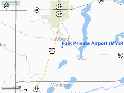
Location & QuickFacts
| FAA Information Effective: | 2008-09-25 |
| Airport Identifier: | MY24 |
| Airport Status: | Operational |
| Longitude/Latitude: | 095-03-08.0770W/46-51-43.8520N
-95.052244/46.862181 (Estimated) |
| Elevation: | 1443 ft / 439.83 m (Estimated) |
| Land: | 0 acres |
| From nearest city: | 3 nautical miles SE of Park Rapids, MN |
| Location: | Hubbard County, MN |
| Magnetic Variation: | 04E (1985) |
Owner & Manager
| Ownership: | Privately owned |
| Owner: | Ronald L. Falk |
| Address: | Rt 4, Box 25
Park Rapids, MN 56470 |
| Phone number: | 218-732-8830 |
| Manager: | Ronald L. Falk |
| Address: | Rt 4, Box 25
Park Rapids, MN 56470 |
| Phone number: | 218-732-8830 |
Airport Operations and Facilities
| Airport Use: | Private |
| Wind indicator: | Yes |
| Segmented Circle: | No |
| Control Tower: | No |
| Landing fee charge: | No |
| Sectional chart: | Twin Cities |
| Region: | AGL - Great Lakes |
| Boundary ARTCC: | ZMP - Minneapolis |
| Tie-in FSS: | PNM - Princeton |
| FSS on Airport: | No |
| FSS Toll Free: | 1-800-WX-BRIEF |
Runway Information
Runway 09/27
| Dimension: | 2300 x 150 ft / 701.0 x 45.7 m |
| Surface: | TURF, |
| |
Runway 09 |
Runway 27 |
| Traffic Pattern: | Right | Left |
|
Radio Navigation Aids
| ID |
Type |
Name |
Ch |
Freq |
Var |
Dist |
| PK | NDB | Spida | | 269.00 | 04E | 3.6 nm |
| PWC | NDB | Pine River | | 330.00 | 03E | 28.7 nm |
| SAZ | NDB | Staples | | 257.00 | 04E | 30.6 nm |
| XVG | NDB | Longville | | 392.00 | 04E | 35.6 nm |
| PKD | VOR/DME | Park Rapids | 043X | 110.60 | 04E | 2.3 nm |
| DTL | VOR/DME | Detroit Lakes | 049X | 111.20 | 05E | 34.4 nm |
| BJI | VORTAC | Bemidji | 023X | 108.60 | 04E | 42.9 nm |
Remarks
- ALL OPERATIONS AT THE FALK ARPT ARE CONDUCTED IN VFR CONDITIONS ONLY AND TRAFFIC PATTERN OPERATIONS ARE CONDUCTED TO THE SOUTH OF THE EAST/WEST RUNWAY.
Images and information placed above are from
http://www.airport-data.com/airport/MY24/
We thank them for the data!
| General Info
|
| Country |
United States
|
| State |
MINNESOTA
|
| FAA ID |
MY24
|
| Latitude |
46-51-43.852N
|
| Longitude |
095-03-08.077W
|
| Elevation |
1443 feet
|
| Near City |
PARK RAPIDS
|
We don't guarantee the information is fresh and accurate. The data may
be wrong or outdated.
For more up-to-date information please refer to other sources.
|
|


