 |
|
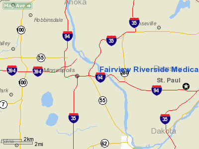
Fairview Riverside Medical Center Heliport |
Location & QuickFacts
| FAA Information Effective: | 2008-09-25 |
| Airport Identifier: | 9MN4 |
| Airport Status: | Operational |
| Longitude/Latitude: | 093-14-14.8060W/44-58-01.3750N
-93.237446/44.967049 (Estimated) |
| Elevation: | 987 ft / 300.84 m (Estimated) |
| Land: | 0 acres |
| From nearest city: | 1 nautical miles N of Minneapolis, MN |
| Location: | Hennepin County, MN |
| Magnetic Variation: | 03E (1995) |
Owner & Manager
| Ownership: | Privately owned |
| Owner: | Fairview Riverside Med Center |
| Address: | 2450 Riverside Ave S
Minneapolis, MN 55454-1400 |
| Phone number: | 612-672-6946 |
| Manager: | Hospital Administrator |
| Address: | 2450 Riverside Ave S
Minneapolis, MN 55454 |
| Phone number: | 612-672-6946 |
Airport Operations and Facilities
| Airport Use: | Private
MEDICAL USE. |
| Segmented Circle: | No |
| Control Tower: | No |
| Lighting Schedule: | DUSK-DAWN
FOR PERIMETER LGTS CALL (612) 672-6946. |
| Beacon Color: | Clear-Green-Yellow (heliport) |
| Sectional chart: | Twin Cities |
| Region: | AGL - Great Lakes |
| Boundary ARTCC: | ZMP - Minneapolis |
| Tie-in FSS: | PNM - Princeton |
| FSS on Airport: | No |
| FSS Toll Free: | 1-800-WX-BRIEF |
Runway Information
Helipad H1
| Dimension: | 45 x 45 ft / 13.7 x 13.7 m |
| Surface: | ASPH,
ROOFTOP |
| |
Runway H1 |
Runway |
| Traffic Pattern: | Left | Left |
|
Radio Navigation Aids
| ID |
Type |
Name |
Ch |
Freq |
Var |
Dist |
| MS | NDB | Narco | | 266.00 | 02E | 10.5 nm |
| PPI | NDB | Hopey | | 400.00 | 03E | 13.8 nm |
| OEO | NDB | Osceola | | 233.00 | 01E | 31.1 nm |
| RNH | NDB | New Richmond | | 257.00 | 02E | 31.8 nm |
| CBG | NDB | Cambridge | | 350.00 | 03E | 35.5 nm |
| GYL | NDB | Glencoe | | 407.00 | 03E | 38.2 nm |
| PNM | NDB | Princeton | | 368.00 | 03E | 39.2 nm |
| AHH | NDB | Ameron | | 278.00 | 01E | 41.3 nm |
| ROS | NDB | Rush City | | 282.00 | 02E | 45.5 nm |
| HCD | NDB | Hutchinson | | 209.00 | 04E | 49.2 nm |
| MSP | VOR/DME | Minneapolis | 100X | 115.30 | 02E | 4.2 nm |
| FCM | VOR/DME | Flying Cloud | 055X | 111.80 | 06E | 12.6 nm |
| FOW | VOR/DME | Halfway | 049X | 111.20 | 02E | 46.2 nm |
| STC | VOR/DME | St Cloud | 058X | 112.10 | 03E | 49.3 nm |
| GEP | VORTAC | Gopher | 120X | 117.30 | 06E | 12.2 nm |
| FGT | VORTAC | Farmington | 104X | 115.70 | 06E | 20.3 nm |
| MSP | VOT | Minneapolis St Paul | | 111.00 | | 5.1 nm |
| STP | VOT | St Paul | | 114.40 | | 7.7 nm |
Remarks
- APP/DEP FM 115-020; PRIOR TO ENTERING CALSS B AIRSPACE CTC MINNEAPOLIS APCH CTL; AREA MKD; KEPT CLEAR; MAINTAIN RADIO CTC WITH HOSP; WIND INDICATOR.
Images and information placed above are from
http://www.airport-data.com/airport/9MN4/
We thank them for the data!
| General Info
|
| Country |
United States
|
| State |
MINNESOTA
|
| FAA ID |
9MN4
|
| Latitude |
44-58-01.375N
|
| Longitude |
093-14-14.806W
|
| Elevation |
987 feet
|
| Near City |
MINNEAPOLIS
|
We don't guarantee the information is fresh and accurate. The data may
be wrong or outdated.
For more up-to-date information please refer to other sources.
|
|


