 |
|
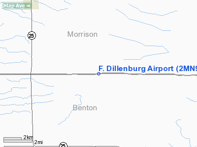
Location & QuickFacts
| FAA Information Effective: | 2008-09-25 |
| Airport Identifier: | 2MN9 |
| Airport Status: | Operational |
| Longitude/Latitude: | 093-59-42.9430W/45-49-27.8780N
-93.995262/45.824411 (Estimated) |
| Elevation: | 1295 ft / 394.72 m (Estimated) |
| Land: | 0 acres |
| From nearest city: | 10 nautical miles NW of Foley, MN |
| Location: | Morrison County, MN |
| Magnetic Variation: | 04E (1985) |
Owner & Manager
| Ownership: | Privately owned |
| Owner: | Francis P. Dillenburg |
| Address: | Rr 3
Foley, MN 56329 |
| Phone number: | 612-355-2475 |
| Manager: | Francis P. Dillenburg |
| Address: | Rr 3
Foley, MN 56329 |
| Phone number: | 612-355-2475 |
Airport Operations and Facilities
| Airport Use: | Private |
| Wind indicator: | Yes |
| Segmented Circle: | No |
| Control Tower: | No |
| Landing fee charge: | No |
| Sectional chart: | Twin Cities |
| Region: | AGL - Great Lakes |
| Boundary ARTCC: | ZMP - Minneapolis |
| Tie-in FSS: | PNM - Princeton |
| FSS on Airport: | No |
| FSS Toll Free: | 1-800-WX-BRIEF |
Runway Information
Runway 09/27
| Dimension: | 2000 x 65 ft / 609.6 x 19.8 m |
| Surface: | TURF, |
| |
Runway 09 |
Runway 27 |
| Traffic Pattern: | Left | Left |
|
Radio Navigation Aids
| ID |
Type |
Name |
Ch |
Freq |
Var |
Dist |
| LXL | NDB | Little Falls | | 359.00 | 03E | 16.3 nm |
| XCR | NDB | Ripley | | 404.00 | 03E | 21.1 nm |
| PNM | NDB | Princeton | | 368.00 | 03E | 22.6 nm |
| JMR | NDB | Mora | | 327.00 | 03E | 30.7 nm |
| CBG | NDB | Cambridge | | 350.00 | 03E | 34.7 nm |
| ROS | NDB | Rush City | | 282.00 | 02E | 44.3 nm |
| AIT | NDB | Aitkin | | 397.00 | 03E | 45.5 nm |
| SAZ | NDB | Staples | | 257.00 | 04E | 47.6 nm |
| RYM | TACAN | Camp Ripley | 048X | | 03E | 22.0 nm |
| STC | VOR/DME | St Cloud | 058X | 112.10 | 03E | 16.7 nm |
| BRD | VORTAC | Brainerd | 116X | 116.90 | 03E | 31.5 nm |
| DWN | VORTAC | Darwin | 027X | 109.00 | 07E | 48.3 nm |
| GEP | VORTAC | Gopher | 120X | 117.30 | 06E | 48.5 nm |
Images and information placed above are from
http://www.airport-data.com/airport/2MN9/
We thank them for the data!
| General Info
|
| Country |
United States
|
| State |
MINNESOTA
|
| FAA ID |
2MN9
|
| Latitude |
45-49-27.878N
|
| Longitude |
093-59-42.943W
|
| Elevation |
1295 feet
|
| Near City |
FOLEY
|
We don't guarantee the information is fresh and accurate. The data may
be wrong or outdated.
For more up-to-date information please refer to other sources.
|
|


